1950 Reis- und Handels-Aktiengesellschaft Pictorial Map of the World with the History of Rice
WorldRice-rhag-1950$2,000.00

Title
Der Reis in der Welt.
1950 (undated) 32.5 x 45.25 in (82.55 x 114.935 cm) 1 : 33000000
1950 (undated) 32.5 x 45.25 in (82.55 x 114.935 cm) 1 : 33000000
Description
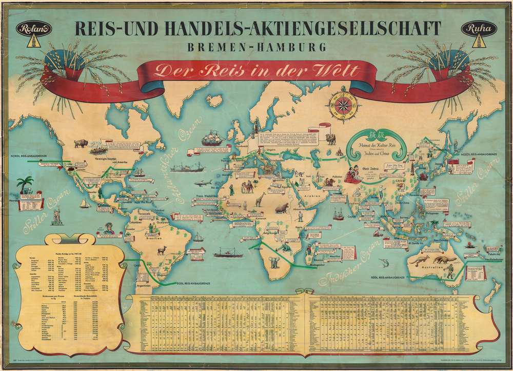
This is a c. 1950 pictorial map of the world chronicling rice cultivation created for Reis-und Handels-Aktiengesellschaft (Rice and Trading Corporation).
A Closer Look
Text banners provide short historical notes about rice cultivation. One such references Alexander the Great, while another discusses Native American wild rice harvests in Wisconsin and Minnesota. Few countries are identified by name, but the map does provide the word for rice in various languages. Statistics concerning rice production and r consumption occupy a cartouche in the lower left. A large table along the bottom border contains rice cultivation and import/export statistics from 1926 through 1950. Pictorial vignettes depict stereotypical regional scenes. (A mistake appears in Australia where a giant anteater appears next to a kangaroo. The giant anteater is not Australian fauna, rather it is indigenous to Central and South America.)Publication History and Census
This map was created and published by Graphia Hans Gundlach and Company c. 1950 for Reis-und Handels-Aktiengesellschaft Bremen - Hamburg. This is the only known cataloged example.Condition
Average. Full professional restoration. Areas of infill to border. Several closed tears evident.