
1917 Manuscript World War I Panoramic Views of Part of the Western Front


This item has been sold.
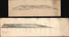
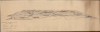
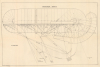
Panoramic View. La Bassee (Canal) to Loos. No 30. Balloon Section. 21:2:1917. / Panoramic View from Q 24a0.0: Lens to Vimy.
Only Known Surviving Examples of WWI 'balloonatic' Views.
Choose a Collection:
- Digital Map Information
- Suitable for large format printing
- Full resolution TIFF file
- ICC color profile embedded
- Delivered instantly via download link
This Item
Enquire
Only Known Surviving Examples of WWI 'balloonatic' Views.
An extraordinary survival, this is a pair of manuscript panoramic views of part of the Western Front in northeastern France during World War I (1914 - 1918). These views were drawn by members of the Royal Naval Air Service and the Royal Flying Corps who rode in baskets beneath hydrogen-filled balloons thousands of feet above the front lines to observe enemy movements and direct artillery fire. Known as kite balloons, these were legitimate military targets, earning the 'balloonatics' had a very high mortality rate.Panoramic View La Bassee (Canal) to Loos
This view was drawn on February 21, 1917, by a member of No. 30 Balloon Section, 3rd Balloon Company, 1st Balloon Wing. It references a specific trench map, Sheet 36c NW Edition 7b. The map grid is faintly superimposed over the entire view, with each quadrant numbered from the foreground to the background. Towns and villages are illustrated, with church spires the most noticeable feature in many. Forests and lakes are illustrated, along with roads and other features. The red line in the foreground running across the entire view must be the front line, which was static in February 1917. This part of the front was known as the Loos Salient.Panoramic View from Q24a0.0: Lens to Vimy
Drawn just over two weeks after the view from La Bassée to Loos on March 9, 1917, this view provides the same level of meticulous detail as the other panorama. This sheet also references a specific trench map, Sheet 36c SW, and the map grid is faintly superimposed, just as with the other panorama. Towns and villages, roads, and forests are illustrated. A brown line that winds through the foreground marks the front line. This view also illustrates part of the Loos Salient.The Loos Salient
The Loos Salient was in the Pas-de-Calais region of France and was established after the British failed to gain any ground during the Battle of Loos (September 24- October 13, 1915). The Battle of Loos was supposed to support the breakthrough of the Artois, recapture lost territory, and restart movement along the Western Front. Instead, it established the precarious Loos Salient, which for the next two years provided the Germans with a static target for their artillery. The Loos Salient also witnessed experiments in 20th-century siege warfare, including extensive tunneling. When the lines stabilized, the Salient went from the La Bassée Canal in the north to Double Crassier in the south. The Durand Group (whose website provided much of the preceding information) has done impressive work over the last twenty-plus years in studying and excavating the subterranean parts of this battlefield.The Kite Balloon Training Manual
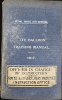
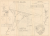
The two incredible panoramas are accompanied by another rarity: The 1917 Royal Naval Air Service Kite Balloon Training Manual. Published by the Air Department of the Admiralty, the Training Manual covers a range of topics including the theory and practice of free ballooning, hydrogen, two different types of balloons, operations over land and sea, chart and map reading, photography, winches, and instruments, and is full of images and diagrams. It also includes two folding diagrams of balloons in a pocket on the back cover. The Training Manual makes a distinction between Army Balloons, Corps (or artillery) Balloons, and Divisional Balloons. In short, Army Balloons are used by observers and were flown at altitudes of at least 4,000 feet (suggesting that observers in Army Balloons likely drew the present views), Corps Balloons were used in cooperation with heavy artillery, and Divisional balloons were used in reconnaissance and observation of fire for the field guns and howitzers. Chapter 9 in the Training Manual discusses aerial photography and its use in conjunction with photography from kite balloons, particularly when applied to map making. HathiTrust has digitized the entire Training Manual for those interested in reading this chapter or any of the others. We note only 15 examples of the Training Manual cataloged in OCLC.Publication History and Census
Both these views were drawn by hand in 1917, making them unique artifacts. We have been unable to locate any similar views.Condition
Very good. Drawn on heavy paper. One measures 8.5 x 32.25 inches on a sheet 11 x 39.5 inches; the other view measures 6.5 x 30 inches on a sheet 9.5 x 30 inches. Some light soiling to both.