This item has been sold, but you can get on the Waitlist to be notified if another example becomes available, or purchase a digital scan.
1934 Teller Automobile Map of Yosemite National Park
YosemiteMotoristsGuide-teller-1934$87.50


Title
Yosemite National Park Motorists Guide. / Motorists Guide Yosemite National Park 1935.
1934 (dated) 34.25 x 24 in (86.995 x 60.96 cm) 1 : 160000
1934 (dated) 34.25 x 24 in (86.995 x 60.96 cm) 1 : 160000
Description
A comprehensive guide to the roads and attractions of Yosemite National Park, drawn in 1934 by H. S. Teller and printed by the U.S. Geological Survey.
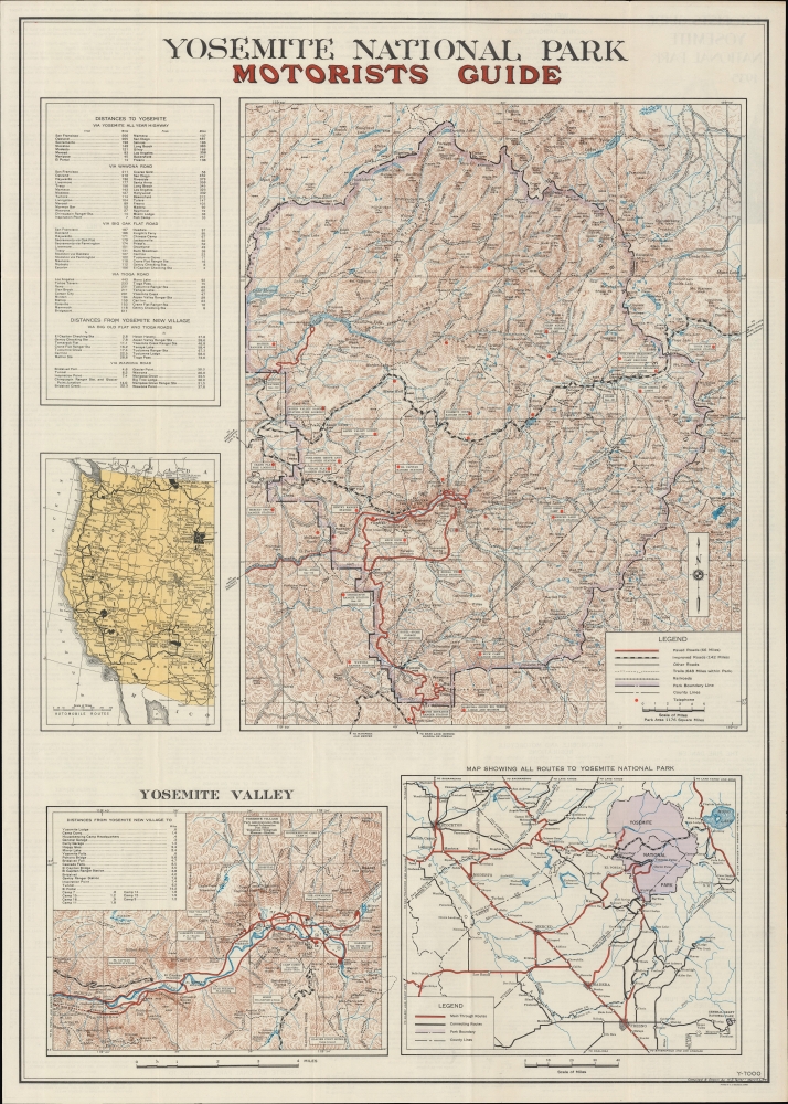
The Southern Pacific Railroad had built a partial line to Yosemite Valley, but still relied on stagecoaches for most of the journey. Thus, there was a strong argument to be made for constructing a railroad to the valley, which was completed in the first decade of the 20th century as the Yosemite Valley Railroad. This proved even more challenging than the construction of stagecoach roads, but was successful once operations began in 1907. In 1913, specially-built buses made by the White Motor Company provided regular service to Yosemite Valley (the railroad had a collaborative relationship with the White Motor Co., as White cars would wait for arriving trains at their terminus at El Portal, seen at left here, and drive passengers to attractions around the valley). However, automobiles would eventually eclipse the railroad, with the first paved road reaching the valley (Glacier Point) in 1918, with others following soon afterwards. This map appeared just after the opening of the Wawona Tunnel in 1933, which is still the longest highway tunnel in California (a portion of the old route of Wawona Road can be seen just to its south).
A Closer Look
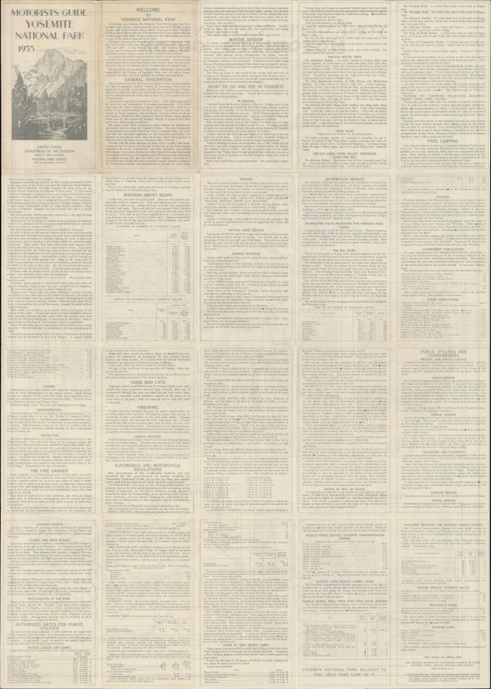
The sheet is divided into multiple portions, with a large topographic map at right displaying various types and quality of road in the vicinity of Yosemite Valley, along with railroads, ranger stations, campgrounds, fire lookouts, telephones, hiking trails, mountains (with their elevations recorded), and other features. To its left are a table of distances between Yosemite Valley and various towns and cities by different routes, as well as a map of national parks and major automobile routes in the western United States. At bottom-left is a topographic map in the style of the larger map above, focusing specifically on the Yosemite Valley, and noting lookout points, ranger stations, campgrounds, and more. At bottom-right is a map of eastern-central California, highlighting roads to Yosemite National Park, particularly those leading from the cities of California Central Valley to the west. The verso includes a tremendous wealth of information about the park for visitors, including - but not limited to - roads, fire danger, bears, firearms, hotels, and horseback riding.Roads to and through Yosemite
Soon after the Yosemite Valley and environs became a popular destination due to its natural beauty, which occurred soon after the California Gold Rush, efforts were made to establish wagon roads to the valley. Initially, these followed Native American routes. By the late 1860s, efforts were made to expand existing dirt trails (the Coulterville Road) and build an entirely new road (the Big Oak Flat Road), allowing access to Yosemite Valley from the west. Both projects ran into technical, financial, and political obstacles, but were driven on by competition against each other and the popular demand for such a route. Both roads were completed in 1874 within a month of each other (neither made much money despite charging tolls since travelers could always choose the other route if it was less expensive). The following year, a road further south from Mariposa was also constructed. Nevertheless, these stagecoach roads took two days from the nearest cities and were dangerous, not least because of highway robbers.The Southern Pacific Railroad had built a partial line to Yosemite Valley, but still relied on stagecoaches for most of the journey. Thus, there was a strong argument to be made for constructing a railroad to the valley, which was completed in the first decade of the 20th century as the Yosemite Valley Railroad. This proved even more challenging than the construction of stagecoach roads, but was successful once operations began in 1907. In 1913, specially-built buses made by the White Motor Company provided regular service to Yosemite Valley (the railroad had a collaborative relationship with the White Motor Co., as White cars would wait for arriving trains at their terminus at El Portal, seen at left here, and drive passengers to attractions around the valley). However, automobiles would eventually eclipse the railroad, with the first paved road reaching the valley (Glacier Point) in 1918, with others following soon afterwards. This map appeared just after the opening of the Wawona Tunnel in 1933, which is still the longest highway tunnel in California (a portion of the old route of Wawona Road can be seen just to its south).
Publication History and Census
This map was compiled and drawn by H. S. Teller, about whom little is known, and was printed by the U.S. Geological Survey in 1934 for the 1935 'Motorists Guide Yosemite National Park.' The OCLC notes it among the holdings of the University of California Berkeley, Stanford University, the University of California Davis, the University of Oregon, the University of Washington, and Cornell University.Cartographer
The United States Geological Survey (1878 - Present), aka the U.S.G.S., is a scientific agency of the United States government, which was founded in 1879. USGS scientists study the landscape of the United States, its natural resources, and the natural hazards that threaten it. The organization has four major science disciplines: biology, geography, geology, and hydrology. It is a bureau of the United States Department of the Interior and is the department's only scientific agency. More by this mapmaker...
Condition
Very good. Light wear along original folds. Small tear at junction of folds professionally repaired.
References
OCLC 26050337.