
Adrichem, Christian Kruik van (Christiano Adrichomio)
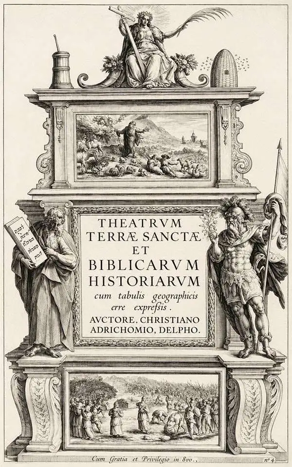
Christian Kruik van Adrichem (February 13, 1533 - June 20, 1585), alternatively known as Christianus Crucius Adrichomius was a Dutch theologian active in the second half of the 16th century. Adrichem was born in Delft of a wealthy family - at one point his father, Adriaen Claesz, was mayor of Delft. Adrichem was ordained in 1566. He served as the director of the Convent of St. Barbara in Delft until expelled by the Protestant Reformation. Fleeing the anti-Catholic sentiment of the Reformation, Adrichem reestablished himself in Cologne (Koln) where compiled various religious works including his important historical atlas, the Theatrum Terrae Sanctae et Biblicarum Historiarum. Adrichem's important atlas was published posthumously by his associate Gerardis Brunius in 1590. The work went through numerous editions and served as the foundation of most subsequent maps of the Holy Land well into the 18th century.
Adrichem, Christian Kruik van is also known as: Christiano Adrichomio
The Holy City for the Armchair Pilgrim.
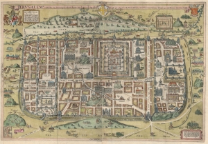
Ierusalem, et suburbia eius, sicut tempore Christi floruit ... descripta per Christianum Adrichom Delphum.
$2,000.00
Acquire
- Digital Map Information
- Suitable for large format printing
- File Size: 43.73 MB
- File Type: ZIP / TIFF
- ICC color profile embedded
- Delivered instantly via download link
This is an elegant example of Christian van Adrichem's influential 1584 plan of the Biblical Jerusalem. It was included in his 1584 Theatrum Terrae Sanctae, a Biblical atlas intended to provide visual structure to Catholic catechism - not only to inform the religious scholar, but to provide the basis for a sort of 'virtual pilgrimage' to the holy sites of Jerusalem when actual travel there was, for most, utterly impossible. (more details)
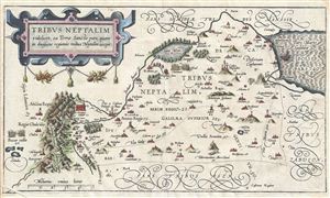
Tribus Neptalim videlicet, ea Terrae Sanctae pars, quam in divisione regionis tribus Neptalim accepit.
$495.00
Acquire
- Digital Map Information
- Suitable for large format printing
- DPI: 300
- File Size: 5.64 MB
- File Type: ZIP / TIFF
- ICC color profile embedded
- Delivered instantly via download link
A fine example of Christian van Adrichem's rare 1590 map of the lands granted to the Tribe of Naphtali at the time of Joshua's division of the Twelve Tribes. The map is oriented to the east and covers form the Sea of Galilee northwards along the Jordan River as ... (more details)
Finest 17th century large-scale map of the Holy Land.
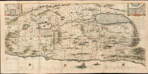
[Situs Terrae Promissionis.]
$6,500.00
Acquire
- Digital Map Information
- Suitable for large format printing
- File Size: 118.78 MB
- File Type: ZIP / TIFF
- ICC color profile embedded
- Delivered instantly via download link
Commonly known as the 'Hornius Map', this is the 1662 Johannes Jansson and Georgius Hornius 6-sheet map of the Holy Land in a beautifully colored, joined example. This map is an expansion on the allegorical Holy Land cartography pioneered by Christian van Adrichem around 1590. Jansson expanded and embellished Adrichem's map to illustrate the text composed by Georgius Hornius (George Horn) for volume six of his Novus Atlas, Accuratissimia Orbis Antiqui Delineatio. (more details)
Rare, separately-issued Biblical Jerusalem.
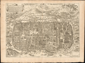
Jerusalem comme elle estoit du temps que Nostre Sauveur Jesus Christ souffrit mort et passion pour nous.
$4,500.00
Acquire
- Digital Map Information
- Suitable for large format printing
- File Size: 26.38 MB
- File Type: ZIP / TIFF
- ICC color profile embedded
- Delivered instantly via download link
This is a rare, separately-issued c. 1670 Gerard Jollain the Elder broadsheet map of Biblical Jerusalem, after Christian van Adrichem: an allegorical depiction of Jerusalem during Christ's lifetime. This work was instrumental in codifying elements of Christian veneration of the Holy City, in particular the Stations of the Cross. (more details)
Rare, Revised edition of a Foundational Map.
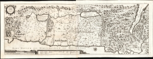
Tabula Geographica Terrae Sanctae.
$1,500.00
Acquire
- Digital Map Information
- Suitable for large format printing
- File Size: 41.75 MB
- File Type: ZIP / TIFF
- ICC color profile embedded
- Delivered instantly via download link
This is a large, rare map of the Holy Land, engraved in 1743 for inclusion in the fifth volume of Blasio Ugolino's monumental Thesaurus Antiquitatum Sacrarum, ultimately a thirty-four collection of Latin descriptions of Jewish customs, laws, institutions, and rites. (more details)
The Holy City for the Armchair Pilgrim.
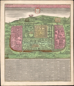
Ierusalem, cum suburbiis prout tempore Christi floruit...
$1,500.00
Acquire
- Digital Map Information
- Suitable for large format printing
- File Size: 39.56 MB
- File Type: ZIP / TIFF
- ICC color profile embedded
- Delivered instantly via download link
This is an attractive example of Matthias Seutter's c. 1745 map of Jerusalem following the influential 1584 model of Christian van Adrichem's. For centuries, Adrichem's portrayal of Jerusalem provided the basis for a sort of 'virtual pilgrimage' to the holy sites when actual travel there was, for most, impossible. Seutter's version of the plan here appears in its Lotter imprint of 1756. (more details)