
American Automobile Association (AAA)

The American Automobile Association (March 4, 1902 - present), better known as AAA ('Triple-A'), is a federations of motor clubs throughout America. A privately held national member association, AAA boasts over 58 million member in the United States and Canada. Founded on March 4, 1902 in Chicago, Illinois, AAA was originally created in response to a lack of roads and highways that were suitable for cars by nine individual motor clubs, including the Chicago Automobile Club, Automobile Club of America, and Automobile Club of New Jersey. AAA began publishing road maps in 1905 and hotel guides in 1917.
AKA: AAA
Go for a cruise around Biscayne Bay!
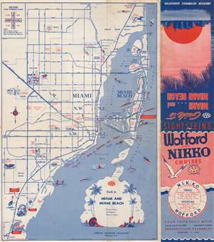
Guide to Miami and Miami Beach.
$250.00
Acquire
- Digital Map Information
- Suitable for large format printing
- Full resolution TIFF file
- ICC color profile embedded
- Delivered instantly via download link
This is a 1945 American Automobile Association city map of Miami and Miami Beach, Florida. Distributed by Wofford and Nikko Cruises, the 'course of Sightseeing Boat Wofford' appears as a dashed line within Biscayne Bay, under the two causeways connecting Miami and Miami Beach, and along Miami's coastline from the Venetian Causeway to the Deering Estate. Pictorial vignettes highlight the Orange Bowl, the West Flagler Kennel Club, Hialeah Park, and the Miami Springs Golf Course. Vignettes also promote the Parrot Jungle, Monkey Jungle, and Miami Rare Bird Farm in South Miami. Red text also identifies numerous city parks, the 36th Street Airport, the Pan American flying boat terminal, and several golf courses. (more details)
Cruising through the Keys.
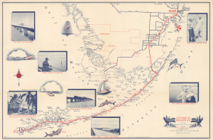
Overseas Highway. / Miami to Key West via Overseas Highway.
$250.00
Acquire
- Digital Map Information
- Suitable for large format printing
- Full resolution TIFF file
- ICC color profile embedded
- Delivered instantly via download link
This is a 1950 American Automobile Association (AAA) map of Southern Florida highlighting the Overseas Highway (U.S. 1) running through the Florida Keys. Adorned with photographs and illustrations, it combines function and aesthetics, highlighting fishing, one of the region's main attractions. (more details)
Tampa and St. Petersburg in detail!
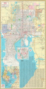
A great map for tourists and snowbirds, this is a double-sided map of Tampa and St. Petersburg, Florida. (more details)