
Baker, Benjamin

Benjamin Baker (1766 - June 29, 1841) was British engraver active in the late 18th and early 19th centuries. Baker was born in London, the son of instrument maker Edward Baker (1730 - 1797). As a young map he was apprenticed to Thomas Beresford, a watchmaker. This likely did not work out, as he was turned over to the engraver, mapmaker, and globemaker William Palmer (1739 - 1812). Baker rose to prominence as an engraver for the British Admiralty and British Ordnance Survey. In time he became the principal engraver for the Ordnance Survey, not only engraving himself, but overseeing the entire team of Ordnance engravers. His son, Benjamin Richard Baker (1792 - 1876) was also a mapmaker, engraver, draughtsman, lithographer, and printer.
A quick stop at Da Nang on the way to Beijing.
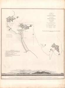
A Chart of part of the Coast of Cochin-China including Turon Harbour and the Island Callao.
$350.00
Acquire
- Digital Map Information
- Suitable for large format printing
- DPI: 600
- File Size: 12.22 MB
- File Type: ZIP / TIFF
- ICC color profile embedded
- Delivered instantly via download link
A map central Vietnamese coast near Da Nang and Hoi An, drawn in 1793 by John Barrow and Henry William Parish, engraved by Benjamin Baker, and included in the first edition of George Leonard Staunton's 1797 An Authentic Account of an Embassy from the King of Great Britain to the Emperor of China. (more details)
Outline of the Macartney Embassy.
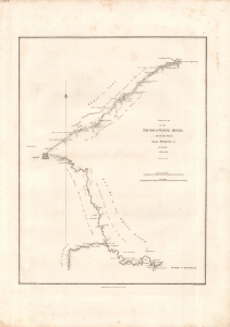
Sketch of the Pay-Ho or White River and of the road from Pekin to Geho.
$400.00
Acquire
- Digital Map Information
- Suitable for large format printing
- Full resolution TIFF file
- ICC color profile embedded
- Delivered instantly via download link
This 1793 sketch map of Beijing and vicinity by Henry William Parish was engraved by Benjamin Baker and included in the first edition of George Leonard Staunton's 1797 An Authentic Account of an Embassy from the King of Great Britain to the Emperor of China. It depicts the vicinity around Beijing, in North Zhili Province (北直隸, roughly today's Hebei), highlighting the areas traversed by the Macartney Embassy in 1793. (more details)
First British embassy to China.
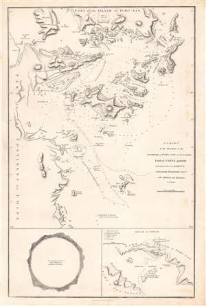
A chart of the islands to the southward of Tchu-san on the eastern coast of China.
$500.00
Acquire
- Digital Map Information
- Suitable for large format printing
- Full resolution TIFF file
- ICC color profile embedded
- Delivered instantly via download link
This is a rare 1796 John Barrow map of modern day Zhoushan (舟山市; Tchu-San), China, prepared to illustrate the official report of the 1793 Macartney Embassy to China. The Embassy has been seen as a deeply consequential historical interaction between China and the British Empire which heralded the systematic crises China would face in the 19th century. (more details)
The best map of Macau.
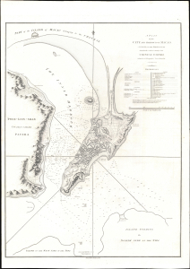
A Plan of the City and Harbour of Macao A Colony of the Portugueze situated at the southern extremity of the Chinese Empire in Lat. 22 ⁰12ʹ44'' N., long. 113⁰35ʹ0'' east of Greenwich.
$1,200.00
Acquire
- Digital Map Information
- Suitable for large format printing
- Full resolution TIFF file
- ICC color profile embedded
- Delivered instantly via download link
A stunning large-format 1796 nautical chart and city map of Macao, its harbor, and the surrounding seas. This map was drawn by Benjamin Baker based on observations collected by the George Macartney Embassy - the first British embassy to China. The map is impressively proportioned and finely engraved, offering meticulous detail of Portugal's primary entrepôt in China. This map is considered the largest and finest 18th-century map of Macao obtainable. (more details)
First British diplomatic mission to China.
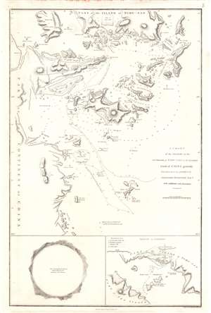
A Chart of the Islands to the Southward of Tchu-san on the Eastern Coast of China generally laid down from one published by Alexander Dalrymple Esqre. with additions and alternations.
$400.00
Acquire
- Digital Map Information
- Suitable for large format printing
- Full resolution TIFF file
- ICC color profile embedded
- Delivered instantly via download link
This is a rare 1796 John Barrow map of modern day Zhoushan (舟山市; Tchu-San), China, prepared to illustrate the official report of the Macartney Embassy to China. At the time Zhoushan (Ting Hai) was a walled city just south of modern-day Shanghai on the opposite side of Hangzhou Bay. The city guarded the entrance to the Qiantang River and thus access to Hangzhou (杭州市). Coverage here extends from Zhoushan Islands south to roughly Dayang Islet and Jiushan Chan Island. Tracks follow the Clarence, one of Macartney's ships as it entered and left the Bay. At the bottom of the map, a curious circular panorama illustrates the view from the Clarence from its anchorage in Zhoushan harbor. (more details)