
Barrow, John

John Barrow (June 19, 1764 – November 23, 1848) was an English statesman, cartographer, and writer active in the late 18th and early 19th centuries. Barrow was born in the village of Dragley Beck, in Ulverston, Cumbria. His first recorded work was as a superintending clerk at a Liverpool iron foundry, but by his early 20s, transitioned to teaching mathematics at a private school in Greenwich. One of his pupils, the young son of Sir George Leonard Staunton, favored him and he was introduced to Lord George Macarteny. Barrow accompanied Macartney as a comptroller of household, on his 1792-1794, embassy to China. Having acquitted himself well, Barrow was hired by Macartney as private secretary on a political mission to the newly acquired Cape Colony, South Africa. Barrow was given the difficult task of reconciling Boer settlers with the indigenous African population. In the course of this voyage he traveled throughout the Cape Colony, coming to know that country well. There he married botanical artist Anna Maria Truter, and, in 1800, acquired a home with the intention of settling in Cape Town. Following the 1802 Peace of Amiens, the British surrendered the colony and Barrow returned to England where he was appointed Second Secretary to the Admiralty, a post he held with honor for the subsequent 40 years. In his position at the Admiralty Barrow promoted various voyages of discovery, including those of John Ross, William Edward Parry, James Clark Ross, and John Franklin. The Barrow Strait in the Canadian Arctic as well as Point Barrow and the city of Barrow in Alaska are named after him. He is reputed to have been the initial proposer of St Helena as the new place of exile for Napoleon Bonaparte following the Battle of Waterloo in 1815. He was a member of the Royal Society and the Raleigh Club, a forerunner of the Royal Geographical Society. In 1835 Sir Robert Peel conferred upon him a baronetcy.
A quick stop at Da Nang on the way to Beijing.
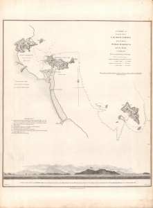
A Chart of part of the Coast of Cochin-China including Turon Harbour and the Island Callao.
$350.00
Acquire
- Digital Map Information
- Suitable for large format printing
- DPI: 600
- File Size: 12.22 MB
- File Type: ZIP / TIFF
- ICC color profile embedded
- Delivered instantly via download link
A map central Vietnamese coast near Da Nang and Hoi An, drawn in 1793 by John Barrow and Henry William Parish, engraved by Benjamin Baker, and included in the first edition of George Leonard Staunton's 1797 An Authentic Account of an Embassy from the King of Great Britain to the Emperor of China. (more details)
A Maladroit Meeting between Britain and China.
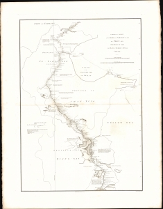
A sketch of a journey from Zhe-Hol in Tartary by land to Pekin and from thence by water to Hang-Tchoo-Foo in China.
$375.00
Acquire
- Digital Map Information
- Suitable for large format printing
- File Size: 13.55 MB
- File Type: ZIP / TIFF
- ICC color profile embedded
- Delivered instantly via download link
This important 1796 John Barrow map of China traces the course of the British Macartney Mission after its unsuccessful meeting with the Qing Emperor Qianlong. As a diplomatic effort, the embassy failed completely, the result of mutual misunderstanding and mistrust between the Qing Court and the British. But, as this map demonstrates, the mission did allow the British to gain a much better direct understanding China's geography (more details)
A lovely palace, before it was burned and looted.
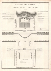
Plan of the Hall of Audience and the Adjacent Courts in the Emperor's Gardens at Yuen-Min-Yuen.
$250.00
Acquire
- Digital Map Information
- Suitable for large format printing
- DPI: 600
- File Size: 10.99 MB
- File Type: ZIP / TIFF
- ICC color profile embedded
- Delivered instantly via download link
A lovely example of Sir John Barrow's 1796 schematic of the main audience hall of the Yuanmingyuan or 'Old Summer Palace,' an impressive complex of palaces and gardens built for the Qing emperors just outside of Beijing. It appeared in George Leonard Staunton's An Authentic Account of an Embassy from the King of Great Britain to the Emperor of China, recounting the Macartney Embassy, a failed British attempt to gain expanded trading and diplomatic rights in China. (more details)
First British embassy to China.
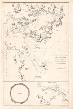
A chart of the islands to the southward of Tchu-san on the eastern coast of China.
$500.00
Acquire
- Digital Map Information
- Suitable for large format printing
- Full resolution TIFF file
- ICC color profile embedded
- Delivered instantly via download link
This is a rare 1796 John Barrow map of modern day Zhoushan (舟山市; Tchu-San), China, prepared to illustrate the official report of the 1793 Macartney Embassy to China. The Embassy has been seen as a deeply consequential historical interaction between China and the British Empire which heralded the systematic crises China would face in the 19th century. (more details)
First British diplomatic mission to China.
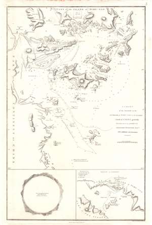
A Chart of the Islands to the Southward of Tchu-san on the Eastern Coast of China generally laid down from one published by Alexander Dalrymple Esqre. with additions and alternations.
$400.00
Acquire
- Digital Map Information
- Suitable for large format printing
- Full resolution TIFF file
- ICC color profile embedded
- Delivered instantly via download link
This is a rare 1796 John Barrow map of modern day Zhoushan (舟山市; Tchu-San), China, prepared to illustrate the official report of the Macartney Embassy to China. At the time Zhoushan (Ting Hai) was a walled city just south of modern-day Shanghai on the opposite side of Hangzhou Bay. The city guarded the entrance to the Qiantang River and thus access to Hangzhou (杭州市). Coverage here extends from Zhoushan Islands south to roughly Dayang Islet and Jiushan Chan Island. Tracks follow the Clarence, one of Macartney's ships as it entered and left the Bay. At the bottom of the map, a curious circular panorama illustrates the view from the Clarence from its anchorage in Zhoushan harbor. (more details)