
Besançon, J.P.

J.P. Besançon (fl. c. 1798 - 1835) was a French engraver who specialized in lettering. Besançon began engraving nautical charts for Charles-François Beautemps-Beaupré (August 6, 1766 - March 16, 1854) in 1802. He engraved 83 maps for Beautemps-Beaupré, then the hydrographer in chief, between 1802 and 1831, when he handed off the work to J.M. Hacq. Little else is known about Besançon's life and career.
At the height of the Haitian Revolution, when a former slave's rise to power that undermined the foundations of the plantation system.
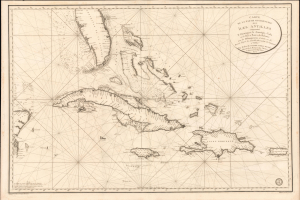
Carte de la Partie Occidentale des Îles Antilles Comprenant St. Domingue, La Jamaique, Cuba et Îles et Bancs de Bahama avec les Débouqumens de toutes ces Îles Dressée d'apres les nouvelles Observations des Espagnols et Publiée Par Ordre du Xontre-Amiral Decrès Ministre de la Marine et des Colonies au Dépôt général de la Marine, en 1801.
$4,000.00
Acquire
- Digital Map Information
- Suitable for large format printing
- Full resolution TIFF file
- ICC color profile embedded
- Delivered instantly via download link
A striking 1801 French Dépôt de la Marine nautical chart of Florida and the Greater Antilles, encompassing Cuba, the Bahamas, Hispaniola, Puerto Rico, and Jamaica. Issued at the height of the Haitian Revolution, the map coincides with the rise of the former slave and revolutionary Toussaint Louverture, who had just unified Hispaniola under his authority, sending shockwaves through the slaveholding societies of the Atlantic world. Published as Napoleon Bonaparte prepared his massive Saint-Domingue Expedition to reclaim France's richest colony, this chart reflects the sudden strategic importance of the Caribbean's sea lanes, making it an artifact of one of history's most transformative revolutions. (more details)
France's fledgling return to the 'China trade.'
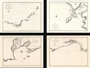
Carte réduite de la Partie Méridionale de l'Île d'Hainan...
$1,800.00
Acquire
- Digital Map Information
- Suitable for large format printing
- Full resolution TIFF file
- ICC color profile embedded
- Delivered instantly via download link
A set of four nautical charts of the southern coast of Hainan Island, China, produced in 1819 by the French Dépôt générale de la Marine. At the time, France was eager to reestablish trade ties with China following the upheavals of the Revolution and Napoleonic Wars, and an accurate understanding of the coastline of Hainan was important to the safe passage of vessels along the coast. (more details)
Increasing French interest in Mexico.
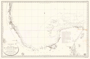
Carte Réduite de la Partie Méridionale du Golfe du Mexique Depuis le Cap Catoche jusqu'à Laguna Madre.
$950.00
Acquire
- Digital Map Information
- Suitable for large format printing
- Full resolution TIFF file
- ICC color profile embedded
- Delivered instantly via download link
This is an 1826 Dépôt de la Marine nautical map of the Gulf Coast of Mexico. The publication of this map in France reflects renewed and growing imperial interest in the New World, which culminated in the French Intervention in Mexico (1838 - 1839). This coast, and the Yucatan specifically, was the most important and wealthiest part of Mexico. The Yucatan was the only place in the world where sisal could be farmed from Henequen agave - the source of most of the world's nautical rope until the invention of synthetics. (more details)
Among the first maps of the Anambas Islands.
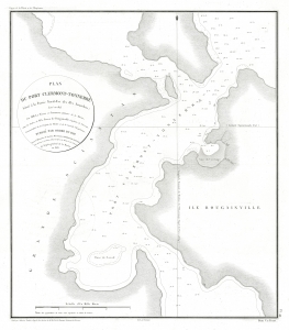
Plan du Port Clermont-Tonnerre Situé à la Partie Nord-Est des Iles Anambas.
$700.00
Acquire
- Digital Map Information
- Suitable for large format printing
- File Size: 10.86 MB
- File Type: ZIP / TIFF
- ICC color profile embedded
- Delivered instantly via download link
This is an 1828 Ambroise Tardieu map of the northeastern part of Siantan Island in the Anambas Islands Regency, part of the Riau Archipelago in Indonesia. Bougainville's expedition marks the first European reconnaissance of the Anambas Islands. (more details)
Bali's Lesser-Known Neighbor.
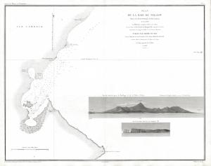
Plan de la Baie de Peejow Située à la Partie Orientale de l'Ile Lombock.
$800.00
Acquire
- Digital Map Information
- Suitable for large format printing
- File Size: 14.86 MB
- File Type: ZIP / TIFF
- ICC color profile embedded
- Delivered instantly via download link
This is an 1837 Ambroise Tardieu nautical chart of the Bay of Peejow on the east coast of the island of Lombok in Indonesia. (more details)
Defending the Dutch East Indies against the British.
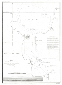
Plan du Détroit de Madura depuis la Pointe Panka jusqu'a l'Embouchure de la Rivière de Sourabaya.
$1,000.00
Acquire
- Digital Map Information
- Suitable for large format printing
- Full resolution TIFF file
- ICC color profile embedded
- Delivered instantly via download link
This is an 1837 Ambroise Tardieu map of the Madura Strait between the islands of Java and Madura in Indonesia. (more details)