
Copley, Charles

Charles Copley (1800 - November 17, 1880), was an American nautical chart and globe publisher based in Brooklyn, New York and active in the middle part of the 19th century. He was born in England and emigrated to the United States in the 1840s. He became a citizen in 1844. Charles Copley's earliest work is associated with the firm of E. and G. W. Blunt and his name appears as hydrographer or engraver on several of Blunt's c. 1840 charts – so he must have began working the Blunt shortly after emigrating. Around 1847 Copley began publishing independently, advertising himself as an engraver and map publisher. Most of his independent work was published in the 1850s. By 1860, the firm renamed itself Charles Copley and Son's, accommodating Charles John Copley Jr. (1826 - 18xx) and Frederick S. Copley (1827 - 18xx). From this point forward, most charts are copyrighted by 'C.C.J and F.S. Copley.' All Copley charts are extremely rare.
Highly detailed chart of the Bahamas and eastern Cuba.
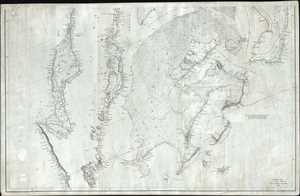
Southern Coast, U. States. Sheet VIII.
$950.00
Acquire
- Digital Map Information
- Suitable for large format printing
- DPI: 300
- File Size: 21.97 MB
- File Type: ZIP / TIFF
- ICC color profile embedded
- Delivered instantly via download link
This is an 1844 Edmund and George William Blunt map of the Bahamas and eastern Cuba. The map depicts the Caribbean from just south of Cuba to Great Abaco, Little Abaco, and the cays to the east of Great Abaco and from the Sagua la Grande River, Cuba and Great Bahama to just east of Santiago de Cuba and Watlings Island. Numerous locations are labeled along the Cuban coast on this highly detailed chart, with a detailed depiction of the small islands and cays situated along the Cuban coastline. The islands of the Bahamas are as meticulously illustrated, with coastal locations, channels, sounds, cays, small islands and other hazards charted. Myriad depth soundings are included, particularly within the Greater Bahama Bank. A note stating the best courses across the Bank is situated on the right side of the map, just below Eleuthera Island. (more details)
Working nautical chart of the Atlantic coast.
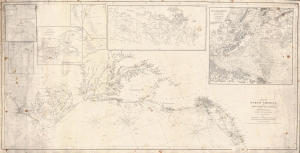
Coast of North America, from Point Judith to Cape St. Antonio (Island of Cuba) Including the Bahama Banks.
$950.00
Acquire
- Digital Map Information
- Suitable for large format printing
- Full resolution TIFF file
- ICC color profile embedded
- Delivered instantly via download link
This is a first edition 1846 Edmund and George William Blunt nautical map of the mid-east coast of the United States featuring manuscript notations. (more details)