
Danckerts Family

The Danckerts family (fl. 1628 - 1717) were a Dutch engraving and cartographic publishing firm active in Amsterdam during the latter half of the 17th and early 18th centuries. The firm was founded by Cornelis Dankerts II (1603-1656) and his brother Dancker Danckerts (1614-16?). Cornelius and Dancker published few maps, but did pass the business on to Cornelius' son Justus Danckerts (1635 - 1701) and grandsons Theodorus Danckerts (1663-1727) and Cornelius Danckerts III (1664-1717). The firm was most active in this period between 1680 and 1700 when a number of atlases and maps appeared bearing either the Justus Danckerts or Theodorus Danckerts imprint. At the time, it was in vogue in Amsterdam to leave maps undated, which makes Danckerts maps particularly difficult to ascribe. Similarly, there is a considerable corpus of maps signed as Cornelius Danckerts. When dated we can correctly attribute these to either Cornelius II or Cornelius III, though, typically, most are undated and consequently difficult to attach to the correct Danckerts family member. The Danckerts family is well known for its highly detailed and graphic engraving style. In addition to numerous atlas maps, they also produced a number of spectacular Dutch wall maps. In the early 18th century, the Danckerts map plates were purchased by R. and J. Ottens, who reprinted many of them under their own imprint. (Ref: Keuning, J., "Cornelis Danckerts and his "Niew Aerdsh Pleyn"", Imago Mundi, Vol. 12 (1955), pp. 136-139.)
Rare, French-printed Edition.
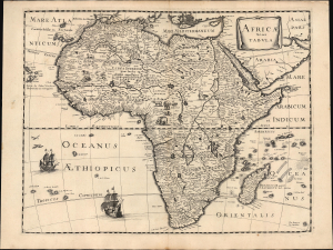
Africae nova Tabula.
$3,000.00
Acquire
- Digital Map Information
- Suitable for large format printing
- File Size: 18.78 MB
- File Type: ZIP / TIFF
- ICC color profile embedded
- Delivered instantly via download link
This is Peter Mariette's 1650 map of Africa, published in his Theatre Géographique de France. The present example is a rare French edition that does not appear in OCLC and has appeared only twice on the market since 2008. (more details)
Separately-Issued Rarity of the Caribbean.
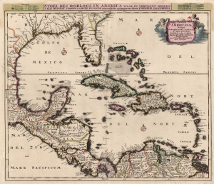
Insulae Americanae, Nempe: Cuba, Hispaniola, Jamaica, Pto Rico, Lucania, Antillae vulgo Caribae, Barlo -Et Sotto - Vento. Etc.
$2,000.00
Acquire
- Digital Map Information
- Suitable for large format printing
- Full resolution TIFF file
- ICC color profile embedded
- Delivered instantly via download link
This is Cornelius Danckerts' rare 1696 map of Florida, the West Indies, Central America, the Caribbean, and the Spanish Main. This map covers from Mexico to the Antilles and from Florida to the Spanish Main, inclusive of Cuba, the Bahamas, Hispaniola, Jamaica, Porto (Puerto) Rico, and the Lesser Antilles. It extends as far north as Georgia and South Carolina, here referred to as 'Florida Gallica'. (more details)
Transylvania after the Great Turkish War.
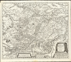
Nova Transilvaniae Principatus Tabula. Novissima descriptia editia Per R. et I. Ottens. Amstelodami Cum Priviligeo.
$1,600.00
Acquire
- Digital Map Information
- Suitable for large format printing
- File Size: 26.04 MB
- File Type: ZIP / TIFF
- ICC color profile embedded
- Delivered instantly via download link
This is Josue and Renier Ottens / Danckerts c. 1725 map of Transylvania. The map was published in the wake of the Great Turkish War (1683 - 1699) during a period of German migration into Transylvania and the Banat. (more details)