
Eddy, Gerald Allen

Gerald Allen Eddy (October 12, 1889 - September 9, 1967) was an American artist. Born in Michigan, Eddy's parents either divorced or his father died between 1900 and 1910. In 1910 Eddy was living with his mother, brother, and stepfather in Los Angeles and working as an artist. Eddy was a prolific cartographer and created numerous maps of different areas of the western United States. He married Madolyn M. Smith on January 18, 1911. By 1917, the couple had one daughter, according to his World War I draft card. By 1919, Eddy was drawing views for newspapers in southern California. By 1939 Eddy was a staff artist for the San Francisco Call-Bulletin and drew courtroom sketches and maps for the newspaper. By 1940 his maps would be syndicated in newspapers across the country. He was married to his wife Madolyn when he died.
Hoover Dam under construction.
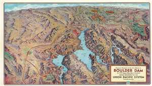
Panorama Perspective of the Area Adjacent to Boulder Dam as it Will Appear When Dam is Completed.
$300.00
Acquire
- Digital Map Information
- Suitable for large format printing
- Full resolution TIFF file
- ICC color profile embedded
- Delivered instantly via download link
This is a 1934 Gerald A. Eddy bird's-eye view perspective map of Hoover (Boulder) Dam, Lake Mead, and environs at the height of its construction. Hoover (Boulder) Dam appears in the lower-left next to Boulder City, explicitly founded to house the thousands of workers involved in construction. Lake Mead dominates the foreground, and the view stretches hundreds of miles north to Salt Lake City, Utah. This was published as a promotional piece for Union Pacific Railroad, and thus a red line traces the railroad's route south from Salt Lake City to Las Vegas and on to Boulder City and the construction site. The Grand Canyon, Zion National Park, Bryce Canyon National Park, and Cedar Breaks National Monument are highlighted, no doubt in the hopes of driving tourism despite the Great Depressing. The region's mountain ranges, canyons, and other natural wonders are also identified. (more details)
Beginnings of Death Valley tourism.
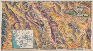
[Death Valley.]
$250.00
Acquire
- Digital Map Information
- Suitable for large format printing
- Full resolution TIFF file
- ICC color profile embedded
- Delivered instantly via download link
This is a 1934 Gerald Eddy pictorial map of Death Valley, California. Issued just year after Death Valley National Monument was chartered, this is one of the earliest obtainable touristic presentations of the dramatic desert. (more details)
L.A.'s Art Deco Grandeur.
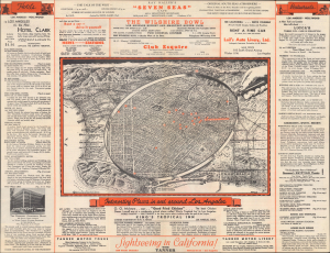
Interesting Places in and around Los Angeles. / Los Angeles and Southern California...
$300.00
Acquire
- Digital Map Information
- Suitable for large format printing
- Full resolution TIFF file
- ICC color profile embedded
- Delivered instantly via download link
This is a pictorial view of Downtown Los Angeles and environs, drawn by Gerald Eddy in 1934 and published the following year by the National Travel Service, a travel agency in L.A. It presents the city during the Great Depression, when it largely bucked national and international economic trends and built many of its most iconic buildings. (more details)
L.A.'s history gets the Hollywood treatment.
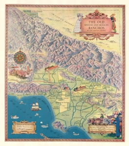
The Old Spanish and Mexican Ranchos of Los Angeles County.
$550.00
Acquire
- Digital Map Information
- Suitable for large format printing
- File Size: 36.74 MB
- File Type: ZIP / TIFF
- ICC color profile embedded
- Delivered instantly via download link
This is a fanciful 1937 Gerald Eddy pictorial map of the historic Spanish and Mexican ranchos of Los Angeles County, the names of which were later applied to neighborhoods and towns. Eddy's work fits within a broader cultural movement in Southern California in the early-mid 20th century, often labeled Spanish Revival, that grasped at an idealized vision of California's past, creating something unique and idiosyncratic. (more details)
The largest alpine lake in North America - known for its beaches and its skiing.
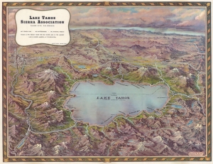
Lake Tahoe.
$450.00
Acquire
- Digital Map Information
- Suitable for large format printing
- Full resolution TIFF file
- ICC color profile embedded
- Delivered instantly via download link
This is a gorgeous c. 1950 Gerald A. Eddy bird's-eye view map of Lake Tahoe. Situated astride the border between California and Nevada, Lake Tahoe dominates the foreground. Bays, harbors, and towns along its banks beckon to the weary Los Angeleno or other city dwellers, calling to them as sirens call to sailors. Ski resorts, mountain peaks, numerous smaller lakes, and other natural features contribute to the area's welcoming aura. Reno, Carson City, and Truckee all are labeled, along with many other towns. (more details)
Atomic Age and Lake Mead.
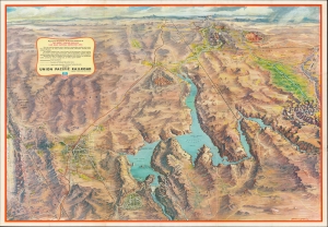
Panoramic Perspective of the Area Adjacent to Las Vegas - Hoover Dam and Lake Mead National Recreation Area.
$350.00
Acquire
A stunning Gerald A. Eddy bird's-eye view map of Hoover Dam, Lake Mead, Las Vegas, and environs, produced in 1958 for the Union Pacific Railroad. It captures the region at the height of the Atomic Age, when Las Vegas became a tourist haven and nearby parts of Nevada became testing grounds for nuclear weapons. (more details)
All roads lead to Reno.

A c. 1960 strip road map by Gerald Eddy, produced for the Harolds Club casino in Reno, Nevada. Between the recto and verso, the entire route from Nome, Alaska, to the Mexico-Guatemala border is charted, with primacy of place given to Reno and Harolds Club specifically. (more details)
Early Days of Interstate 80.
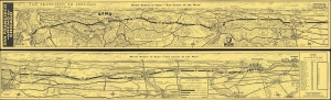
San Francisco via Reno to Chicago / Direct Routes to Reno - 'Fun Center of the West'.
$450.00
Acquire
A whimsical two-sided pictorial strip map of highway routes between San Francisco and Chicago drawn by Gerald Eddy in 1961 for Harold's Club casino in Reno. Among other features, it is notable for showcasing Interstate 80, only designated five years prior. It is part of series of similar strip map issued by Eddy for Herod's Club, but by far the rarest. (more details)