
Forbes, William H.
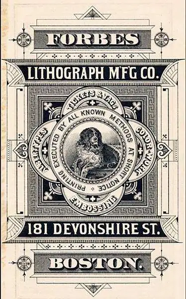
William H. Forbes (1836 - February 3, 1915) was an English-American businessman and printer active in the second half of the 19th and early 20th centuries. Forbes was born in Liverpool England and immigrated to the United States at 12 years old. In the United States, he lived with Quaker relatives at Milton-on-the-Hudson, who provided him with a top-notch education. Forbes apprenticed as lithographer under H. A. Strong in New York. Following his maturity, he relocated to Boston in 1861, founding William H. Forbes and Company shortly after, in 1862. Forbes proved an excellent lithographer and savvy businessman. He reorganized his growing printing concern in 1875, incorporating as Forbes Lithograph Manufacturing Company in 1875. They focused on lithography, embossing, Albertype process printing, typesetting, copper and steel plate printing, and photolithography. At its height, Forbes Lithograph Manufacturing Company had over 70 presses located in Boston, New York, Chicago, and London, and staffed more than 600 workers, including 60 designers, artists, engravers, and lithograph artists. By 1881, Forbes himself had taken a back seat, working as the company treasurer, with William P. Hunt serving as president. In his personal life Forbes was well liked. He married the sister of well-known lithographer Louis Prang. After his death, the firm was taken over by his son, William S. Forbes. During World War II they were major printers of Allied military currency, producing more than 4 billion notes. The firm went out of business in the second half of the 20th century.
A rare broadside promoting M.K. Paine's Green Mountain Balm - a medical miracle!
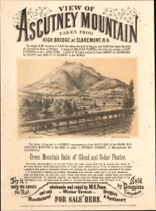
View of Ascutney Mountain Taken From High Bridge at Claremont, N.H.
$300.00
Acquire
- Digital Map Information
- Suitable for large format printing
- File Size: 15.38 MB
- File Type: ZIP / TIFF
- ICC color profile embedded
- Delivered instantly via download link
This is an 1868 Milton K. Paine broadside advertising view of Mount Ascutney, Vermont. Ascutney is a monadnock, a type of mountain that rises isolated from surrounding mountains. Paine, a Vermont druggist and apothecary, maintained a shop in Windsor, Vermont, at the base of the mountain. Today, Mount Ascutney is regarded as the best hang-gliding location in the Northeastern United States and also hosts the Ascutney Mountain Resort, first opened in the years after World War II (1939 - 1945). (more details)
Holy grail of Ge'hog'raphy.
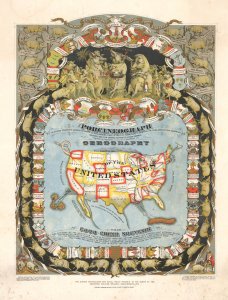
This Porcineograph. / This Good-Cheer Souvenir.
$15,000.00
Acquire
- Digital Map Information
- Suitable for large format printing
- Full resolution TIFF file
- ICC color profile embedded
- Delivered instantly via download link
The coveted Porcineograph, in its rare first edition, considered one of the greatest examples of cartographic whimsy ever made! This is a comical 1876 William Emerson Baker chromolithograph pictorial map - geo'hog'raphy - of the United States as a pig. Issued as a party favor for the founding of Baker's 'Sanitary Piggery', the image is not only humorous but also examines the impact of pigs in American history, including their role in the foundation of the Massachusetts Senate and the Declaration of the War of 1812. (more details)
Revere Beach - the largest resort hotel on the New England coast.
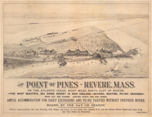
The Point of Pines. Revere, Mass. On the Atlantic Ocean, Eight Miles North East of Boston. The Most Beautiful Sea Side Resort in New England - Bathing, Boating, Pic-Nic Grounds.
$750.00
Acquire
- Digital Map Information
- Suitable for large format printing
- File Size: 29.54 MB
- File Type: ZIP / TIFF
- ICC color profile embedded
- Delivered instantly via download link
This is a c. 1882 E.R. Howe bird's-eye view map of the Point of Pines at Revere Beach or Chelsea Beach, Massachusetts. A point of land on Boston Harbor between Boston and Lynn, the Point of Pines was once called Chelsea Beach, but is known as Revere Beach today. Two hotels, the Goodwood and the Pines, occupy the foreground, along with a café. Vacationers and day-trippers stroll along the beach and pathways leading to and from the hotels. A railroad station (a stop on the Boston, Revere Beach, and Lynn Railroad) appears in the background and is connected to the hotels via pathways. (more details)