
Hacq, Jacques-Marie

Jacques-Marie Hacq (September 22, 1785 – 18??) was a French letter and line engraver, and historian, active in Paris during the middle part of the 19th century. Hacq was born in Paris and trained under J. P. Besançon, who he succeeded at the Dépôt de la Guerre in 1830. He engraved for the Dépôt de la Guerre as early as 1830 and for the Dépôt des Cartes et Plans de la Marine from, at least, 1840 to 1852. In addition to his work for the French Government, he also completed maps and engravings for Lesage, Lapie, Dufour, Duperrez, Gouvion St. Cyr, and Dumont d'Urville. His historical works include a history of the Napoleonic Wars and a history of Paris under the reign of Louis XIII. During most of his career in Paris he lived at 58 Rue de la Harpe.
A rare nautical chart of the French overseas collective St. Pierre.
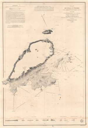
Plan de l'Ile St. Pierre (Côte Méridionale de Terre Neuve).
$450.00
Acquire
- Digital Map Information
- Suitable for large format printing
- DPI: 600
- File Size: 81.96 MB
- File Type: ZIP / TIFF
- ICC color profile embedded
- Delivered instantly via download link
This is an 1834 Jules de la Roche-Poncié and Dépot de la Marine nautical chart or maritime map of St. Pierre Island, part of the French overseas collective, ('collectivité d'outre-mer'), St. Pierre and Miquelon. St. Pierre dominates the sheet, and its coastlines appear in impressive detail. Coves, points, bays, and other coastal locations are labeled. The Ile aux Chiens, Ile aux Vainqueurs, the Ile aux Pigeons, and Grand Colombier are illustrated and labeled, along with numerous smaller coastal islands. Depth soundings, navigation directions, and other notations provide mariners with navigational assistance. Nine coastal views appear along the bottom border to further aid navigation. (more details)
Tracing the first European exploration of the Anambas Islands.
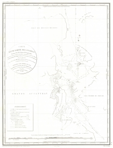
Carte d'une Partie des Anambas Reconnue Par M. le Baron de Bougainville.
$750.00
Acquire
- Digital Map Information
- Suitable for large format printing
- File Size: 9.67 MB
- File Type: ZIP / TIFF
- ICC color profile embedded
- Delivered instantly via download link
This is an 1828 Ambroise Tardieu map of the northeastern part of Siantan Island and the surrounding islands in the Anambas Islands Regency, part of the Riau Archipelago in Indonesia. Bougainville's expedition marks the first European reconnaissance of the Anambas Islands. (more details)
Early, gorgeous chart of the East Indies.
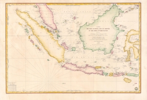
Carte des Iles Sumatra, Java et Borneo et des mers Environnantes...
$1,000.00
Acquire
- Digital Map Information
- Suitable for large format printing
- Full resolution TIFF file
- ICC color profile embedded
- Delivered instantly via download link
A beautiful and rare 1839 French Depot-General de la Marine nautical chart or maritime map of the East Indies or Insular Southeast Asia - including Singapore. The size and level of detail is impressive, reflecting the importance of the chart as representing the pinnacle of hydrographical knowledge at the time. (more details)
French colonial interest in the Philippines. Also, rectification of charts.
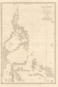
Carte des Iles Philippines, Célèbes et Moluques.
$4,500.00
Acquire
- Digital Map Information
- Suitable for large format printing
- Full resolution TIFF file
- ICC color profile embedded
- Delivered instantly via download link
A spectacular 1840 / 1852 map of the Philippines by Pierre Daussy and the French Dépot-général de la Marine. This map is significant as it reflects growing French interest in the Far East and coincides with the first French attempt to seize the Philippine island of Basilan as a base to counterbalance British power in Hong Kong. It is also part of the French Bureau des Longitudes' ongoing effort to revise its Table des Positions Géographiques des Principaux Lieux du Globe to conform to the most up-to-date measurements made possible by advances in hydrography, including widespread early 19th century adoption in the marine chronometer. Daussy published dozens of new charts, including this one, to reflect the significant corrections. (more details)
Challenging British Hegemony in the Indian Ocean.
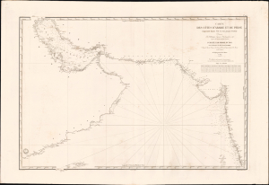
Carte des côtes d'Arabie, et de Perse, comprenant depuis l'Ile Socotra jusqu'à Bombay.
$2,500.00
Acquire
- Digital Map Information
- Suitable for large format printing
- File Size: 39.57 MB
- File Type: ZIP / TIFF
- ICC color profile embedded
- Delivered instantly via download link
This is a rare, large-format 1840 nautical chart of the Arabian Sea and Persian Gulf prepared by the French Dépôt Général de la Marine. At the time it was produced, France was trying to match Britian's growing dominance of the Indian Ocean, presenting itself to indigenous rulers as an alternative trading partner. (more details)
Largest Atoll Structure in the World.
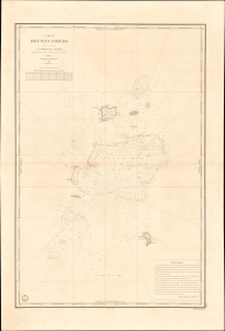
Carte des Iles Chagos. No. 945.
$1,200.00
Acquire
- Digital Map Information
- Suitable for large format printing
- File Size: 28.38 MB
- File Type: ZIP / TIFF
- ICC color profile embedded
- Delivered instantly via download link
This is a scarce, large-format 1841 French Dépôt-général de la marine nautical chart of the Chagos Archipelago in the Indian Ocean. It was produced at a time when Britain and France were vying for influence in the Indian Ocean, part of a wider, cautious global imperial competition in the wake of the Napoleonic Wars. (more details)
Second earliest, and earliest obtainable scientific map of the Galapagos.
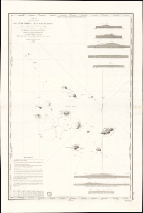
Carte d'une Partie de L'Archipel des Galapagos Levée et dressée en 1838 à bord de la Vénus...
$7,500.00
Acquire
- Digital Map Information
- Suitable for large format printing
- File Size: 2032.23 MB
- File Type: ZIP / TIFF
- ICC color profile embedded
- Delivered instantly via download link
An extraordinary discovery, this is Urbain Dortet de Tessan's 1842 nautical map of the Galapagos Islands, considered the second scientific map of the Galapagos. The map is the result of survey work performed in July of 1836 on the westward circumnavigation of the Vénus under Admiral Abel Aubert Dupetit-Thouars. The Vénus's visit to the Galapagos followed Darwin by just one year, and thus Beagle hydrographer Robert Fitzroy's contemporaneous mapping of the archipelago. This chart, published in 1842, and Fitzroy's chart, published in 1841, constitute the first comprehensive nautical overview of the islands and are comparable in both rarity and significance. (more details)
The French set their eyes on Singapore.
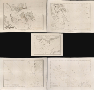
Carte des Atterrages de Singapore. / Carte Particulière des détroits de Singapore, Durian et Rhio. / Carte des Détroits de Singapore, Durian et Rhio et des Parages Environnants. / Carte du Détroit del Malacca Partie Septentrionale. / Carte du Détroit de Malacca Partie Méridionale.
$22,000.00
Acquire
- Digital Map Information
- Suitable for large format printing
- Full resolution TIFF file
- ICC color profile embedded
- Delivered instantly via download link
An exceptional set of five rare 1840s nautical maps/charts detailing Singapore, Malaya, and the Straits of Malacca and Singapore compiled by Urban Dortet de Tessan for the French Dépôt-Général de la Marine. The charts correspond to the Lagrené Mission, a French attempt to establish a colonial presence in East and Southeast Asia that challenged British regional hegemony. (more details)
Sinking paradise.
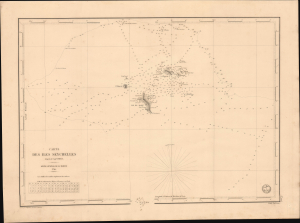
Carte des Iles Seychelles. No. 1205.
$1,500.00
Acquire
- Digital Map Information
- Suitable for large format printing
- File Size: 17.83 MB
- File Type: ZIP / TIFF
- ICC color profile embedded
- Delivered instantly via download link
This is a rare 1849 French Dépôt-général de la marine nautical chart of the Seychelles Islands in the Indian Ocean. It was produced at a time when Britain and France were vying for influence in the Indian Ocean, part of a wider, cautious global imperial competition in the wake of the Napoleonic Wars (1803 - 1815). (more details)
Main Trade Route of the Caribbean.
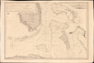
Carte des Canaux de la Providence et de Bahama. D'après la Carte en deux feuilles de E. Blunt de 1847.
$4,000.00
Acquire
- Digital Map Information
- Suitable for large format printing
- Full resolution TIFF file
- ICC color profile embedded
- Delivered instantly via download link
This is a large-format 1851 nautical chart or map of southern Florida and the Bahamas, focusing on the Bahama Banks, produced by the French Dépôt de la Marine. Based on a 1847 chart by American hydrographer Edmund Blunt, the chart represents the most detailed hydrographic information on these notoriously tricky waters available at the time. The map marks a point of rising French trade and activity in the Gulf under the Second Empire. (more details)
Main Waypoint in the Atlantic.
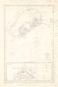
Iles Bermudas, d'après les travaux les plus récents.
$850.00
Acquire
- Digital Map Information
- Suitable for large format printing
- Full resolution TIFF file
- ICC color profile embedded
- Delivered instantly via download link
This is an 1852 nautical chart or map of Bermuda issued by the French Dépôt général de la Marine. It presents the island when it had become the primary waypoint between Europe and the Americas, as well as one of Britain's most important strategic holdings globally. (more details)
An incredible detailed chart of Guanabara Bay - including many of its islands.
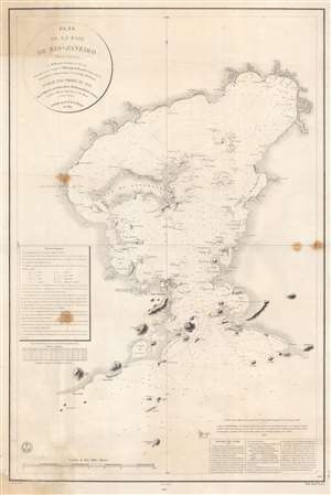
Plan de la Baie de Rio - Janeiro.
$1,000.00
Acquire
- Digital Map Information
- Suitable for large format printing
- File Size: 66.1 MB
- File Type: ZIP / TIFF
- ICC color profile embedded
- Delivered instantly via download link
This is an 1866 edition of the Dépôt de la Marine nautical chart or map of Guanabara Bay, Rio de Janeiro, Brazil. Rio de Janeiro appears near the mouth of the bay, with numerous buildings illustrated but not labeled. The only identified building is the Chateau S. Cristovaô (situated outside the city) which is marked as the Residence of the Emperor. The Ile do Governador (Ilha do Governador - today the site of Rio de Janeiro's Galeão - Antônio Carlos Jobim International Airport) is prominently illustrated, with its coastline appearing in detail. Numerous smaller islands throughout the bay are depicted as well. Smaller bays, capes, points, and even beaches are labeled around the bay. Depth soundings fill the bay, providing a more detailed understanding of its navigability. (more details)