
Logerot, Auguste

Auguste Logerot (fl. c. 1839 - c. 1880) was a French map and general interest publisher active throughout the mid to late 19th century. A. Logerot worked with other French publishers, cartographers and engravers of the period including Fremin, Dufour, Dyonnet, and Vuillemin. He published a large corpus of map and geographical atlases, though few of his map represented unique or exceptionally interesting work. This exception are his wonderful jigsaw puzzle maps - a style popular in 19th century France. Jigsaw puzzle maps are a kind of educational map printed on board and carved up in puzzle format. Logerot's imprint is frequently misprinted as Lagerot or Logeret. Logerot shared offices with several other publishers, printers and engravers at Quai des Augustins 55, Paris. Little else is known of Logerot's life and work.
The Fortification of Paris.
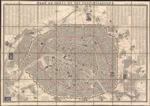
Plan de Paris et ses Fortifications.
$950.00
Acquire
- Digital Map Information
- Suitable for large format printing
- Full resolution TIFF file
- ICC color profile embedded
- Delivered instantly via download link
This is a striking 1844 large-scale July Monarchy (1830 - 1848) map of Paris, France. The map is surrounded by 34 vignette illustrations of important sites - significant as the only edition of this map to feature these. The map predates the Haussmann Renovations (1853 - 1870) but celebrates the 1844 completion of the Thiers Wall and Ring Forts - likely the reason for this deluxe vignette edition. It additionally features profile and vignette illustrations of important sites throughout the map itself. (more details)
Paris the year before the Haussmann renovations.
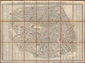
Nouveau Plan ou Guide de l'Étranger dans Paris.
$600.00
Acquire
- Digital Map Information
- Suitable for large format printing
- Full resolution TIFF file
- ICC color profile embedded
- Delivered instantly via download link
This is Auguste Logerot's 1852 pictorial city plan or map of Paris, published on the eve of the Haussmann Renovations. Pictorial illustrations highlight monuments, landmarks, and other important buildings, including the Palais du Louvre, Notre Dame de Paris, the Palais du Luxembourg, the Arc de Triomphe, and the Hotel des Invalides. Paris's celebrated gardens, including the Tuileries, the Champ de Mars, and the Jardin des Plantes are illustrated and labeled. Hand coloring highlights the city's twelve arrondissements. A street index occupies the left and right borders. (more details)
One of the classic sieges in all of history and survived by Leo Tolstoy.
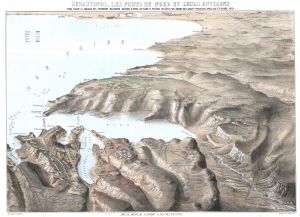
Sebastopol, Les Forts du Nord et Leurs Environs. Pour suivre la marche des opérations militaires, dessiné d'après les plans et dessins par ordre des gouvernements français, anglais et russe, etc.
$850.00
Acquire
- Digital Map Information
- Suitable for large format printing
- File Size: 45.31 MB
- File Type: ZIP / TIFF
- ICC color profile embedded
- Delivered instantly via download link
This is a c. 1855 Auguste Logerot bird's-eye view map of the siege of Sevastopol (Sebastopol) during the Crimean War. Sevastopol, the largest city on the Crimean Peninsula, occupies the foreground and is illustrated in detail. Numerous forts, redoubts, and other fortifications are identified, along with artillery batteries and even a few lighthouses. Russian, British, French, and Ottoman troop positions are colored. The Battle of Inkermann and the fighting at Koughil are directly referenced on the view. (more details)