
Nepal Police Mountaineering and Adventure Foundation

The Nepal Police Mountaineering and Adventure Foundation was established by Nepalese Police Inspector General Khadgajeet Baral in about 1977 in order to establish mountaineering regimes for Nepali police officials, and to promulgate both mountain conservation and mountaineer rescue services. The NPMAF produced a series of trekking maps in the 1980s, sold in order to support these activities.
Rare Nepalese Trekking Map of the Kathmandu Region
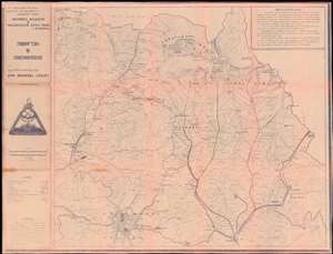
This is a 1983 Nepal Police Mountaineering and Adventure Foundation cyanotype map of the trekking routes from Kathmandu to Gosainkunda lake in Nepal's Langtang National Park, and the Helambu region. Gosainkunda, in particular, is a place of great religious significance, and is a major pilgrimage destination.
The cyanotype map shows rivers and bridges, lakes glaciers, hot springs, villages and towns, passable roads, as well as air strips, police stations and check posts. The map covers the region between the Tibetan border and Kathmandu, and is peppered with hundreds of settlements - many too small to be named. The mountainous topography is shown with great detail, using gradients and altitudes above sea level. (more details)
The cyanotype map shows rivers and bridges, lakes glaciers, hot springs, villages and towns, passable roads, as well as air strips, police stations and check posts. The map covers the region between the Tibetan border and Kathmandu, and is peppered with hundreds of settlements - many too small to be named. The mountainous topography is shown with great detail, using gradients and altitudes above sea level. (more details)
Rare Nepalese Trekking Map of the Annapurna Circuit.
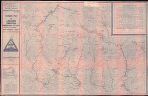
Latest Trekking Map Second Impression August 1983 Around Annapurna, Annapurna Sanctuary, and Kali Gandaki.
$400.00
Acquire
This is a 1983 Nepal Police Mountaineering and Adventure Foundation cyanotype map of the Annapurna Circuit. It is centered on the Annapurna Massif, showing the major towns as well as settlements too small to be named. Typical stops on the trek - Besisahar, Khudi, Bahundanda, Jagat, Dharapani, Chame, Pisang (upper and lower,) Manang, Letdar, the Thorong Pass, Muktinath, Marpha, Lete, Tatopani, Ghorepani, Birethani and Pokhara - are identified. In addition, the trekking path to Annapurna Base Camp via Ghandrung is shown. (more details)