
Swett, C. A.

C. A. Swett (fl. c. 1850 - 1865) was a Boston based engraver and lithographer. His firm, Swett's Zincography, issued several maps of Boston between 1860 and 1864, as well as a map of the White Mountains. Swett is otherwise extremely elusive.
Boston's expansion and urbanization.
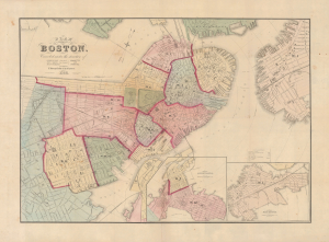
Plan of Boston, Corrected under the Direction of...
$1,500.00
Acquire
- Digital Map Information
- Suitable for large format printing
- Full resolution TIFF file
- ICC color profile embedded
- Delivered instantly via download link
This is an 1866 city map of Boston produced by Nathaniel Henry Crafts, head of the Boston City Engineer's Office. It reflects the city as it had just taken on a recognizable form, with massive landfill projects in the Back Bay, South Boston, and East Boston, and an increasing number of bridges linking Boston with Cambridge and Charlestown. (more details)