
1866 Crafts Map of Boston, Massachusetts, w/Back Bay and Other Landfill Projects

Plan of Boston, Corrected under the Direction of...
Boston's expansion and urbanization.
- Digital Map Information
- Suitable for large format printing
- Full resolution TIFF file
- ICC color profile embedded
- Delivered instantly via download link
Boston's expansion and urbanization.
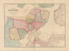
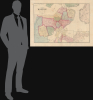
This is an 1866 city map of Boston produced by Nathaniel Henry Crafts, head of the Boston City Engineer's Office. It reflects the city as it had just taken on a recognizable form, with massive landfill projects in the Back Bay, South Boston, and East Boston, and an increasing number of bridges linking Boston with Cambridge and Charlestown.A Closer Look
This map, updated regularly and based upon official engineering records, represents the finest mapping of Boston between 1860 and 1870 - Boston's most vibrant period of expansion, landfill development, urbanization, and modernization. Oriented with north towards top-right, city wards are color-coded and numbered. Streets are labeled throughout, with important buildings, such as City Hall, the Courthouse, Massachusetts General Hospital, and the Athenaeum, outlined. Both Boston Common and the Public Garden are depicted in detail, with footpaths appearing as parallel dotted lines. Insets of South Boston and East Boston occupy the lower-right.The Back Bay and Other Land Reclamation Projects
This map is notable for reflecting the intense, ongoing landfill or land reclamation projects that were reshaping Boston at this time, most notably the Back Bay. Reclamation work on the Back Bay had begun only in 1857, with the first significant building in the neighborhood, the Arlington Street Church, adjacent to the Public Garden, only completed in 1861. The entire landfill project was not completed until 1882, but it took off in earnest in the late 1850s. Still, Crafts ghosts in the original coasts of the marshland as well as the Mill Dam and Boston and Worcester Railroad, which had been the only non-marshy features in the area in the early-mid 19th century. The Cross Dam, seen here, was built later, as the Back Bay was under construction, to divide the planned reclaimed area into two basins of 600 acres each. While the eastern part of the Back Bay was being built, the westerly basin housed waterwheels that would be turned by inflowing water when the Charles River was at high tide before flowing back out into the Charles.Similarly, ongoing land reclamation in East Boston and South Boston is indicated here with a combination of existing streets and ghosted in future development. Future land reclamation would be undertaken in Cambridge and Charlestown, and the continued growth of Boston led to its annexation of Roxbury, Jamaica, Dorchester, and Charlestown in the 1870s.
A New Series of Maps of Boston
Nancy S. Seashoales in her book, Gaining Ground: A History of Landmaking in Boston provides an exciting history of the present map.[…] That year [1860] the City Council decided to have a new 500-scale map of the city prepared by the city engineer's office. This map was then issued annually, with updates, from 1861 to 1868 (except in 1865) under the name of the city engineer - James Slade (1861 - 1863) titled, for example, Plan of Boston, Corrected under the direction of…Committee on Printing, James Slade, City Engineer [1862] and N. Henry Crafts (1864 - 1868) titled, for example, Plan of Boston, with Additions and Corrections made by N. Henry Crafts, City Engineer 1868. In 1868, the map was enlarged to include Roxbury, which had been annexed to the city that year. In 1869, responsibility for the map shifted to the office of the city surveyor, Thomas W. Davis, and the map was published under Davis's name that year and in 1870, when as Plan of Boston, with Additions and Corrections made under direction of Thomas W. Davis, City Surveyor, it was enlarged again to accommodate the annexation of Dorchester. With its large scale, annual updates, and inclusion, after 1863, of the variation of the Chesbrough 1630 shoreline, the city engineer's/surveyor's map is generally an accurate source for a study of landmaking.Seashoales then goes on to state that, after 1870, the city stopped publishing its Plan of Boston because both the lithographic stone and the original engraved copper plate were destroyed in the Great Fire. It was not until 1880, when two young men in the city surveyor's office, Irwin C. Cromack and George F. Loring, formed the Boston Map Company, that a new, updated plan of Boston was published.
Publication History and Census
This map was created in the City Engineer's office under the direction of Nathaniel Henry Crafts, drawn by Henry Morse Wightman, engraved by C.A. Swett, lithographed by Augustus Meisel, and published in 1866 as the third to last in a series of city plans published by the city surveyor's office. Two examples of this edition are noted in the OCLC, at the University of Chicago and the Boston Public Library.Cartographers
Nathaniel Henry Crafts (March 15, 1828 - June 14, 1908) served as the City Engineer of Boston from 1864 through 1872. Born in Watertown, Massachusetts, Crafts worked for his brother Joseph in the wool pulling trade from the age of sixteen for about five years until leaving to join the offices of the chief engineer of the eastern division of the Boston Water Works, William S. Whitwell, in June 1849. He worked for Whitwell until 1851, when he left to work in the office of the city engineer of Boston under E. S. Chesbrough. Chesbrough served as city engineer for four years and then Crafts worked for his successor, James Slade, until 1864. Crafts succeeded Slade as city engineer. The completion of the Chestnut Hill Reservoir ranked among the most important of the projects completed during Crafts' tenure as city engineer. After he resigned as city engineer in 1872, Crafts worked as a consultant for cities and towns throughout the northeastern United States. He married Emeline Broad on November 13, 1851, with whom he had at least two daughters. Further Details...
Henry Morse Wightman (January 5, 1840 - April 3, 1885) was an American civil engineer. Born in Cambridge, Massachusetts, Wightman graduated from the English high school in 1857. He joined the office of the city engineer as a 'rodman' soon after graduation and spent the rest of his life working in that office. He worked on the project to raise the waters of Lake Cochituate, the rebuilding of the Dover Street bridge, oversaw the construction of the Public Garden, and was the engineer for the Back Bay Commission. As such he completed surveys and plans for the filling and laying out of the whole Back Bay territory and surveyed the entire Stony Brook watershed. After the Back Bay project was completed, Wightman returned to the office of the city engineer and soon became the resident engineer in charge of the work at the Chestnut Hill Reservoir. In 1870, Wightman became the chief assistant to city engineer Nathaniel Henry Crafts and Joseph P. Davis. When Davis retired in 1880, the city council named Wightman city engineer, a position he held until his death of double pneumonia. Further Details...
C. A. Swett (fl. c. 1850 - 1865) was a Boston based engraver and lithographer. His firm, Swett's Zincography, issued several maps of Boston between 1860 and 1864, as well as a map of the White Mountains. Swett is otherwise extremely elusive. Further Details...
Augustus Meisel (December 12, 1824 - January 24, 1885) was a German-American lithographer active in Boston during the mid-19th century. Born in Baden, Germany, Meisel immigrated to the United States United States with his brother Berthold (December 10, 1831 - April 5, 1915). The pair arrived in New Orleans on December 5, 1848. They were 48ers, those middle-class Germans who emigrated to the United States to avoid persecution associated with participating in the failed 1848 Springtime of the Peoples Revolutions. Augustus became a naturalized American citizen on September 3, 1855, with Berthold receiving his citizenship a little over a month later. The brothers worked together as lithographers in Boston until Augustus's death. He died January 24, 1885, of pneumonia. Further Details...
Condition
Very good. Some wear and toning on old fold lines. Laid down on linen.
References
OCLC 46844431. Seasholes, Nancy S. Gaining Ground: A History of Landmaking in Boston (Cambridge: MIT Press) 2018, pages 441 - 442.