
Swett, C. A. (sold)

C. A. Swett (fl. c. 1850 - 1865) was a Boston based engraver and lithographer. His firm, Swett's Zincography, issued several maps of Boston between 1860 and 1864, as well as a map of the White Mountains. Swett is otherwise extremely elusive.
The first specific map of New Hampshire's White Mountains.
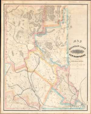
Map of the Mountain and Lake Regions of New Hampshire with Rail-Road Routes.
sold
- Digital Map Information
- Suitable for large format printing
- DPI: 600
- File Size: 74.88 MB
- File Type: ZIP / TIFF
- ICC color profile embedded
- Delivered instantly via download link
This is Marshall Conant's important 1852 wall map of the lakes and White Mountains regions of New Hampshire, likely the first specific map of the White Mountains. Depicting from Mount Washington to Portsmouth and Manchester, Conant places the map's focus on the region's railways. Likely produced to promote Conant's employer, the Cocheco Railroad, prominent black lines identify and trace railroads' routes from Portsmouth, Dover, and Manchester through the White Mountains. Conant dedicates significant effort to detailing the White Mountains, labeling numerous individual peaks. Well-known landmarks, including the Flume, the Lafayette Hotel, the Crawford House, and the Notch House, also appear. (more details)
Expansion and urbanization.
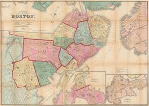
Plan of Boston Corrected under the direction of Charles W. Slack, Lewis Rice, Danl. J. Sweeney, Alderman, Com. Council, Committee on Printing, of 1867, by N. Henry Crafts, City Engineer.
sold
- Digital Map Information
- Suitable for large format printing
- Full resolution TIFF file
- ICC color profile embedded
- Delivered instantly via download link
An 1867 city map of Boston produced for the Boston City Engineer's Office. This map, updated regularly and based upon official engineering records, represents the finest mapping of Boston between 1860 and 1870 - Boston's most vibrant period of expansion, landfill development, urbanization, and modernization. (more details)