
Tavernier, Jean-Baptiste
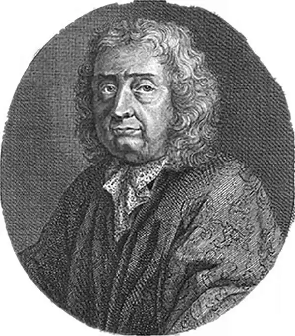
Jean-Baptiste Tavernier (1605 - 1689) was a French gem merchant, traveler, and adventurer active in India and East Asia in the middle part of the 17th century. Tavernier was born in Paris of a French or Flemish Huguenot family that had emigrated to Antwerp, to escape persecution, and which subsequently returned to Paris after the publication of the Edict of Nantes, which promised protection for French Protestants. Tavernier had a family connection to mapmaking as both his father Gabriel and his uncle Melchior were cartographers and engravers. Nonetheless, despite a natural talent for drawing and engraving, he had an insatiable wanderlust and instead traveled independently to India and Asia where he made his fortune in the gem trade. Tavernier made a total of six voyages to Persia, India, and Asia between 1630 and 1668. Tavernier is best known for the discovery/purchase of the 116-carat Tavernier Blue diamond that he subsequently sold to Louis XIV of France in 1668 for 120,000 livres, the equivalent of 172,000 ounces of pure gold, and a letter of ennoblement. (Five years later, Louis had his court jeweler Jean Pitau recut the stone into the 68 carat French Blue and had it set as a hatpin. The gem was reset by his great-grandson Louis XV in The Medal of The Order of the Golden Fleece, stolen in 1792, and was recut and re-emerged in London 30 years later as The Hope Diamond). A wealthy man from his adventures, Tavernier acquired the Barony of Aubonne, and settled into a life of leisure wherein, to occupy himself he published a narrative of his voyages, along with two maps, as Les Six Voyages de Jean-Baptiste Tavernier (1676). Tavernier died in Moscow in 1689, at the age of eighty-four. There is a persistent and most likely false legend that he died from being torn apart by wild dogs as a result of a curse on the Tavernier Blue (Hope Diamond). He one of three brothers of the French merchant adventurer Daniel Tavernier who also made numerous voyages to East Asia.
Worthless youths and the most beautiful women.
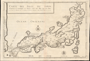
Carte des Isles du Iapon Esquelles est Remqarqué la Route tant par Mer que part Terre que Tiennent les Hollandois pour se transporter de la Ville de Nagasaqui a Iedo demeure de Roy de ces mesmes Isles.
$3,500.00
Acquire
- Digital Map Information
- Suitable for large format printing
- File Size: 28.74 MB
- File Type: ZIP / TIFF
- ICC color profile embedded
- Delivered instantly via download link
This is the large-format 1679 first edition of J. B. Tavernier's landmark map of Japan, eastern Korea, and the intervening sea, here named Sea of Korea (Mer de Coreer). (more details)
Early European mapping of the South China Sea.
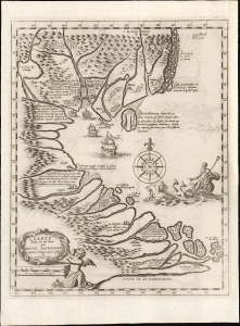
A Carte Faite sur les Lieux part Daniel Tavernier in plusieurs Voiages qu il a fait au Tonquin.
$900.00
Acquire
- Digital Map Information
- Suitable for large format printing
- File Size: 3.84 MB
- File Type: ZIP / TIFF
- ICC color profile embedded
- Delivered instantly via download link
This is a 1682 map of what is today Vietnam and the South China Sea by the French Huguenot merchant-adventurer Daniel Tavernier. The map covers the coast of Vietnam from southern China to the Mekong Delta. It includes parts of modern-day China, including the Island of Hainan, and the Chinese coast roughly as far north as modern-day Hong Kong and Macau. It names the Island of Shangchuan (上川岛), just south of Hong Kong, where the Navarrese-Basque Roman Catholic missionary, St. Francis Xavier, died. (more details)
Supporting Vietnamese claims in the South China Sea.
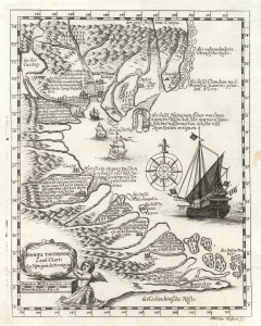
Daniel Taverniers Land-Charte des Königreichs Tunqvin.
$850.00
Acquire
- Digital Map Information
- Suitable for large format printing
- DPI: 600
- File Size: 4.66 MB
- File Type: ZIP / TIFF
- ICC color profile embedded
- Delivered instantly via download link
This is an important 1684 map of Vietnam and the South China Sea by the French Huguenot merchant adventurer, Daniel Tavernier. This is one of several maps citied to support modern-day Vietnamese claims against China to soverignty over disputed island clusters in the South China Sea. (more details)
Revealing Central Asia.
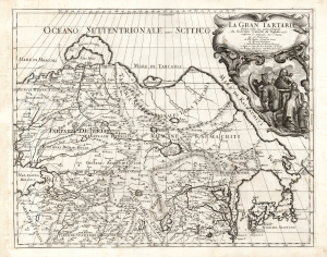
La Gran Tartaria.
$650.00
Acquire
- Digital Map Information
- Suitable for large format printing
- DPI: 600
- File Size: 55.88 MB
- File Type: ZIP / TIFF
- ICC color profile embedded
- Delivered instantly via download link
This is Cantelli da Vignola's 1693 map of Central and northeastern Asia, focusing on 'Tartar lands', an expansive territory spanning from the Russian steppe to the Great Wall of China. (more details)