This item has been sold, but you can get on the Waitlist to be notified if another example becomes available, or purchase a digital scan.
1935 Ruth Taylor White Pictorial Map of the Philippines
Philippines-taylor-1935$100.00

Title
Philippine Islands.
1935 (undated) 12 x 9 in (30.48 x 22.86 cm)
1935 (undated) 12 x 9 in (30.48 x 22.86 cm)
Description
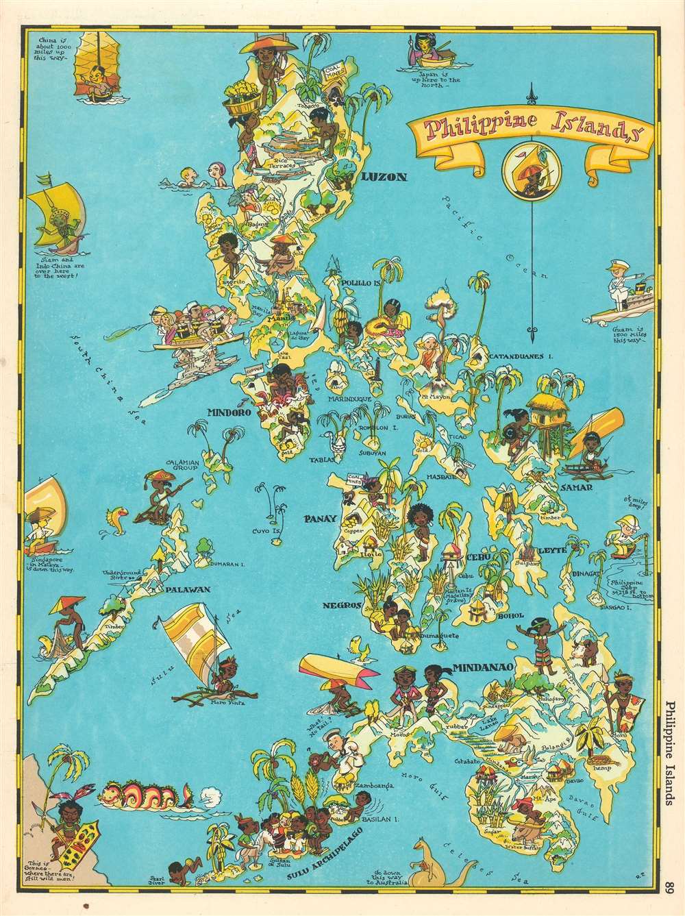
This is a 1935 Ruth Taylor White pictorial map or 'cartograph' of the Philippines. The map depicts the archipelago from the South China. Sea to the Pacific Ocean and from Luzon to the Celebes Sea and Borneo. This 'cartograph' epitomizes the style and aesthetic of Ruth Taylor White, in that it is not meant to be geographically accurate but to entertain. In the 1930s, Manila was known as 'The Pearl of the Orient' and was an incredibly popular tourist destination. Here, White depicts a steamer full of tourists heading into Manila Bay right alongside and American battleship, complete with oversize guns. Native Filipinos, most of whom are barely clothed, are illustrated going about their lives beside white tourists frolicking in the ocean and reading in the sun. Many of the islands in the archipelago are labeled, and resources, such as copper, sulfur, gold, rubber, timber, and tobacco, are referenced. White also uses stereotypical caricatures of regional neighbors to globally situate the Philippines, including using a kangaroo and its joey to indicate the direction to Australia.
Publication History
This pictorial map or 'cartograph' was published in Frank and Ruth Taylor's book Our U.S.A.: A Gay Geography in 1935.Cartographer
Ruth D. Taylor White (March 1896 - 20??), a.k.a. Ruth Taylor Day, was an American pictorial mapmaker, what she liked to call 'carto-graphy'. Ruth was born Oregon to the painter John S. Taylor (1858 - 1927). Her interest in cartographic mapmaking was probably inspired by her sister Della Taylor Hoss (1900 - 1997), also an important pictorial cartographer. One of her first published works was a cover of The Stanford Illustrated Review, where her brother Frank attended university. Frank was an accomplished journalist and writer, and Ruth provided the illustrations for two of his books, popular works about the national parks, ’Oh Ranger!’ A Book About the National Parks and Grand Canyon Country. In the spring of 1930, White traveled to Hawaii, where she received a commission from the Hawaii Tourist Bureau to create pictorial maps of the Hawaiian Islands. Sets of five maps began appearing in 1931, with maps of Kauai, Oahu, Maui, Hawaii, and the island chain as part of the set. These were most likely handed out to visitors by the Bureau. White’s most famous work, a pictorial atlas entitled, Our USA: A Gay Geography was published in 1935 and was filled with ‘cartography’ of each state, which she published with her brother as Ruth Taylor. White is also known for her map of Treasure Island, the site of the Golden Gate International Exposition. A third sister, Bernice Taylor Fitzgerald, was also an artist, but did not make maps. Ruth was still an active artist as late as 1997. There is no record of her death, suggesting she may well be a centenarian. More by this mapmaker...
Source
Taylor, Frank J. and Ruth Taylor, Our U.S.A.: A Gay Geography (Boston: Little, Brown, and Company) 1935.
Condition
Very good. Even overall toning. Text on verso.