
Widman, Giorgio

Giorgio Widman (fl. 1672 to 1682) was a celebrated map and lettering engraver, who worked primarily with the De Rossi publishing house. He is perhaps best known for having executed the lettering of Giovanni Battista Falda's superb 1675 map of Rome.
Scarce and Elegantly-Engraved Map of the Far East.

Il Regno Della China detto presentemente Catay e Mangin diviso sopra le Carte piú esatte sue Principali Provincie.
$2,200.00
Acquire
- Digital Map Information
- Suitable for large format printing
- DPI: 600
- File Size: 48.62 MB
- File Type: ZIP / TIFF
- ICC color profile embedded
- Delivered instantly via download link
This is a scarce 1682 Cantelli da Vignola map of China, Japan, and Korea, presenting a striking and up-to-date view of the Far East benefitting from Jesuit and Dutch reports. Its framework is derived from the 1552 Martino Martini map by Blaeu, but this map is significantly updated after the reports of the Jesuits Bento de Góis and Johann Grueber. (more details)
Crimea and Caucasus of the 17th century.
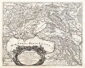
Tartaria d'Europa o vero Piccola Tartaria divisa da Giacomo Cantelli da Vignola ne Tartari Nogai e del Crim, o di Precop Soggetti al proprio Kam ne Tartari di Budziack, d'Oczackow, e di Dobruss, soggetti al Turco, ne Tartari Circassi, e di Mordua Soggetti al Gran Duca di Moscovia e nelle Due Uckraine...
$1,200.00
Acquire
- Digital Map Information
- Suitable for large format printing
- DPI: 600
- File Size: 68.61 MB
- File Type: ZIP / TIFF
- ICC color profile embedded
- Delivered instantly via download link
This is a 1684 Cantelli da Vignola map of the Caucasus, the lands of the Circassian and Crimean Tartars, Georgia, and Ukraine. The region - peopled by an array of Tatar and Cossack tribes - was largely under the domination of the Crimean Khanate and the Nogai Horde, but represented a borderland contested by the Grand Duchy of Muscovy and the Turkish Empire. (more details)
Revealing Central Asia.
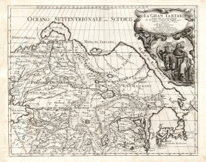
La Gran Tartaria.
$650.00
Acquire
- Digital Map Information
- Suitable for large format printing
- DPI: 600
- File Size: 55.88 MB
- File Type: ZIP / TIFF
- ICC color profile embedded
- Delivered instantly via download link
This is Cantelli da Vignola's 1693 map of Central and northeastern Asia, focusing on 'Tartar lands', an expansive territory spanning from the Russian steppe to the Great Wall of China. (more details)