
Zannoni, Giovanni Antonio Bartolomeo Rizzi

Giovanni Antonio Bartolomeo Rizzi Zannoni (September 2, 1736 - May 20, 1814) was an 18th century Italian cartographer active in Venice and Naples. Zannoni was born in Padua, Italy on September 2, 1736. Between 1749 and 1751 Zannoni studied Astronomy at the University of Padua under John Polen, a prominent astronomer of the period. After leaving the University, Zannoni was commissioned by the King of Poland, Augustus III, to map that country. Zannoni's subsequent survey is considered the first accurate triangulation of Poland. Afterwards Zannoni's services were in high demand and he traveled around much of Europe, working on various surveys in Denmark, Germany, Prussia, and Sweden. Around 1757 Zannoni was caught up in the hostilities surrounding the Seven Year War and, after one battle, was taken to Paris as a prisoner of war. Paris must have suited Zannoni for he remained for nearly 20 years, even taking service with the Paris Engineer's Office. It was also here in Paris the Zannoni developed the cartographic contacts that would lead to his most prolific cartographic publications, including the Atlas Moderne in conjunction with Lattre. In 1781, Zannoni was called to Naples by the Bourbon monarchy to help in the revision of the Charter of 1769. Afterwards he stayed on and produced a numerous important maps of the Kingdom of Naples. Zannoni is considered a careful and precise cartographer and his work, particularly the maps he made in Naples, have been praised by R.V. Tooley as 'remarkable for a marvelously minute attention to detail, and amply deserves the commendation passed upon it by Sir George Fordham' (Tooley, Maps and Mapmakers, 21). Zannoni would spend the remainder of his days in Naples and passed away on May 20, 1814.
Map depicting all of the Caribbean, Florida, and Central America.
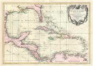
Carte geo-hydrographique du Golfe du Mexique et de ses isles. Construit d'apres les memoires les plus recens, et assujeties, pour l'emplacement de ces principales positions aux latitudes et longitudes, determinées par observation.
$800.00
Acquire
- Digital Map Information
- Suitable for large format printing
- DPI: 300
- File Size: 5.82 MB
- File Type: ZIP / TIFF
- ICC color profile embedded
- Delivered instantly via download link
A beautiful example of Zannoni's 1762 map of the West Indies, Florida and Central America. Covers from the Gulf of Mexico to the Lesser Antilles including all of the West Indies, Florida and Central America, with parts of Louisiana, Mexico and northern South ... (more details)
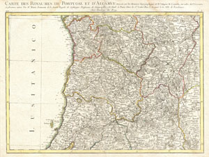
Carte des Royaumes de Portugal et D'Algarve.
$225.00
Acquire
- Digital Map Information
- Suitable for large format printing
- DPI: 300
- File Size: 10.08 MB
- File Type: ZIP / TIFF
- ICC color profile embedded
- Delivered instantly via download link
A beautiful example of Rizzi-Zannoni's curious decorative map of northern Portugal and Oporto. Covers from just north of Lisbon north to Galicia and east as far as Valladolid, Spain. Engraved in a highly unusual topographic style, this map offers excellent ... (more details)
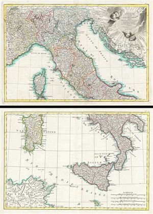
L'Italie divisee en ses differens Etats dress d'apres les meilleurs Cartes appuyee sur les Observations Astromom'.
$550.00
Acquire
- Digital Map Information
- Suitable for large format printing
- DPI: 300
- File Size: 17.51 MB
- File Type: ZIP / TIFF
- ICC color profile embedded
- Delivered instantly via download link
A beautiful example of Rizzi-Zannoni's 1783 two sheet decorative map of Italy. The upper sheet covers from Lake Geneva and the Venetian States south to include Rome, Corsica, and Capitana. It also includes the Gulf of Venice and the states of Dalmatia, ... (more details)
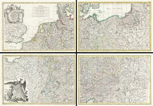
Carte de L'Empire D'Alemagne avec les Etats de Boheme.
$750.00
Acquire
- Digital Map Information
- Suitable for large format printing
- DPI: 300
- File Size: 42.33 MB
- File Type: ZIP / TIFF
- ICC color profile embedded
- Delivered instantly via download link
A rare compete example of Rizzi-Zannoni's 1783 decorative four panel map of the German empire and Poland. Rizzi-Zannoni's map covers from Jutland to the Gulf of Venice and from england to Poland. The map offers excellent detail throughout showing ... (more details)
The best large-format pre-Napoleonic map of the Kingdom of Naples.
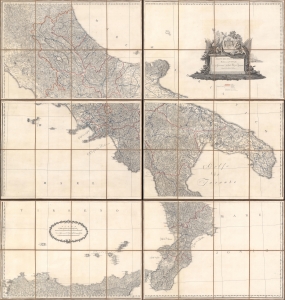
Atlante del regno di Napoli - Ridotto in VI. Fogli da G.A. Rizzi-Zannoni, Geografo di Sua Maestà Siciliana.
$1,900.00
Acquire
- Digital Map Information
- Suitable for large format printing
- Full resolution TIFF file
- ICC color profile embedded
- Delivered instantly via download link
A striking c. 1805 folding map of the Kingdom of Naples - the largest and most impressive map of that region yet published. It was made by Giovanni Antonio Rizzi Zannoni, one of the greatest Italian cartographers of his time, and published during an era of rapid political transitions in southern Italy, a result of the French Revolution and the Napoleonic Wars. (more details)