
Bünting, Heinrich

Heinrich Bünting (1545 – 1606) was a Protestant pastor and theologian. He was born in Hanover, and studied theology at the University of Wittenberg. He earned his Master's degree in 1569. He remained in Wittenberg as a pastor there, before being appointed to that same position at Alt Calenberg, in the service of the Dukes of Saxony. The estate was dissolved when the marriage of the Duchess Sidona and Duke Eric the Younger foundered, and Bünting became pastor in Gronau in 1575. In Gronau, he wrote his two major works - the 1581 Itinerarium Sacrae Scripturae, and the 1584 Brunswick and Lüneburg Chronicle. He produced a smaller work on Biblical coins and measures in 1582. He would briefly serve as superintendent in Goslar, but he would be dismissed as a result of theological differences. Stung, he returned to his hometown and changed to the less controversial profession of a beer brewer, until his death in 1606. The work for which he is best known, Itinerarium Sacrae Scripturae, was the first complete summary of biblical geography. It remained in print in more than sixty editions, long after his death. Earlier editions contain some of the most distinctive and sought after maps, most notably his map of the world in the shape of a cloverleaf, and an allegorical map of Asia in the form of a Pegasus.
Tribes of Israel.
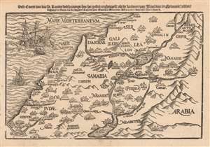
Dese Caerte van des H. Landts Beschrijvinge/ hoe het gestelt is gheweest/ als de kinderen van Israel daer in ghewoont hebben.
$750.00
Acquire
- Digital Map Information
- Suitable for large format printing
- DPI: 600
- File Size: 4.78 MB
- File Type: ZIP / TIFF
- ICC color profile embedded
- Delivered instantly via download link
This is a scarce 1635 Dutch woodcut map of the Holy Land, presenting (as per the title) a 'map of the Holy Lands, describing how it was when the Children of Israel lived there.' The map depicts the location of present-day Israel, Palestine, and parts of Lebanon, Syria, and Jordan. (more details)