
Bry, Theodore de
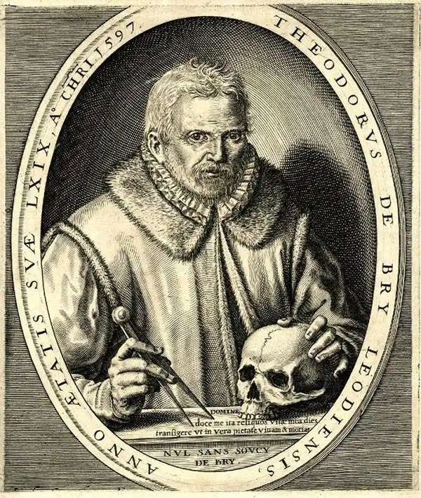
Théodore de Bry (1528 - March 27, 1598) was an important publisher active in the mid to late 16th century. De Bry was born in 1528 in Liege, then a Prince-Bishopric and thus independent of neighboring nations. The De Bry family were accomplished jewelers and copperplate engravers and, following the family tradition, Theodore apprenticed in these fields under his grandfather Thiry de Bry senior (? - 1528), and later under his father, Thiry de Bry junior (1495 - 1590). To avoid growing religious strife in the region Théodore de Bry left Liege for the more tolerant Strasburg. Shortly afterwards, in 1577, he moved again to Antwerp and, in 1580 to London, where he became well known for his engraving skills. It was either in Antwerp or in London that De Bry befriended the English publisher and editor of traveler's tales Richard Hakluyt. Inspired by Hakluyt's work, De Bry began to collect travelers' tales, particularly of voyages to New World. His most prominent acquisition was most likely the letters and papers of the French painter and mapmaker Jacques Le Moyne de Morgues discussing a disastrous attempt by French Huguenots to colonize parts of Florida. Around, 1588 De Bry moved to Frankfurt where he began his own publishing firm. Among De Bry's earliest and most prominent publications are his Grands Voyages, a multivolume compilation of travelers' tales that included the work of Le Moyne as well as some of the earliest published depictions of the North American mainland. The firm also published various other works including an important account of early English attempts to colonize Virginia with illustrations by John White. De Bry died in Frankfurt on March 27, 1598, having never left the shores of Europe, though his name was associated throughout Europe with tales of travel and adventure. Théodore de Bry was succeeded by his son Jean-Théodore (1560 - 1623) who continued the publishing firm until his own death in 1623.
First specific map of Florida.
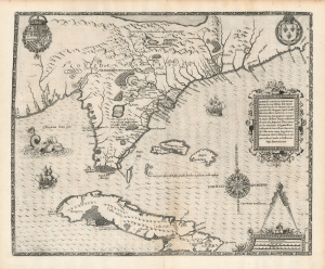
Floridae Americae Provinciae Recens and Exactissima Descriptio Auctore Iacobo Le Moyne cui Cognomen de Morgues, qui Laudonierum…
$10,000.00
Acquire
- Digital Map Information
- Suitable for large format printing
- Full resolution TIFF file
- ICC color profile embedded
- Delivered instantly via download link
…the most remarkable and important map, which has been preserved from the sixteenth century maps, of that part of the East Coast which lies between Cape Hatteras and Cape Florida … the first French map to show Florida … considered the most important map of Florida. - Johns Matthews BaxterA map of extraordinary rarity and seminal importance, this is one of the earliest and most influential maps of the American southeast ever published. Drawn by the French artist Jacques Le Moyne de Morgues c. 1565 and published by Theodore de Bry in 1591, this magnificent map details the Florida peninsula and Carolina coast from Cuba to the Bahamas, to 'Prom Terra flag' or, as it is known today, Cape Lookout near Beaufort, North Carolina. (more details)
A 16th century map of Madagascar based on information from the first Dutch expedition to the East Indies.
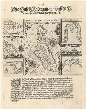
Insula de S. Laurety. / Die Insel Madagascar.
$400.00
Acquire
- Digital Map Information
- Suitable for large format printing
- DPI: 600
- File Size: 6.54 MB
- File Type: ZIP / TIFF
- ICC color profile embedded
- Delivered instantly via download link
This is a 1599 Theodor de Bry map of Madagascar. The map depicts the entire island from the southwest with the African coast illustrated along the left side. Numerous locations throughout the islands are labeled, as are several smaller islands situated between Africa and Madagascar. Two wind roses appear on either side of Madagascar and the Tropic of Capricorn passes through the island's southern quarter. Four inset maps appear in the maps four corners and illustrate Santa Maria Island, the Coromos Islands, Dantogil Bay, and Saint Augustine Harbor. Nineteen different locations within the inset maps are alphabetically identified and correspond to a key located below the map. (more details)