
Bry, Theodore de (sold)
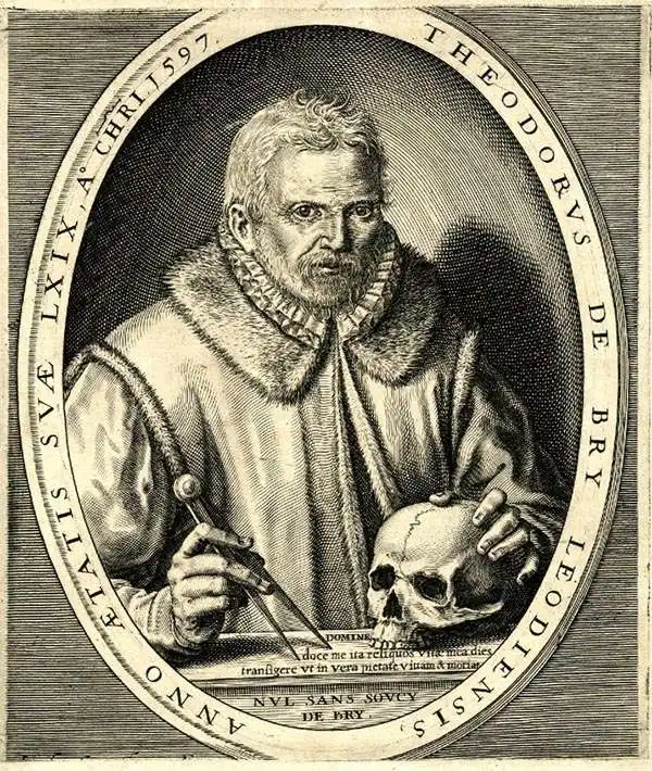
Théodore de Bry (1528 - March 27, 1598) was an important publisher active in the mid to late 16th century. De Bry was born in 1528 in Liege, then a Prince-Bishopric and thus independent of neighboring nations. The De Bry family were accomplished jewelers and copperplate engravers and, following the family tradition, Theodore apprenticed in these fields under his grandfather Thiry de Bry senior (? - 1528), and later under his father, Thiry de Bry junior (1495 - 1590). To avoid growing religious strife in the region, Théodore de Bry left Liege for the more tolerant Strasbourg. Shortly afterward, in 1577, he moved again to Antwerp and, in 1580, to London, where he became well known for his engraving skills. In either Antwerp or London, De Bry befriended the English publisher and editor of travelers' tales Richard Hakluyt. Inspired by Hakluyt's work, De Bry began to collect travelers' tales, particularly of voyages to the New World. His most prominent acquisition was most likely the letters and papers of the French painter and mapmaker Jacques Le Moyne de Morgues discussing a disastrous attempt by French Huguenots to colonize parts of Florida. Around 1588, De Bry moved to Frankfurt, where he began his own publishing firm. Among De Bry's earliest and most prominent publications are his Grands Voyages, a multivolume compilation of travelers' tales that included the work of Le Moyne as well as some of the earliest published depictions of the North American mainland. The firm also published various other works, including an important account of early English attempts to colonize Virginia with illustrations by John White. De Bry died in Frankfurt on March 27, 1598, having never left the shores of Europe, though his name was associated throughout Europe with tales of travel and adventure. Théodore de Bry was succeeded by his son Jean-Théodore (1560 - 1623), who continued the publishing firm until his own death in 1623.
The first detailed map of any part of North America by an actual Colonist.
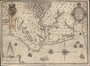
Americae Pars, Nunc Virginia dicta, primum ab Anglis inventa sumtibus Dn. Walteri Raleigh Equestris ordinis Viri Anno Dni. M.D LXXXV...
sold
- Digital Map Information
- Suitable for large format printing
- Full resolution TIFF file
- ICC color profile embedded
- Delivered instantly via download link
This is John White's 1590 map of the first Virginia colony. It is one of the first maps of any part of the modern-day United States, and the first map of a settled area produced by a colonist. Specifically, it is the first map to result from England's efforts to colonize North America. It is the earliest map available to the collector of Virginia and North Carolina, and it is the first map to name Chesapeake Bay. It is among the most influential early Americas maps, the traces of which are found on maps for decades to follow. (more details)
The most influential map of Florida ever printed.
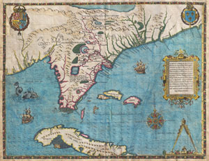
Floridae Americae Provinciae Recens & Exactissima Descriptio Auctore Iacobo Le Moyne cui Cognomen de Morgues, qui Laudonierum …
sold
- Digital Map Information
- Suitable for large format printing
- DPI: 300
- File Size: 13.89 MB
- File Type: ZIP / TIFF
- ICC color profile embedded
- Delivered instantly via download link
…the most remarkable and important map, which has been preserved from the sixteenth century maps, of that part of the East Coast which lies between Cape Hatteras and Cape Florida … the first French map to show Florida … considered the most important map of ... (more details)
Revealing Dutch Secrets in the East.
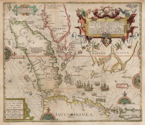
Nova Tabula Insularum Javae, Sumatrae, Borneonis et Aliarum Mallaccam usquae delineate in insula Iava...
sold
- Digital Map Information
- Suitable for large format printing
- DPI: 600
- File Size: 34.83 MB
- File Type: ZIP / TIFF
- ICC color profile embedded
- Delivered instantly via download link
This scarce, beautiful map of the East Indies is Theodore De Bry's 1598 edition of the suppressed work of Cornelis Claesz and Willem Lodewijcksz. The map represents the first Dutch voyage to the Spice Islands and thus the dawn of the Dutch ascendency as a global trade powerhouse. It is also among the earliest printed maps to include Bali. (more details)
A seminal map in the search for a Northeast Passage to Asia.
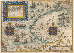
Tabula terrae Nouae Zemblae in qua fretum sinusq Waigats item ord littorialis Tartariae atq Russiae, ad urgem usq Kildeinam ….Authore Gerhardo De Veer.
sold
- Digital Map Information
- Suitable for large format printing
- DPI: 300
- File Size: 3.54 MB
- File Type: ZIP / TIFF
- ICC color profile embedded
- Delivered instantly via download link
A highly important map regarding the early search for a Northeast Passage. This remarkable map was drawn in 1601 by Theodore de Bry to describe the ill fated third voyage of the Dutch explorer William Barentsz in search of the Northeast Passage. The map depicts ... (more details)
Henry Hudson's Final Voyage.
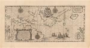
Tabula nautica, qua repraesentātur orae maritimae meatus, ac freta, noviter a H. Hudsono Anglo ad Caurum supra Novam Franciam indagata anno 1612.
sold
- Digital Map Information
- Suitable for large format printing
- Full resolution TIFF file
- ICC color profile embedded
- Delivered instantly via download link
This is Johann Theodore De Bry's 1613 edition of Hessel Gerritz' chart of the North Atlantic and the Canadian Maritimes, based on the reports of Henry Hudson's fourth, final voyage. Predated only by Gerritsz' much rarer 1612 issue, this is the first map of Hudson Bay and the surrounding region, and remained the best chart of the northern regions of Canada for decades. The chart reaches from the British Isles to the western shore of James Bay, extending from 50° - 70° N. (more details)
Exquisitely detailed map and view of Recife, Brazil.
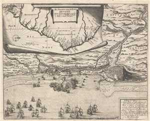
Das Norder Theil des Lands Brasilien.
sold
- Digital Map Information
- Suitable for large format printing
- DPI: 300
- File Size: 9.36 MB
- File Type: ZIP / TIFF
- ICC color profile embedded
- Delivered instantly via download link
This is a stunningly engraved 1655 Matthaeus Merian map of the coast of Brazil and a view of Olinda and Recife in Pernambuco, Brazil. The inset map, shown as if being unrolled on a piece of parchment, shows the coast of Brazil, and more specifically the Capitania ... (more details)
Exquisitely detailed map and view of Recife, Brazil.
Das Norder Theil des Lands Brasilien.
sold
- Digital Map Information
- Suitable for large format printing
- DPI: 300
- File Size: 8.15 MB
- File Type: ZIP / TIFF
- ICC color profile embedded
- Delivered instantly via download link
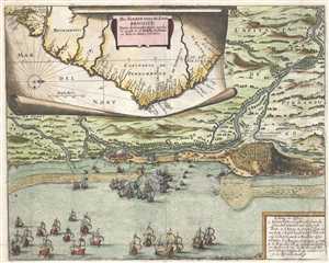
This is a stunningly engraved 1655 Matthaeus Merian map of the coast of Brazil and a view of Olinda and Recife in Pernambuco, Brazil. The inset map, shown as if being unrolled on a piece of parchment, shows the coast of Brazil, and more specifically the Capitania ... (more details)