
1601 Theodore de Bry Regnum Congo / Indiae Orientalis

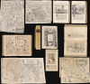
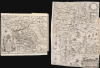
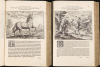
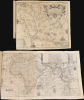
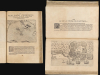
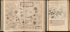
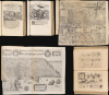
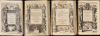
Regnum Congo hoc est. Vera Descriptio Regni Africani.../ II Pars Indiae Orientalis, in qua Iohan Hugonis Lintscotani Navigatio in Orientem.../ Tertia Pars Indiae Orientalis.../ Pars Quarta Indiae Orientalis...
Early edition of an essential collection of travels
Early edition of an essential collection of travels
This is a handsome 1601 collection of the first four books of the brothers Johann Theodor and Johann Israel de Bry's Indiae Orientalis, in their first Latin editions. These comprise the first four books of what would later be termed De Bry's Petits Voyages. Published serially from 1598 to 1628, this work offered European readers up-to-date reports of discoveries in Africa and the East, supported by a wealth of images and maps. These first editions contained what was probably the most complete picture available of the latest discoveries from Africa to the Spice Islands. In the case of Cornelis de Houten's voyage to the Spice Islands, De Bry's copies of the Cornelis Claesz maps suppressed from the initial Dutch report were the first glimpses of the momentous journey available to readers. When these editions were printed and sold, the discoveries within their pages were still current and would have been received eagerly. Indeed, collectors for centuries sought out the volumes of De Bry's Voyages in an effort to assemble a complete or 'perfect' De Bry, with no less a book fiend than Thomas Jefferson among them.A Closer Look
This neatly vellum-bound folio displays the embossed title Pigafetta Regnum Congo, referring to its first part, Theodore De Bry's 1598 'Regnum Congo hoc est Vera Descriptio Regni Africani.' The folio actually contains Regnum Congo and three other books as well:- II. Pars Indiae Orientalis in qua Iohan Hugonis Lintscotiani Navigatio in Orientem
- Tertia Pars Indiae Orientalis qua pars Altera Navigationis Ioan Hugonis de Lindtschotten, in Orientem Institutae
- Pars Quarta Indiae Orientalis: qua Primum varii generis Animalia, Fructis, Arbores: Item, Aromata seu Species et Materialia
Duarte's Fleeting Glimpse of Africa
In 1589, a Portuguese trader named Duarte Lopez arrived in Rome as an emissary to Pope Sixtus V on behalf of the King of the Congo: King Álvaro II, a Catholic convert, sought papal protection for his kingdom; Lopez sought to develop trade contacts for Congo's mineral wealth. Filippo Pigafetta, a scholar and diplomat then in Papal service, was commissioned to take Lopez's testimony, which was accompanied by a manuscript map. Lopez's mission failed, and he returned empty-handed to the Congo, where he mysteriously disappeared. Pigafetta published Lopez's account in 1591 as Relatione del reame di Congo, adding his own observations and references. Engraver Natale Bonifacio supplied several views and two maps.When the De Brys produced their German Pigafetta in 1597, it was not the first translation (it was preceded by a Dutch, Claesz edition in 1596 and an English, Wolfe edition in 1597). But both the Claesz and the Wolfe editions were smaller format books; neither contained the full complement of images supplied by Pigafetta, and those that were included copied Natale's engravings imperfectly as woodcuts. Claesz only included a small version of the Congo map. In sharp contrast, the De Bry editions not only included large, beautifully executed copperplate copies of 7 of the 8 images appearing in the 1591 edition, but also included 7 newly engraved images based on the text. Between the inherent quality of the De Bry's production and the vast reach afforded by the firm's access to the semiannual Frankfurt Book Fair, their editions of Pigafetta can be said not only to have been more beautiful, but to have had greater impact than the original Rome edition.
Key Maps: Pigafetta
Pigafetta's two maps appear near the beginning of the book.West Africa: Tabula Geogra Regni Congo. This map of the Congo River and its vicinity was derived from the manuscript Duarte Lopez provided to Pigafetta. It is a beautiful, richly engraved work, detailing the Congo River, its tributaries, dozens of other rivers and more than thirty cities. The region is full of dramatically presented mountains - some of them named 'Crystal Mountains', indicating the presence of gems. Overall, consistent with Duarte's efforts to court Papal support, the map presents the Kingdom as navigable, urbanized, and Christianized (note the crosses and steeples).
Africa / Nile River: Tabulam hanc Aegypti, si aequus ac dilignes lecot. This larger map presents Africa east of Guinea, showing the Kingdom of the Congo in relation to the rest of the continent. One of the first early maps of the continent to credibly revise the Ptolemaic model of the Nile, reframing the ancient conception of the two lakes feeding the Nile from a side-to-side to a vertical arrangement. Pigafetta's formulation here conforms more closely to the actual locations of Lakes Victoria and Tanganyika. This is considered one of the most finely engraved maps of Africa, ornamented with numerous ships, sea monsters, and elaborate cartouches.
Linschoten's Revelations of the East
The next three books are serializations of one of the most important and influential geographical works: Jan Huygen van Linschoten's Itinerario. A clerk to the Archbishop of Goa (the center of Portuguese power in the East) his access provided an unmatched view not only of the means by which the Dutch might reach the Spice Islands, but also rich sociological observations of the cultures with which the Portuguese had been interacting, and with whom the newly-arriving Dutch would need to ingratiate themselves. This book was instrumental in breaking the Portuguese monopoly on the East India trade, and led directly to Dutch supremacy in world trade. Its significance was recognized immediately, and Dutch trading companies supplied copies to each ship sailing east.It is not clear that Linschoten intended his work as a monument to mercantile espionage: he wanted to describe the lands and peoples of the East in a way that would titillate and captivate European readers with exoticism and novelty. To that end, Linschoten's 1596 work contained a wealth of engravings, panoramas, and town plans - many drawn by the author. Many of these depict the styles and customs of both denizens and visitors to Goa, as well as the types of ships used in the India trade; there are also plates dedicated to accurately depicting the spices and fruits found in the East, and the manner of their cultivation. Other images present scenes to shock the European Christian readership: idolatry, martyrdom of missionaries, and funerary rites (such as the Hindu practice of sati).
The De Brys understood well the entertainment appeal of Linschoten's opus, and their translation focuses on that aspect: the nautical charts that characterize the Dutch original are not reproduced here. Instead, they focus on the views and vignettes of Linschoten's book: these are abundantly and beautifully re-engraved and presented throughout the three books (parts II, III, and IV) of Indiae Orientalis. The cartographic elements that the De Brys include from Linschoten are his city plans and views: the depictions of Goa, Angra, Mozambique and other ports of call, rather than the broader charts, served the De Brys' efforts to present the wonders of the East.
Revealing New Dutch Secrets
The 1601 Part III of Indiae Orientalis not only included Linschoten's works. In a remarkable coup for the De Brys, the second part also included Cornelis de Houtmann's 1595-97 voyage to the East Indies. This ill-fated and initially unpromising voyage signaled the Dutch entry into and early domination of the pepper trade. This narrative's appearance alongside Linschoten is logical: Houtmann's voyage was, in almost every respect, guided by Linschoten's intelligence, including Houtmann's plan to enter the Indies via the Sunda Strait (between Sumatra and Java) to establish a foothold in the Javanese port of Bantam. While the voyage itself was, by most measures, a failure, it was a successful and valuable lesson for the Dutch as a proof of concept. In 1598, Willem Lodewijcksz, who sailed with Houtmann and kept the logbook for the journey, published an account of the journey, Historie van Indien. He also provided the publisher, Cornelis Claesz, with charts to illustrate the voyage's findings. While Claesz was allowed to publish the Historie, the charts were swiftly suppressed by the merchants of Amsterdam. Claesz's charts based on Lodewijcksz were seen by very few then, and are now known in only a handful of examples. These efforts to suppress the charts, however, were futile: Lodewijcksz's report reached the De Brys with the charts intact, and were included here. Their presence heightened the importance of the De Brys' Indiae Orientalis beyond mere entertainment: from Frankfurt, news of the new Dutch foothold in the East would spread throughout Europe.This part of Indiae Orientalis is the most image-rich, partly because the views drawn from Linschoten are accompanied by vignettes from Houtmann's misadventures, including views of Bantam, sea battles with the incensed Javans, and the earliest acquirable maps and views of Bali.
Key Maps: Lodewijcks
East Indies / Java: Nova Tabula Insularum Javae, Sumatrae, Borneonis et Aliarum Mallaccam usquae delineate in insula Iava Based on Claesz's chart after Lodewijcksz, this map embraces the East Indies from Sumatra to Borneo, and from Southern Malay (Chersonese) to Java, including the Straits of Malacca, the Straits of Singapore, and the Sunda Strait. It focuses specifically on the Malacca Strait and the Sunda Strait, the former being the Portuguese-controlled route to the spice islands, and the latter being the passage to the Dutch foothold of Bantam. De Bry's engraving is superb and artful. The elaborate compass roses and strapwork cartouches reflect the original, although the primary cartouche's garlands and birds are De Bry's own. The four ships of Houtmann's fleet sail the waters north of Java.Africa / East Indies: Descriptio Hydrographica accommodata ad Battavorum navigationem in Javam insulam Indiae Orientalis. This large chart embraces Africa and the East Indies, including a tantalizing glimpse of 'Terra Australis Incognita.' It illustrated, complete with ship's tracks coming and going, the whole of Houtmann's voyage. As with the above chart, it was engraved by Claesz and suppressed; its source is attributed to Lodewijcks.
The Search for the Northeast Passage
The third section of Part III was dedicated to a great contemporary cause celébre: the three voyages of the Dutch in an effort to find a Northeast Passage to the Indies, especially the third, fateful voyage of Willem Barentsz (c. 1550 - 1597) and its dramatic wintering in Nova Zemla. Thus, bound in with Part III's voluminous collection of plates, can be found De Bry's reduced copy of Barentsz' map of the Arctic:Arctic / Northeast Passage: Deliniatio cartae trium navigationum per Batovos… Barentsz' map was described by William Ginsberg as 'perhaps the most important map of the far northern regions' and is one of the most entertainingly engraved maps of that part of the world, replete with sea monsters, ships, and bears. The map presents knowledge gleaned from Barentsz' three voyages, beginning in 1594 in search of a northeast passage, and traces his fatal third voyage.
In addition to the map, the volume includes vignettes of intrepid Dutch mariners struggling with ice, walruses, bears (lots of bears), and the brutal cold of an Arctic winter. Among these are several small charts detailing the coast of Lappland and the Yugorsky Strait (here termed the Nassau Strait).
The Fruits of the East
The 1601 Part IV of Indiae Orientalis completed De Bry's edition of Linschoten and expanded its descriptions of the East's flora and fauna with the observations of naturalist, collector, and physician Bernhard Paludanus (1550 - 1633). Paludanus was among Linschoten's editors; though he declined offers to create the first botanical garden at Leiden University, his personal wunderkammers (one derived from his European travels, the other comprising natural and artificial objects from Asia and America) were museums in their own right.Part IV would also discuss the tales of a different fruit of the Spice Islands. While Houtmann's first, groundbreaking voyage was a mercantile failure, the second Dutch voyage led by Jacob Cornelius van Neck (1564 - 1638) was an epic success, earning the backers a 400 percent return on their investment. Van Neck's triumphant voyage was reported in this part of the De Brys' work.
A Unique Assemblage
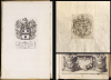
Although the parts of the De Bry Indiae Orientalis were published separately, readers from the start seem intent on bringing them together, with late 17th- and early 18th-century collectors attempting to outdo each other in assembling a 'Perfect De Bry.' Thus, bound examples of multiple parts of Indiae Orientalis can be found. When they are, they lack uniformity: they were bound according to the collector's desires and tastes. For instance, in the present example, maps associated with Part II are bound here among those normally appearing in Part III; the Barentsz map appears among the plates for that volume, rather than in the text section associated with that narrative, and so on. Moreover, even the contents of the same edition of one of these books vary, since the De Brys' continued to add new material to each volume even as it was in production.This assemblage, or sammelband, was bound for an English collector: the bookplate inside the front cover probably belonged to Thomas Foley, MP (1641 - 1701). Foley was an iron magnate and politician: English gentlemen of this period were voracious collectors of books from the continent, and private libraries of the war-ravaged continent found eager buyers. Variation in the toning of the four books bound together here suggests that Foley sourced each from a different collection. Foley was clearly a careful collector: each of these four books is of its first Latin edition, making this a remarkably uniform sammelband. A further armorial, monogrammed bookplate is pasted on the title page verso of Regnum Congo; the monogram also appears in manuscript on the recto of that title page. Although that monogram contains the legible initials CIB (or ICB), we have been unable to identify the bookplate beyond the likelihood that it is German, and typical of copperplate bookplates of the first half of the 17th century. The early provenance of this volume therefore eludes us.
Centuries of Reach
This work was instrumental in cementing Europeans' conceptions both of Africa and of the East, informing and titillating readers while reinforcing an array of stereotypes. The images within these pages continued to exercise impact well into the 20th century, even within the pages of pulp fiction:The first object of my curiosity was a book of medium size lying upon the table and presenting such an antediluvian aspect that I marvelled at beholding it outside a museum or library… altogether an unusual sort of volume to encounter in an abode so lowly. When I opened it to the title page my wonder grew even greater, for it proved to be nothing less rare than Pigafetta’s account of the Congo region, written in Latin from the notes of the sailor Lopez and printed at Frankfort in 1598…What annoyed me was merely the persistent way in which the volume tended to fall open of itself at Plate XII, which represented in gruesome detail a butcher’s shop of the cannibal Anziques… H. P. Lovecraft, The Picture in the House
Publication History and Census
The four books bound together were engraved and printed by the brothers Johann Theodor and Johann Israel de Bry in Frankfurt, in the years 1598, 1599, and 1601. The De Bry volumes do appear in institutional collections and come to market from time to time: bound examples such as this, being compiled after publication by the collector, are unique.Cartographers
Théodore de Bry (1528 - March 27, 1598) was an important publisher active in the mid to late 16th century. De Bry was born in 1528 in Liege, then a Prince-Bishopric and thus independent of neighboring nations. The De Bry family were accomplished jewelers and copperplate engravers and, following the family tradition, Theodore apprenticed in these fields under his grandfather Thiry de Bry senior (? - 1528), and later under his father, Thiry de Bry junior (1495 - 1590). To avoid growing religious strife in the region, Théodore de Bry left Liege for the more tolerant Strasbourg. Shortly afterward, in 1577, he moved again to Antwerp and, in 1580, to London, where he became well known for his engraving skills. In either Antwerp or London, De Bry befriended the English publisher and editor of travelers' tales Richard Hakluyt. Inspired by Hakluyt's work, De Bry began to collect travelers' tales, particularly of voyages to the New World. His most prominent acquisition was most likely the letters and papers of the French painter and mapmaker Jacques Le Moyne de Morgues discussing a disastrous attempt by French Huguenots to colonize parts of Florida. Around 1588, De Bry moved to Frankfurt, where he began his own publishing firm. Among De Bry's earliest and most prominent publications are his Grands Voyages, a multivolume compilation of travelers' tales that included the work of Le Moyne as well as some of the earliest published depictions of the North American mainland. The firm also published various other works, including an important account of early English attempts to colonize Virginia with illustrations by John White. De Bry died in Frankfurt on March 27, 1598, having never left the shores of Europe, though his name was associated throughout Europe with tales of travel and adventure. Théodore de Bry was succeeded by his son Jean-Théodore (1560 - 1623), who continued the publishing firm until his own death in 1623. Further Details...
Filippo Pigafetta (May 1, 1533 - October 26, 1604) was an Italian geographer, cartographic compiler, translator, military engineer, and diplomat, a citizen of the Venetian Republic active in Venice, Rome, Florence, and elsewhere in Europe and the eastern Mediterranean during the late 16th and early 17th centuries. Born in Vicenza, the natural son of Matteo di Camillo Pigafetta, he grew up among relatives at Roncaglia. (He was a descendant of the famed Antonio Pigafetta, Magellan's chronicler.) He was in Bologna in 1553, possibly attending university, although his formal education remains uncertain. After military service, including participation in the Battle of Lepanto in 1571, he accompanied a Venetian embassy to Constantinople in 1573 and subsequently traveled through Egypt and Sinai. His principal contribution to African geography was <i>Relatione del reame di Congo et delle circonvicine contrade</i>, published in Rome in 1591, based on the testimony and writings of the Portuguese merchant and ambassador Duarte Lopes. Pigafetta was not an explorer of the Congo himself: he organized Lopez's information, supplemented it with geographical and historical commentary, and produced an illustrated account accompanied by maps of the Congo kingdom and a substantial portion of Africa. These maps challenged the conventional Ptolemaic arrangement of the central African lakes and disseminated information about the Congo's settlements, rivers, and political geography, although much of the interior remained conjectural. The book circulated through several European translations. His geographical interests also informed reports on fortifications, ports, and the siege of Paris. He served the papacy and, from 1592, the Medici court in Florence. Following contacts begun in 1591 with Abraham Ortelius (1527 - 1598), Pigafetta prepared an Italian translation and revision of the <i>Theatrum Orbis Terrarum</i>, principally in 1602 - 1603, contributing a map and extended description of the Vicenza district. Published posthumously at Antwerp in 1608 as <i>Theatro del mondo</i>, this undertaking joined his regional geographical knowledge to the international atlas trade. Pigafetta returned to the Veneto in 1604 and died at his brother-in-law's villa at Longare, near Vicenza, on October 26 of that year. Further Details...
Jan Huyghen van Linschoten (1563 - February 8, 1611) was a Dutch merchant, cartographer, and historian active in the late 16th century. He was born in Haarlem, the son of a public notary, but moved to Enkhuizen shortly thereafter. In 1576, at 14, Linschoten relocated to Spain to apprentice as a merchant under his older brother, Willem van Linschoten, then active in Seville. He remained until 1580, when he took work in Lisbon, Portugal, under another merchant. He held this position only briefly before Willem introduced him to the Archbishop of Portuguese Goa, Dominican Vicente da Fonseca, who appointed him secretary. Accompnying Vicente da Fonseca, Linschoten arrived in Goa in September of 1583. He remained under Vicente da Fonseca for the next four years, often traveling with the Archbishop to far of locations such as China and Japan. During that time, he became fascinated with Asian cultures and their interaction with Europeans. With access at the highest level, he copied numerous maps and other documents, as well as records on sea routes to and from Goa, and trade agreements. When Vicente da Fonseca died in 1587, Jan Huyghen boarded a ship back to Holland, but was waylaid en route by a pirate attack and shipwreck in the Azores, where he remained until 1592. Back in Holland, Jan Huyghen joined the 1594 expedition of Willem Barentsz to the Kara Sea, north of Russia, in search of the fabled Northeast Passage to Asia. The Barentsz expedition was a failure, but Jan Huyghen survived and back in Holland with the support of Cornelius Claesz, he published an account the voyage. He also published a journal of his travels in Asia, in the process revealing a wealth of Portuguese trade secrets which ultimately influenced Dutch and English attempts to take over the East Asia trade. Among these he revealed was the ‘key’ to unlocking the Portuguese grip on passage through the Malacca Strait. He suggested traders approach the East Indies through the Sunda Strait, thereby circumventing Portuguese patrols in Malacca. This passage eventually became the main VOC thoroughfare into Southeast Asia and led to the Dutch colonization of the East Indies. In 1595 he married Reynu Meynertsdr Seymens, also of Enkhuizen. He remained with his family in Linschoten died in Enkhuizen, where he had worked as town treasurer until his death in 1611. Further Details...
Willem Lodewijcksz (c. 1570 - April 1604) was a Dutch merchant, voyage chronicler, and cartographer associated with Amsterdam and the first Dutch expedition to the East Indies in 1595 - 1597. His birthplace, education, and family circumstances have not been established. Already experienced in seafaring, he joined Cornelis de Houtman's (1565 - 1599) expedition as an assistant merchant aboard the Amsterdam. During the voyage, he undertook reconnaissance, recorded nautical observations, and prepared coastal views, gathering information particularly valuable for mapping the Sunda Strait, northern Java, and Bali. After the fleet returned to the Netherlands in August 1597, the Amsterdam publisher Cornelis Claesz issued his illustrated account as D'Eerste Boeck. Historie van Indien in 1598, with French and Latin translations appearing in the same year. Its cartographic material included coastal profiles, plans of Banten and its harbor, and a separate representation of Bali. Lodewijcksz also compiled a larger regional chart, engraved by Baptista van Doetecum and published separately by Claesz in 1598, covering southern Malaya, Sumatra, southern Borneo, Java, Bali, and neighboring islands. Combining information gathered during the expedition with earlier geographical knowledge, it substantially increased the detail available in print for western and northern Java and the approaches to the Sunda Strait. Although the voyage account announced a chart of Java and Sumatra, that chart is absent from the known editions. Its omission is often attributed to the expedition's merchant backers' desire to restrict commercially sensitive information, although the precise circumstances remain uncertain. Surviving impressions of the separately published regional chart include copies bearing printed sailing directions on the reverse, suggesting its intended practical use rather than proving use at sea. Lodewijcksz's subsequent career remains obscure; he died in April 1604. Further Details...
Gerrit de Veer (c. 1560 - 1625) was a Dutch mariner, Arctic chronicler, and map compiler associated with Amsterdam and the late 16th-century search for a Northeast Passage to Asia. Born probably in Amsterdam around 1570, he was the son of the Amsterdam historian Ellert de Veer (1540 - 1599) and studied navigation under Robert le Canu. His principal cartographic contribution was the illustrated account of three Dutch Arctic expeditions, Waerachtighe beschryvinghe van drie seylagien, published at Amsterdam in 1598. Although his narrative covered the voyages of 1594, 1595, and 1596 - 1597, de Veer personally accompanied only the second and third expeditions, sailing with Willem Barentsz (c. 1550 - 1597). The maps and plans accompanying his account documented the approaches to Novaya Zemlya, Yugorsky Strait, the northern Russian coast, and the survivors' return route toward Kola. These publications incorporated Barentsz's observations rather than representing wholly independent surveys by de Veer; the chart of Novaya Zemlya and adjacent coasts was engraved by Baptista van Doetecum. During the final expedition, de Veer survived the winter of 1596 - 1597 in a wooden shelter on northeastern Novaya Zemlya after the expedition's ship became trapped in ice. The crew subsequently departed in two open boats, and Barentsz died during their return journey. De Veer reached Kola with the survivors and returned to Amsterdam in 1597. His account, issued in several languages, preserved both geographical information and a detailed eyewitness record of the expedition. Little is securely documented about his later career; his exact death date and place remain unknown, although a letter from his former navigation teacher indicates he died before 1627. Further Details...
Condition
Very good. Sammelband folio, 18th century vellum. Gold embossed morocco title. Part I: 60pp. 2 folding maps, 14 plates. [)( 4, A-G4, H6. Aa-Cc4, Dd2.] Part II: 114pp. 38 plates. [:6, A-P4. A4-I4, K2.] Part III: 170pp. 4 folding maps. 3 folio maps, 60 plates [**A-V4, X6. a-h4, i2, k4(inserted K2) l-q4] Part IV: 111pp. 21 plates [:4 A-O4. a-d4, e6] Few marginal mends, mended tears at insertion points of some of the folding maps. Else excellent.
References
OCLC 1359708311.