
Doncker, Hendrick

Hendrick Doncker (1626 - 1699) (a.k.a. Henri Donker) was a Dutch bookseller and publisher of sea charts and nautical atlases active in Amsterdam during the middle part of the 17th century. He maintained a presence on Nieuwe Brugsteeg, Amsterdam. He married Elizabeth Abrahamsd Rensing in 1647. Doncker was somewhat unique to this period in that he did not copy the work of earlier cartographers, instead producing his own map. Moreover, Doncker's charts were widely admired for their constant revision and overall accuracy. In addition to producing his own charts, he also collaborated with Pieter Goos and Anthonie Jacobsz to producing the pilot guide De Zeespiegel. Following his 1699 death, Doncker's remaining stock and valuable map plates were acquired by Johannes van Keulen. He was survived by a daughter, Anna Doncker.
Majorca, Minorca and Ibiça.
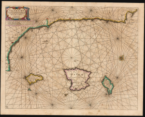
Valentien ende Catalonia tusschen C. de S. Martin ende C. de Creos als mede de eylanden van Majorca, Minorca ende Yvica. 'T Amsterdam: by Hendrick Doncker.
$2,500.00
Acquire
- Digital Map Information
- Suitable for large format printing
- File Size: 17.98 MB
- File Type: ZIP / TIFF
- ICC color profile embedded
- Delivered instantly via download link
This is Hendrick Doncker's rare c. 1669 chart of the Balearic Islands, portraying the islands of Majorca, Minorca, and Ibiza (Ibiça). The chart includes part of the Mediterranean coast of Spain, from C. St. Martin on the coast of Valencia to the Cap de Creus on the coast of Catalonia. (more details)
First scientific charting of the River Don, by Peter The Great's Handpicked Admiral.
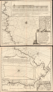
Nieuwe zeer Accurate, en Naauwkeurige Caart vande Rivierde Don of Tanais, Met aanwijzinge van alle des Selfs Dieptens, Droogtens etc. afgemeeten in 't Iaar 1699.
$3,250.00
Acquire
- Digital Map Information
- Suitable for large format printing
- Full resolution TIFF file
- ICC color profile embedded
- Delivered instantly via download link
This is Cornelis Cruys' rare, two-sheet chart of the Don River, the first modern astronomical survey of that waterway, based on his 1699 observations made while accompanying Peter the Great and the new Russian Black Sea Fleet from Voronezh to Azov. The plates were engraved by Hendrick Doncker for inclusion in Cruys' 1704 atlas of the Don; the present example is of the c. 1729 state, updated and printed by the Ottens firm for inclusion in their atlases. All states of the chart are rare, with the Doncker all but unacquirable. (more details)