
Harris, John

John Harris (fl. 1686 – 1730) was a British cartographer, engraver and draughtsman active in London during the late 17th and early 18th centuries. Harris is believed to have been born in Northamponshire but little else is certain regarding his personal life as 'John Harris' was an exceedingly common name be 17th century London. Nonetheless, his known work includes engravings for Philip Lea, Robert Morden, Herman Moll, and others.
Exceptional separate issue propaganda map promoting British interests during King William's War.
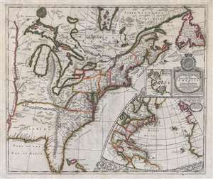
A New Map of the English Empire in America viz Virginia, New York, Maryland, New Jersey, Carolina, New England, Pennsylvania, New England, Pennsylvania, New Foundland, New France etc.
$17,000.00
Acquire
- Digital Map Information
- Suitable for large format printing
- Full resolution TIFF file
- ICC color profile embedded
- Delivered instantly via download link
An important and extremely rare separately issued c. 1695 map of the eastern part of North America by Robert Morden and Christopher Browne. Centered on the eastern Great Lakes, this map covers from the Mississippi River Valley to the Grand Banks and Newfoundland ... (more details)
Enigmatic lakes in the American West.
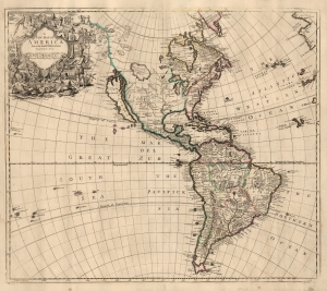
A New Map of America from the Latest Observations.
$2,500.00
Acquire
- Digital Map Information
- Suitable for large format printing
- File Size: 21.14 MB
- File Type: ZIP / TIFF
- ICC color profile embedded
- Delivered instantly via download link
This elegant English map of the Western Hemisphere, produced by John Senex in 1721, presents a fascinating glimpse of early Colonial America - increasingly detailed in the east, whilst retaining great misconceptions with regard to the western part of the continent. (more details)
From Vienna to Belgrade.
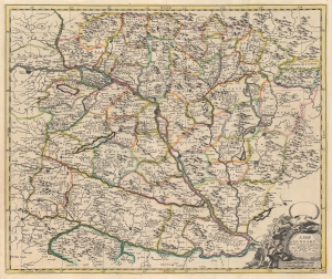
A Map of Hungary and Countries adjacent.
$400.00
Acquire
- Digital Map Information
- Suitable for large format printing
- DPI: 600
- File Size: 58.89 MB
- File Type: ZIP / TIFF
- ICC color profile embedded
- Delivered instantly via download link
This is a 1721 John Senex map of Hungary and the surrounding region, including parts of modern-day Austria, Slovakia, Croatia, and Serbia. (more details)
Frontier of France and Italy, with a Snarky Cartouche.
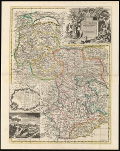
A New Map of Savoy and Piedmont From the latest Observations Revis'd by I. Senex.
$850.00
Acquire
- Digital Map Information
- Suitable for large format printing
- DPI: 600
- File Size: 66.23 MB
- File Type: ZIP / TIFF
- ICC color profile embedded
- Delivered instantly via download link
This is John Senex's 1721 map of the Duchy of Savoy and the Principality of Piedmont. The map is retrospective, illustrating the region in the wake of the War of the Spanish Succession (1701 - 1714). Coverage extends from Lake Geneva and Switzerland in the north to Nice and the Mediterranean Sea in the south, including parts of Dauphiné and Provence, and part of the Duchy of Milan to the east. (more details)