
Lapie, Pierre M. (Alexandre Emile Lapie)

Pierre M. Lapie (fl. 1779 - 1850) and his son Alexandre Emile Lapie (fl. 1809 - 1850) were French cartographers and engravers active in the early part of the 19th century. The Lapies were commissioned officers in the French army holding the ranks of Colonel and Capitan, respectively. Alexander enjoyed the title of "First Geographer to the King", and this title appears on several of his atlases. Both father and son were exceptional engravers and fastidious cartographers. Working separately and jointly they published four important atlases, an 1811 Atlas of the French Empire (Alexander), the 1812 Atlas Classique et Universel (Pierre), the Atlas Universel de Geographie Ancienne et Modern (joint issue), and the 1848 Atlas Militaire (Alexander). They also issued many smaller maps and independent issues. All of these are products of exceptional beauty and detail. Despite producing many beautiful maps and atlases, the work of the Lapie family remains largely underappreciated by most modern collectors and map historians. The later 19th century cartographer A. H. Dufour claimed to be a student of Lapie, though it is unclear if he was referring to the father or the son. The work of the Lapie firm, with its precise engraving and informational density, strongly influenced the mid-19th century German commercial map publishers whose maps would eventually dominate the continental market.
AKA: Alexandre Emile Lapie
Map used by American politician Samuel Atkins Eliot on his 1821 'Grand Tour' of Europe.
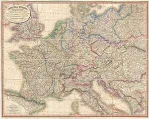
Central Europe: Comprehending France and Austria, with the Kingdom of the Netherlands, Hanover, Germany, Prussia, Northern Italy, and c.
$500.00
Acquire
- Digital Map Information
- Suitable for large format printing
- DPI: 300
- File Size: 31.35 MB
- File Type: ZIP / TIFF
- ICC color profile embedded
- Delivered instantly via download link
A fine example of Laurie and Whittle's 1818 map of central Europe, focusing mainly on France, the Netherland, Belgium, Austria, Hungary, an inset of Transylvania, Prussia, Switzerland, and Germany. Partially included are England, Spain, Italy, Turkey, the Balkans, Poland, and Denmark. All major towns and roads are identified as well as limited topographical features, with elevation rendered in hachure. The cartographers credit the work of French map publisher Pierre M. Lapie as the source for this map. First issued in 1816, this useful map is an example of the second edition published in 1818. Subsequent editions were issued in both atlas format and case, as in the present example. Such maps were popular with American tourists on the 'Grand Tour.' (more details)
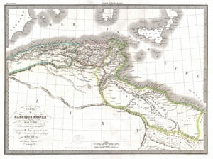
Carte de L'Afrique Propre de la Numidie et D'une Partie de la Mauritanie.
$125.00
Acquire
- Digital Map Information
- Suitable for large format printing
- DPI: 300
- File Size: 10.32 MB
- File Type: ZIP / TIFF
- ICC color profile embedded
- Delivered instantly via download link
An unusual and attractive 1829 map of the ancient empires of Mauritania, Carthage, and Numidia. Depicts what is today known as the Barbary Coast around 200 BC. This map illustrates a crucial turning point early in the Second Punic War. The Carthaginian Empire ... (more details)
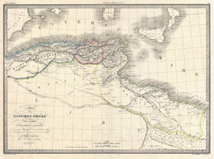
Carte de L'Afrique Propre de la Numidie et D'une Partie de la Mauritanie.
$125.00
Acquire
- Digital Map Information
- Suitable for large format printing
- DPI: 300
- File Size: 13.83 MB
- File Type: ZIP / TIFF
- ICC color profile embedded
- Delivered instantly via download link
An unusual and attractive 1843 map of the ancient empires of Mauritania, Carthage, and Numidia shortly after the end of the Second Punic War. Depicts what is today known as the Barbary Coast around 190 BC. The Empire of Carthage has been annexed as a Roman ... (more details)
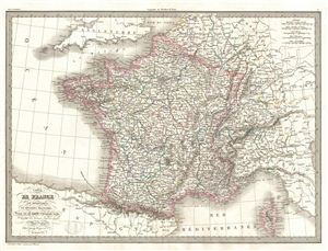
Carte de France par departemens et divisions militaires.
$150.00
Acquire
- Digital Map Information
- Suitable for large format printing
- DPI: 300
- File Size: 12.05 MB
- File Type: ZIP / TIFF
- ICC color profile embedded
- Delivered instantly via download link
A fine first edition example of M. Lapie's 1829 Map of France by Military Departments and Divisions. Centered on France, the map includes parts of adjacent Spain, england, Switzerland, Italy and Germany. Lapie's map offers fine detail throughout with ... (more details)
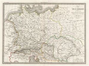
Carte de la Germanie Ancienne.
$150.00
Acquire
- Digital Map Information
- Suitable for large format printing
- DPI: 300
- File Size: 13.3 MB
- File Type: ZIP / TIFF
- ICC color profile embedded
- Delivered instantly via download link
A fine first edition example of M. Lapie's 1830 map of Ancient Germany. Centered on the Roman Germania, the map covers the lands of the Germanic peoples prior to the fall of the Roman empire. At the time Germania was a name given to the lands between ... (more details)
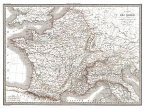
Carte des Gaules.
$175.00
Acquire
- Digital Map Information
- Suitable for large format printing
- DPI: 300
- File Size: 14.93 MB
- File Type: ZIP / TIFF
- ICC color profile embedded
- Delivered instantly via download link
A fine first edition example of M. Lapie's 1831 map of Gaul. Centered on Gallia Celtica, the map covers all the five parts of Gaul including Gallia Cisalpina, Gallia Narbonensis, Gallia Aquitania and Gallia Belgica. Gaul was the ancient name of a ... (more details)
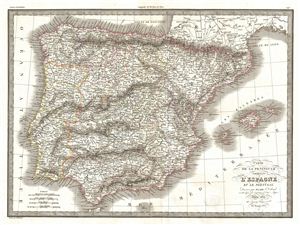
Carte de la Peninsule Comprenant l'Espagne et la Portugal.
$175.00
Acquire
- Digital Map Information
- Suitable for large format printing
- DPI: 300
- File Size: 14.65 MB
- File Type: ZIP / TIFF
- ICC color profile embedded
- Delivered instantly via download link
A fine first edition example of M. Lapie's 1831 map of the Iberia or Spain and Portugal. The map covers all of Spain and Portugal from France to the Mediterranean Sea and from the Atlantic to the Balearic Islands. During this period Portugal on ... (more details)
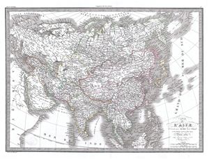
Carte de l'Asie.
$225.00
Acquire
- Digital Map Information
- Suitable for large format printing
- Full resolution TIFF file
- ICC color profile embedded
- Delivered instantly via download link
A fine first edition example of M. Lapie's 1832 map of Asia. In the early 19th century Asia was coming under increasingly imperial european sway. In India full British rule allowed england to attain naval and trade supremacy throughout the ... (more details)
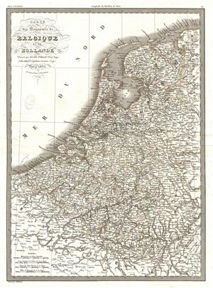
Carte des Royaumes de Belgique et de Hollande.
$175.00
Acquire
- Digital Map Information
- Suitable for large format printing
- DPI: 300
- File Size: 5.55 MB
- File Type: ZIP / TIFF
- ICC color profile embedded
- Delivered instantly via download link
A fine first edition example of M. Lapie's 1833 map of the Kingdoms of Belgium and Holland. The map covers all of Belgium and Holland from the North Sea to the Kingdom of France. Just three years prior to the making of this map, the Belgian ... (more details)
Highlights the Republic of Texas and is one of the earliest non-American maps to illustrate the Republic.
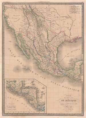
Carte des États-Unis du Méxique.
$600.00
Acquire
- Digital Map Information
- Suitable for large format printing
- DPI: 600
- File Size: 54.18 MB
- File Type: ZIP / TIFF
- ICC color profile embedded
- Delivered instantly via download link
This is an 1838 Pierre and Alexandre Lapie map of Mexico and the southwestern United States and is also one of the earliest non-American maps to include the Republic of Texas - anticipating the pending 1839 French official recognition of Texas. The Republic of Texas is bordered in yellow, highlighting its existence. Mexico is bordered in green, with its borders extending from the Yucatan to the Oregon Territory encompassing all of California and the other southwestern states. States within Mexico are labeled and bordered by thin lines of varying colors to allow for easy differentiation.
Cities and towns throughout Mexico are identified, including Mexico City, Cuernavaca, Veracruz, and Oaxaca, with Santa Fe, San Francisco, Monterey, Santa Barbara, and San Diego marked in northern Mexico, now the United States. Several Indian tribes are identified in northern Mexico, including the Apaches. A large portion of this region between the Rocky Mountains and the Pacific Coast is labeled as 'unknown'. Both the Great Salt Lake, identified as Lake Timpanogos, and Utah Lake, labeled as Lake Teguayo, are illustrated following the example of Humboldt. The apocryphal Buenaventura River is also included and is illustrated as connecting from Lake Teguayo to the Pacific Ocean, the final incarnation of the long-sought River of the West, a speculative alternative to the Northwest Passage. In the United States (as it existed in 1838) only rivers are illustrated, and a handful of Indian tribes are referenced. An inset map of Central America is situated in the lower left corner and depicts the region from the Yucatan to Chagres, Panama (labeled Colombie). (more details)
Cities and towns throughout Mexico are identified, including Mexico City, Cuernavaca, Veracruz, and Oaxaca, with Santa Fe, San Francisco, Monterey, Santa Barbara, and San Diego marked in northern Mexico, now the United States. Several Indian tribes are identified in northern Mexico, including the Apaches. A large portion of this region between the Rocky Mountains and the Pacific Coast is labeled as 'unknown'. Both the Great Salt Lake, identified as Lake Timpanogos, and Utah Lake, labeled as Lake Teguayo, are illustrated following the example of Humboldt. The apocryphal Buenaventura River is also included and is illustrated as connecting from Lake Teguayo to the Pacific Ocean, the final incarnation of the long-sought River of the West, a speculative alternative to the Northwest Passage. In the United States (as it existed in 1838) only rivers are illustrated, and a handful of Indian tribes are referenced. An inset map of Central America is situated in the lower left corner and depicts the region from the Yucatan to Chagres, Panama (labeled Colombie). (more details)
French recognition of the Republic of Texas!
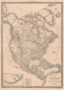
Carte de l'Amérique Septentrionale.
$700.00
Acquire
- Digital Map Information
- Suitable for large format printing
- DPI: 600
- File Size: 50.74 MB
- File Type: ZIP / TIFF
- ICC color profile embedded
- Delivered instantly via download link
This is Pierre Lapie’s 1842 map of North America highlighting the Republic of Texas. France officially recognized the nascent Republic on September 25, 1839 - before any other European power - and thus, French maps like this are some of the earliest representations of the Republic. (more details)
Includes the Republic of Texas.
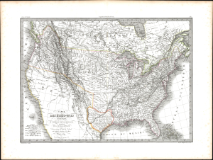
Carte des États-Unis d'Amérique, du Canada, du Nouveau Brunswick et d'une partie de la Nouvelle Bretagne.
$750.00
Acquire
- Digital Map Information
- Suitable for large format printing
- Full resolution TIFF file
- ICC color profile embedded
- Delivered instantly via download link
This is an 1841 Pierre and Alexandre Lapie map of the United States, which is one of the earliest non-American maps to include the Republic of Texas. The map depicts the region from the Pacific Ocean to the Atlantic Ocean and from 'New Britain' (Canada) to Mexico. Ephemeral geographic zones are noted, among them the Northwest Territory and the Arkansas Territory, which included the Indian Territory. The Missouri Territory encompasses all the Midwest and stretches to the Pacific Ocean. The map's color coding suggests that the borders of the United States include British Columbia. American Indian tribes, such as the Pawnee, Blackfeet, Shoshone, and Sioux, are identified. (more details)