
Lazius, Wolfgang
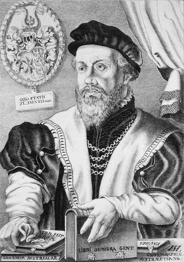
Wolfgang Lazius (October 31, 1514 – June 19, 1565) was an Austrian humanist, cartographer, historian, and physician. He was born Wolfgang Laz in Vienna, and would be trained in medicine in the University of Vienna in 1541. He did not remain a medical doctor: he would become the official historian to Holy Roman Emperor Ferdinand I, and curated the imperial collections. His position as historian led him to travel broadly, and to write historical works; he avidly accumulated a remarkable library, occasionally stooping to theft to do so. His maps of Austria, Bavaria, Hungary, and Greece were influential, providing source material not only to Ortelius but also to the many later mapmakers who copied the Antwerp atlas publisher.
The Danube below Vienna.
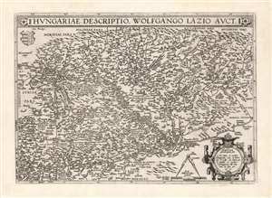
Hungariae Descriptio Wolfgango Lazio Auct.
$750.00
Acquire
- Digital Map Information
- Suitable for large format printing
- DPI: 600
- File Size: 62.82 MB
- File Type: ZIP / TIFF
- ICC color profile embedded
- Delivered instantly via download link
This is Abraham Ortelius' 1570 map of Hungary, the first acquirable, accurate map of that region, and the first atlas map of Hungary. The map includes parts of Austria, Slovakia and Romania, with parts of Croatia, Bosnia and Serbia in the south. The heart of the map is the River Danube, reaching from Vienna in the west to the Romanian river Olt (here in the German Alt and the Latin Aluta) Buda and Pest are shown. Belgrade appears at the confluence of the Sau and the Danube, with the antiquated German appellation Griechschweissenburg. (more details)
The Danube below Vienna.
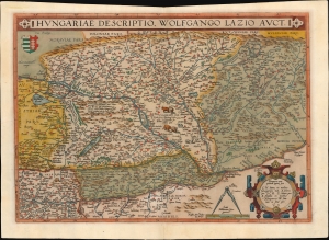
Hungariae Descriptio Wolfgango Lazio Auct.
$700.00
Acquire
- Digital Map Information
- Suitable for large format printing
- Full resolution TIFF file
- ICC color profile embedded
- Delivered instantly via download link
This is Abraham Ortelius' 1570 map of Hungary, the first acquirable, accurate map specifically of that region, and the first to appear in an atlas. (more details)
The 16th Century European Frontier.
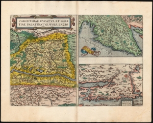
Carinthiae Ducatus, Et Goritiae Palatinus, Wolf. Lazio auctore./ Histriae tabula a Petro Coppo descr./ Zarae, et Sebenici Descriptio.
$550.00
Acquire
- Digital Map Information
- Suitable for large format printing
- Full resolution TIFF file
- ICC color profile embedded
- Delivered instantly via download link
This is Abraham Ortelius' 1573 engraving containing the maps of The Duchy of Carinthiae in Austria, Istria on the Adriatic coasts of Croatia and Slovenia, and the region around the Croatian ports of Zara and Srebrenica. Although the maps are not contiguous with one another, they all represent very contemporary maps of western strongholds near Europe's frontier with Habsburg Hungary and with the Ottoman Empire.
Ortelius was a keen compiler of sources: his map of the Duchy of Carinthia comes from the very current map of the Viennese Wolfgang Lazius; Carinthiae ducatus cum palatinate Goricia appeared in his 1561 atlas of Austria. Carinthia, the southernmost region of Austria, is now noted for the mountains of the Eastern Alps; the region on the map extends southwards beyond the Karawank Mountains into what is now northern Slovenia. The map is bisected by the Drava River running west to east. In addition to the mountains this region is also known for its lakes. The present map includes the Millstätter See, the Ossiacher See, and the Wörthersee. On the Slovenian side of the Karawank mountains near the city of Idria (Idrija) there is noted, Argenti viva fodine: a quicksilver, or mercury, mine. This is an accurate notation of keen interest: anyone seeking to purify mined silver or gold required quicksilver for the process; and the mine of Idrija had produced that rare metal going back to 1490.
The map of Istria - the Adriatic peninsula predominantly held by Croatia and Slovenia - Ortelius credited to its ultimate source, Pietro Coppo. The Venetian Coppo had lived in a town on the northwest coast of Istria for most of his life, and in about 1525 had produced a woodcut map of the area. Although in his text Ortelius also credits the scholar Leandro Alberti, Ortelius' map appears to be a closer to Bertelli's 1569 iteration of the Coppo.
The third map focuses on the region around the Croatian cities of Zadar (Zara) and Šibenik (Sebenici). Zadar is the oldest continuously inhabited city in Croatia and is a historical center of Dalmatia. The name 'Zara' began to be applied to the city when it was absorbed by the Republic of Venice in the 15th century. Šibenik is the third-largest city of Dalmatia, and like Zadar was held for a time by the Republic of Venice. Ortelius claimed his source to be anonymous; Meurer and Woodward have attributed the 1570 source map to Paolo Forlani. (more details)
Ortelius was a keen compiler of sources: his map of the Duchy of Carinthia comes from the very current map of the Viennese Wolfgang Lazius; Carinthiae ducatus cum palatinate Goricia appeared in his 1561 atlas of Austria. Carinthia, the southernmost region of Austria, is now noted for the mountains of the Eastern Alps; the region on the map extends southwards beyond the Karawank Mountains into what is now northern Slovenia. The map is bisected by the Drava River running west to east. In addition to the mountains this region is also known for its lakes. The present map includes the Millstätter See, the Ossiacher See, and the Wörthersee. On the Slovenian side of the Karawank mountains near the city of Idria (Idrija) there is noted, Argenti viva fodine: a quicksilver, or mercury, mine. This is an accurate notation of keen interest: anyone seeking to purify mined silver or gold required quicksilver for the process; and the mine of Idrija had produced that rare metal going back to 1490.
The map of Istria - the Adriatic peninsula predominantly held by Croatia and Slovenia - Ortelius credited to its ultimate source, Pietro Coppo. The Venetian Coppo had lived in a town on the northwest coast of Istria for most of his life, and in about 1525 had produced a woodcut map of the area. Although in his text Ortelius also credits the scholar Leandro Alberti, Ortelius' map appears to be a closer to Bertelli's 1569 iteration of the Coppo.
The third map focuses on the region around the Croatian cities of Zadar (Zara) and Šibenik (Sebenici). Zadar is the oldest continuously inhabited city in Croatia and is a historical center of Dalmatia. The name 'Zara' began to be applied to the city when it was absorbed by the Republic of Venice in the 15th century. Šibenik is the third-largest city of Dalmatia, and like Zadar was held for a time by the Republic of Venice. Ortelius claimed his source to be anonymous; Meurer and Woodward have attributed the 1570 source map to Paolo Forlani. (more details)
16th Century Italian Frontier.
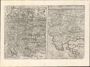
Rhetiae alpestris descriptio, in qua hodie Tirolis Comitatus. / Goritiae. Karstii, Chaczeolae, Carniolae, Histriae, et Windorum Marchae Descrip.
$450.00
Acquire
- Digital Map Information
- Suitable for large format printing
- Full resolution TIFF file
- ICC color profile embedded
- Delivered instantly via download link
This 1573 Abraham Ortelius engraving features two Wolfgang Lazius maps: Tyrol in southern Austria and northern Italy, and the modern-day border regions of Slovenia, Italy, and Croatia. Although the maps are not contiguous, they all represent contemporary maps of western strongholds at Italy's frontiers with Austria and Croatia. (more details)
Borderlands of Italy, Austria, Croatia, and Slovenia.
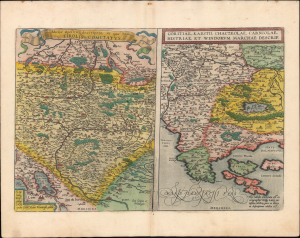
Rhetiae alpestris descriptio, in qua hodie Tirolis Comitatus. / Goritiae. Karstii, Chaczeolae, Carniolae, Histriae, et Windorum Marchae Descrip.
$275.00
Acquire
- Digital Map Information
- Suitable for large format printing
- Full resolution TIFF file
- ICC color profile embedded
- Delivered instantly via download link
This is an old-color 1595 Abraham Ortelius engraving from the Theatrum Orbis Terrarum featuring two Wolfgang Lazius maps: Tyrol in southern Austria and northern Italy, and the modern-day border regions of Slovenia, Italy, and Croatia. Although the maps are not contiguous, they all represent contemporary maps of western strongholds at Italy's frontiers with Austria and Croatia. (more details)