
Moreno, Miguel

Miguel Moreno (fl. c. 1792 - 1845) was a Spanish cartographer and draftsman active with the Depósito Hidrográfico in Madrid during the first half of the 19th century. Hs served in the Spanish royal navy as a pilot as early as 1808. By 1807 he was producing nautical charts for the Depósito Hidrográfico. He participated in the geographical expedition to South America of Cosme Damián Churruca (1792 - 95), which included the Antilles. Moreno was widely considered the Depósito Hidrográfico's primary expert on the Gulf Coast and Puerto Rico.
Cuba's Central Coast.
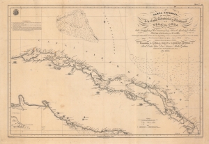
Carta Esferica de una parte de la Costa Setentrional y Meridional de la Isla de Cuba, desde Nuevitas hasta el rio Camarioca y desde Labana la Mar hasta los Jardines, con el Canal viejo de Bahama y el de Santaren.
$1,600.00
Acquire
- Digital Map Information
- Suitable for large format printing
- Full resolution TIFF file
- ICC color profile embedded
- Delivered instantly via download link
A beautifully engraved 1836 nautical chart of the central portion of Cuba and surrounding waters produced by Spain's Dirección de Hidrografía. It highlights the difficulty of navigating the Old Bahama Channel (Canal Viejo de Bahama), the waters between the Bahamas and Cuba. (more details)
First Accurate Chart and Map of Puerto Rico.
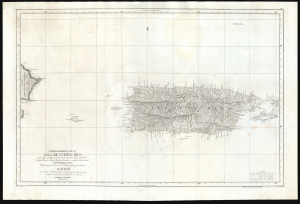
Carta Esferica De La Isla De Puerto-Rico y las adyacentes, que a la misma pertenecen Vicques, Culebra, Cajades Muertos, Mona, Monito y Desecho, con partie de las islas de Santa Domingo y Saona…
$1,500.00
Acquire
- Digital Map Information
- Suitable for large format printing
- Full resolution TIFF file
- ICC color profile embedded
- Delivered instantly via download link
An elegant, large nautical chart and topographical map of Puerto Rico, first published in 1840 by Miguel Moreno of the Spanish Depósito Hidrográfico. While presented as a nautical chart, both the coasts and interior of the island are scientifically precise and rich with detail. This is the first such map of Puerto Rico, surpassing the 1791 Tomas Lopez map, which had been considered the best map of Puerto Rico for nearly 50 years. (more details)