
Moreno, Miguel (sold)

Miguel Moreno (fl. c. 1792 - 1845) was a Spanish cartographer and draftsman active with the Depósito Hidrográfico in Madrid during the first half of the 19th century. Hs served in the Spanish royal navy as a pilot as early as 1808. By 1807 he was producing nautical charts for the Depósito Hidrográfico. He participated in the geographical expedition to South America of Cosme Damián Churruca (1792 - 95), which included the Antilles. Moreno was widely considered the Depósito Hidrográfico's primary expert on the Gulf Coast and Puerto Rico.
'The first large-scale printed chart of the Texas coast based on actual soundings and explorations.' - Martin and Martin
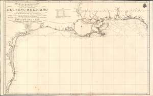
Carta Particular de las Costas Setentrionales del Seno Mexicano que comprende las de Florída Ocidental Las Margenes de la Luisiana y toda la rivera que sigue por la Bahia de S. Bernardo y el Rio Bravo del Norte hasta la Laguna Madre.
sold
- Digital Map Information
- Suitable for large format printing
- Full resolution TIFF file
- ICC color profile embedded
- Delivered instantly via download link
One of the most important maps of Texas, considered 'the first large-scale printed chart of the Texas coast based on actual soundings and explorations' (Martin and Martin). This is the 1807 Spanish Direccion Hidrografica map of the Gulf Coast in the vicinity of Texas and Louisiana. The chart follows directly on the seminal Jose Antonio de Evia (1740 - 18??) survey of the Gulf Coast, conducted between 1785 and 1786. This was the first scientific mapping of this region, resulting in, among other things, the naming of Galveston Bay. The Evia survey resulted in two subsequent maps, the 1799 Carta Esferica que Comprehende las Costas del Seno Mexicano - essentially a general chart of the Gulf of Mexico, and this more specific 1807 map offering considerably more detail to the costliness of Texas and Louisiana. (more details)
One of the first trigonometric charts of Puerto Rico.
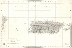
Carta Esferica De La Isla De Puerto-Rico y las adyacentes, que a la misma pertenecen Vicques, Culebra, Cajades Muertos, Mona, Monito y Desecho, con partie de las islas de Santa Domino y Saona…
sold
- Digital Map Information
- Suitable for large format printing
- DPI: 600
- File Size: 37.27 MB
- File Type: ZIP / TIFF
- ICC color profile embedded
- Delivered instantly via download link
A stunning 1840 first edition nautical map of Puerto Rico (Porto Rico) by Miguel Moreno of the Spanish Depósito Hidrográfico. It is one of the earliest trigonometric charts of the island. (more details)
Spain recognizes the Republic of Texas?
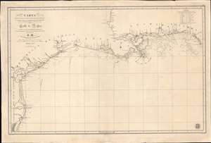
Carta de Las Costas de la Escambia, Alabama y Bocas del rio Misisipi, La Luisiana, tejas, Con la Provincia del Nuevo Santander en el Golfo de Mejico.
sold
- Digital Map Information
- Suitable for large format printing
- DPI: 600
- File Size: 1349.98 MB
- File Type: ZIP / TIFF
- ICC color profile embedded
- Delivered instantly via download link
An unusual 1846 Spanish Direccion Hidrografía nautical chart of the Gulf of Mexico recognizing the Republic of Texas. It is one of very few official Spanish publications to name the Republic of Texas, which Spain never formally recognized. The map emerged during a time of strife, both for Texas, which was involved in its own Texan Revolution (1835 - 1836) followed by the Mexican American War (1846 - 1848), but also in Spain, which was devolving into the Second Carlist War (1846 - 1849). Nonetheless, its production points to the complexity of Spanish-Texan relations during the Revolutionary years, when Texas was blockading Mexican trade and the Spanish West Indies in dire need of fresh trading partners. (more details)
Scarce Spanish nautical chart of Cuba.
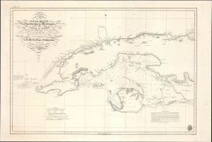
Carta Esferica de una Parte de la Costa Setentrional y Meridional de la Isla de Cuba … 1834.
sold
- Digital Map Information
- Suitable for large format printing
- Full resolution TIFF file
- ICC color profile embedded
- Delivered instantly via download link
This is an 1854 Direccion Hidrografica nautical chart or maritime map of the western part of Cuba, an update of a chart originally published in 1837. It demonstrates the difficulties of navigating the coastal waters off the coast of Cuba, due to shallow waters, strong currents, numerous hazards, and a lack of good anchorages. (more details)