
Reimer, Dietrich Arnold

Dietrich Arnold Reimer (May 13, 1818 - October 15, 1899) was a German publisher. Born in Berlin, Reimer was the son of Georg Andreas Reimer (1776 - 1842), another German printer. He founded a book and map shop in 1845 in Berlin, and after taking over most of the art and geographic publishing from his father two years later, founded Dietrich Reimer Verlag. Heinrich Kiepert (1818 - 1899) began working for his publishing firm in 1852, and in 1868, Reimer made Hermann August Hoefer, a German bookseller, a partner in his company. This move pushed Reimer's publishing firm to international prominence, as the new partnership increased their desire to produce globes and their commitment to improving their maps. He married Henriette Hirzel in 1847, with whom he had three children. Henriette died in 1853, and Reimer remarried in 1855 to Emma Jonas. Reimer gave up control of his publishing house on October 1, 1891, due to health concerns, and the business passed to investor Ersnt Vohsen (1853 - 1919). The firm published under the imprint of 'Dietrich Reimer (Ernst Vohsen)' until Vohsen's death in 1919. Until the end of the World War I (1914 - 1818) and the Treaty of Versailles, the publishing house profited from the colonialism of the German Empire with this business model. It survived both the end of the war and inflation. It was able to recover by the start of World War II (1939 - 1945) but then had to cut back production again, mainly due to a shortage of paper and reduced demand. In April 1945, the publishing house at Wilhelmstrasse 29, including the archive, accounting department, and book warehouse, was destroyed in two air raids. It recovered and is today a prominent German academic publisher. The firm remains in operation today as 'Dietrich Reimer GmbH.'
A pause in the Caucasian War.
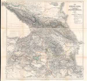
Karte der Kaukasus - Länder und der Angränzenden Türkischen und Persischen Provinzen Armenien, Kurdistan, und Azerbeidjan.
$1,000.00
Acquire
- Digital Map Information
- Suitable for large format printing
- Full resolution TIFF file
- ICC color profile embedded
- Delivered instantly via download link
This is an 1854 map of the Caucasus, published during the Caucasian War (1817 - 1864) and the Crimean War (1853 - 1856) by Heinrich Kiepert, the most accomplished 19th-century cartographer working in the Caucasus and Trans-Caucasus. For 50 years, this served as a definitive map used for treaty negotiation, military activity, and administration. (more details)
By the greatest German cartographer of the 19th century.
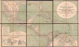
H. Kiepert's Karte des Nördlichen Tropischen America. A New Map of Tropical - America North of the Equator Comprising the West - Indies, Central - America, Mexico, New Cranada and Venezuela.
$3,500.00
Acquire
- Digital Map Information
- Suitable for large format printing
- Full resolution TIFF file
- ICC color profile embedded
- Delivered instantly via download link
This is a large and impressive 1858 map of Florida, the Gulf of Mexico, Central America, the West Indies, and northern South America, compiled by Heinrich Kiepert, the greatest German cartographer of the 19th century. The map presents the region in detail, with color coding to differentiate between countries and a key situated in the lower left. (more details)