
Reimer, Dietrich Arnold (sold)
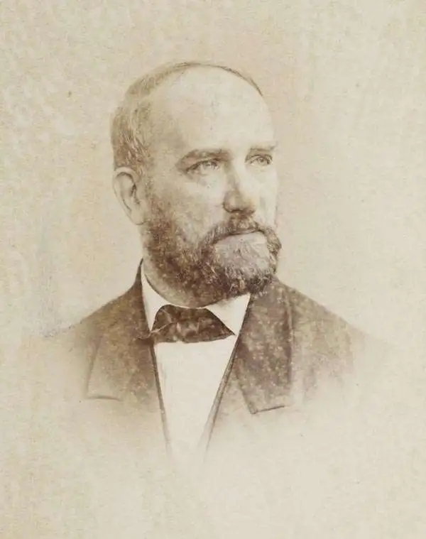
Dietrich Arnold Reimer (May 13, 1818 - October 15, 1899) was a German publisher. Born in Berlin, Reimer was the son of Georg Andreas Reimer (1776 - 1842), another German printer. He founded a book and map shop in 1845 in Berlin, and after taking over most of the art and geographic publishing from his father two years later, founded Dietrich Reimer Verlag. Heinrich Kiepert (1818 - 1899) began working for his publishing firm in 1852, and in 1868, Reimer made Hermann August Hoefer, a German bookseller, a partner in his company. This move pushed Reimer's publishing firm to international prominence, as the new partnership increased their desire to produce globes and their commitment to improving their maps. He married Henriette Hirzel in 1847, with whom he had three children. Henriette died in 1853, and Reimer remarried in 1855 to Emma Jonas. Reimer gave up control of his publishing house on October 1, 1891, due to health concerns, and the business passed to investor Ersnt Vohsen (1853 - 1919). The firm published under the imprint of 'Dietrich Reimer (Ernst Vohsen)' until Vohsen's death in 1919. Until the end of the World War I (1914 - 1818) and the Treaty of Versailles, the publishing house profited from the colonialism of the German Empire with this business model. It survived both the end of the war and inflation. It was able to recover by the start of World War II (1939 - 1945) but then had to cut back production again, mainly due to a shortage of paper and reduced demand. In April 1945, the publishing house at Wilhelmstrasse 29, including the archive, accounting department, and book warehouse, was destroyed in two air raids. It recovered and is today a prominent German academic publisher. The firm remains in operation today as 'Dietrich Reimer GmbH.'
Created by one of the world's foremost experts on the Ottoman Empire at the time - Heinrich Kiepert.
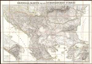
General-Karte von der Europäischen Türkei.
sold
- Digital Map Information
- Suitable for large format printing
- DPI: 600
- File Size: 104.6 MB
- File Type: ZIP / TIFF
- ICC color profile embedded
- Delivered instantly via download link
This is an 1853 Heinrich Kiepert map of the Balkans at the height or the Crimean War. The map depicts the region from southern Italy and the Adriatic Sea to the Black Sea and Istanbul and from Hungary, Moldova, and Bessarabia to the island of Skiros in the Aegean Sea. An inset map in the lower left corner illustrates the autonomous region of Montenegro in detail, while two inset maps in the lower right corner highlight the Dardanelles, also known as the Hellespont, and the Bosporus. (more details)
First German map of the state of California.
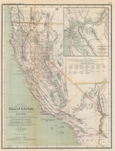
Karte des states California nach er officiellen Karte des State Surveyor General W. M. Eddy (approved and declared to be the official Map of the State of California by act of the Legislature, passed March 25th 1853) mit Berichtigung der Küste und einzelner Pässe nach den in den Jahren 1855-4 asusgeführten Künstenaufnahmen der V. St. Marine unde Recognoscirugen projectirter Eisenbahnlinien durch die Ingenieur Oficiere Gunnison, Beckwith, Williamson, u. a. gezeichnet von H. Kiepert Berlin 1856.
sold
- Digital Map Information
- Suitable for large format printing
- File Size: 10.6 MB
- File Type: ZIP / TIFF
- ICC color profile embedded
- Delivered instantly via download link
This is a rare 1856 H. Kiepert German edition of William M. Eddy's first official map of California. This is the first German-language map specifically of the state of California. (more details)
The British invade Afghanistan, again.
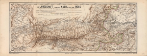
Die Landschaft zwischen Kabul und dem Indus.
sold
- Digital Map Information
- Suitable for large format printing
- File Size: 15.42 MB
- File Type: ZIP / TIFF
- ICC color profile embedded
- Delivered instantly via download link
A scarce and highly detailed 1878 topographical map by Heinrich Kiepert of a portion of eastern Afghanistan and surroundings, highlighting the lands between Kabul and Peshawar. It was made as tensions between Britain and Afghanistan peaked, a side effect of the 'Great Game' competition between Britain and Russia, which led to the Second Anglo-Afghan War. (more details)
German WWI Propaganda criticizing Allied colonialism in the wake of Wilson's Fourteen Points.
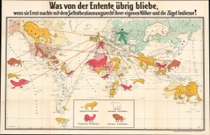
Was von der Entente übrig bliebe wenn sie Ernst machte mit dem Selbstbestimmungsrecht iher eigenen Völker und die Zügel losliesse! [What would remain of the Entente if it took seriously the 'self-determination right' of its own nations and let go of the reins!]
sold
- Digital Map Information
- Suitable for large format printing
- File Size: 36.6 MB
- File Type: ZIP / TIFF
- ICC color profile embedded
- Delivered instantly via download link
This is a fascinating c. 1918 German propaganda pictorial map issued in the wake of World War I (1914 - 1918) criticizing Wilson's Fourteen Points and their call for global 'Self Determination' as hypocritical. The cartographer asks pointedly, 'Why should Germany be morally judged for its colonies, while the Allied (Entente) powers hold the world on colonial leashes?' (more details)