

Carte de L'Isle de St. Domingue une des Grandes Antilles Colonie Francoise et Espagnole.
sold
- Digital Map Information
- Suitable for large format printing
- DPI: 300
- File Size: 3.87 MB
- File Type: ZIP / TIFF
- ICC color profile embedded
- Delivered instantly via download link
A fine example of Rigobert Bonne and Guilleme Raynal's 1780 map of Hispaniola or Santo Domingo (modern day Haiti and the Dominican Republic). Includes southeast tip of Cuba, the Inagua Islands (southern Bahamas), and Turks and Caicos Islands. Highly detailed, ... (more details)
The essential trail map of the American west.
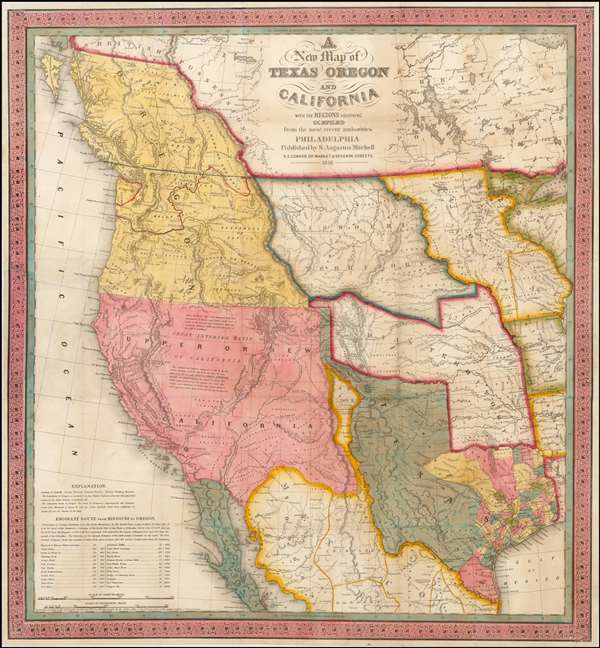
A New Map of Texas, Oregon and California with the Regions Adjoining.
sold
- Digital Map Information
- Suitable for large format printing
- DPI: 300
- File Size: 11.05 MB
- File Type: ZIP / TIFF
- ICC color profile embedded
- Delivered instantly via download link
A stunning example of Mitchell's seminal 1846 pocket map of Texas, Oregon, Upper California, Missouri Territory, the Indian Territory (Oklahoma, though in this example including most of Kansas and Colorado). This important map of Texas is one of the first ... (more details)

Carte Des-Isles de la Sonde, et des Isles Moluques.
sold
- Digital Map Information
- Suitable for large format printing
- DPI: 300
- File Size: 5.15 MB
- File Type: ZIP / TIFF
- ICC color profile embedded
- Delivered instantly via download link
A fine example of Rigobert Bonne and Guilleme Raynal's 1780 map of the East Indies. Covers from the Malay peninsula to Australia inclusive of Sumatra, Java, Singapore, Borneo, New Guinea, and northern Australia (Nouv. Holland). Identifies the strait of ... (more details)

L'Isle de Cuba.
sold
- Digital Map Information
- Suitable for large format printing
- DPI: 300
- File Size: 4.57 MB
- File Type: ZIP / TIFF
- ICC color profile embedded
- Delivered instantly via download link
A fine example of Rigobert Bonne and Guilleme Raynal's 1780 map of Cuba. Shows towns, rivers, some topographical features, political boundaries and important ports and some offshore features. Includes the Bahamas and Florida Keys in lesser detail. Drawn ... (more details)

L'Italie.
sold
- Digital Map Information
- Suitable for large format printing
- DPI: 300
- File Size: 4.43 MB
- File Type: ZIP / TIFF
- ICC color profile embedded
- Delivered instantly via download link
A fine example of Rigobert Bonne and Guilleme Raynal's 1780 map of Italy. Shows towns, rivers, some topographical features, political boundaries and important roadways. Includes the entire peninsula and Sicily, as well as the adjacent areas of Corsica, ... (more details)
Ephemeral pre-Cook mapping of North America.
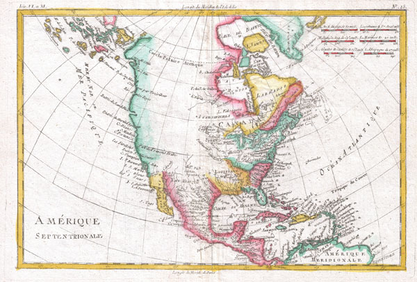
Amerique Septentrionale.
sold
- Digital Map Information
- Suitable for large format printing
- DPI: 300
- File Size: 4.2 MB
- File Type: ZIP / TIFF
- ICC color profile embedded
- Delivered instantly via download link
A fine example of Rigobert Bonne and Guilleme Raynal's 1780 map of North America. Covers the entire continent from the high arctic to Central America, the Caribbean, and the Spanish Main. Offers an early perspective on the region including the ... (more details)
Part of France's premier Burgundy Wine Region.

Dept. de l'Yonee.
sold
- Digital Map Information
- Suitable for large format printing
- File Size: 8.89 MB
- File Type: ZIP / TIFF
- ICC color profile embedded
- Delivered instantly via download link
This is a fascinating 1852 map of the French department of L'Yonne, France. L'Yonne is of France's premier Burgundy wine region and produces some of the worlds finest reds. Yonne is also one of only two departments that produce Chaource ... (more details)
Produces fine Cote de Rhone wines.

Dept. de Vaucluse.
sold
- Digital Map Information
- Suitable for large format printing
- File Size: 9.52 MB
- File Type: ZIP / TIFF
- ICC color profile embedded
- Delivered instantly via download link
This is a fascinating 1852 map of the French department of Vaucluse, France. Vaucluse is the center of wine production in the southern Rhone. Some of the smartest wines in France can be found here. There is also a very strong movement ... (more details)
Côte d'Azur or the French Riviera - Nice, Cannes, St. Tropez!
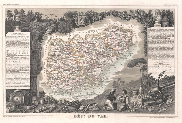
Dept. du Var.
sold
- Digital Map Information
- Suitable for large format printing
- File Size: 9.25 MB
- File Type: ZIP / TIFF
- ICC color profile embedded
- Delivered instantly via download link
This is a fascinating 1852 map of the French department of Var, the heart of the French Riviera or Côte d'Azur. Includes the resort cities of Cannes, Nice and San Tropez, among many others. This area also houses a number of ... (more details)
A stopping point on the Santiago de Compostella pilgrimage route.

Dept. de Tarn et Garonne.
sold
- Digital Map Information
- Suitable for large format printing
- File Size: 8.93 MB
- File Type: ZIP / TIFF
- ICC color profile embedded
- Delivered instantly via download link
This is a fascinating 1852 map of the French department of Tarn et Garonne, France. This map is centered around the city of Moissac, which is known for its fine desert grapes. This area produces a number of quality wines, ... (more details)
Known for Cahors wines.

Dept. du Tarn.
sold
- Digital Map Information
- Suitable for large format printing
- File Size: 8.91 MB
- File Type: ZIP / TIFF
- ICC color profile embedded
- Delivered instantly via download link
This is a fascinating 1852 map of the French department of Tarn, France. This area produces a variety of traditional wines, including Cahors, Mauzac, Loin de l'Oeil and Ondenc for the white varieties and Braucol, Duras and ... (more details)
Map of France's Fromage de Meaux Region.
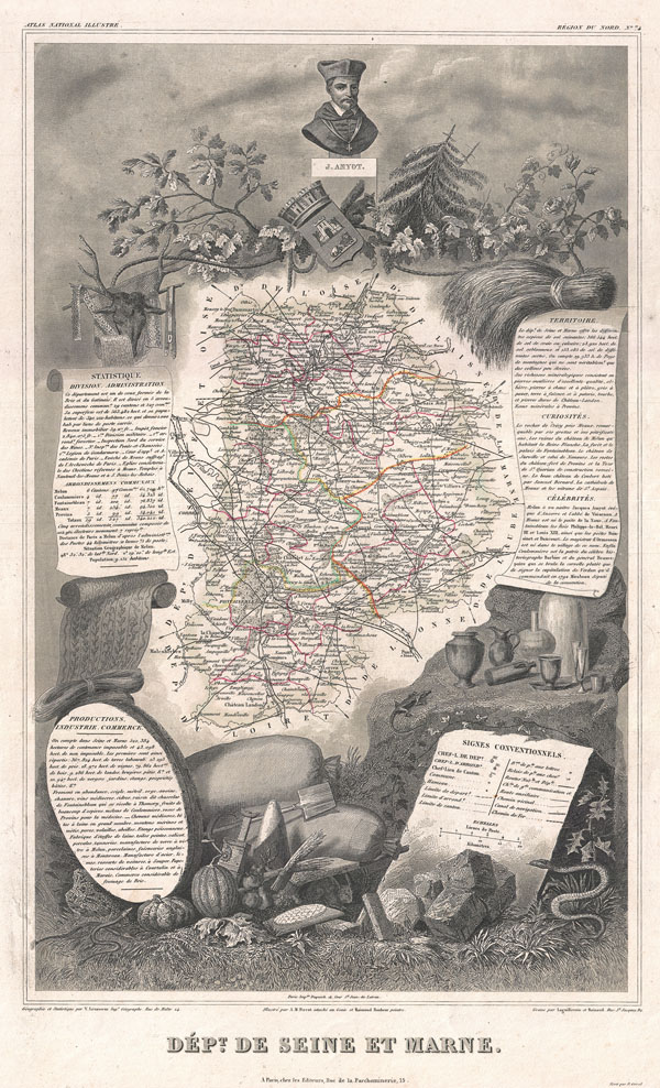
Dept. de Seine et Marne.
sold
- Digital Map Information
- Suitable for large format printing
- File Size: 10.27 MB
- File Type: ZIP / TIFF
- ICC color profile embedded
- Delivered instantly via download link
This is a fascinating 1852 map of the French department of Seine Et Marne, France. This region produces a wide variety of wines and hosts an annual wine and cheese fair. This area is known for its production of a ... (more details)
Part of France's premier Burgundy Wine Region.

Dept. de Saone et Loire.
sold
- Digital Map Information
- Suitable for large format printing
- File Size: 9.63 MB
- File Type: ZIP / TIFF
- ICC color profile embedded
- Delivered instantly via download link
This is a fascinating 1852 map of the French department of Saone et Loire, France. Part of France's important Burgundy or Bourgogne Wine Region. Produces Mercurey and Givry among other red wines. Around Mâcon are ... (more details)
Part of France's premier Burgundy Wine Region.

Dept. de la Hte. Saone.
sold
- Digital Map Information
- Suitable for large format printing
- File Size: 9.63 MB
- File Type: ZIP / TIFF
- ICC color profile embedded
- Delivered instantly via download link
This is a fascinating 1852 map of the French department of Haute-Saone, France. Part of France's important Burgundy or Bourgogne Wine Region. This area is home to the Jean Roussey cheese factory. The map proper ... (more details)
Home of Beaujolais and other great French wines.

Dept. du Rhone.
sold
- Digital Map Information
- Suitable for large format printing
- File Size: 9.63 MB
- File Type: ZIP / TIFF
- ICC color profile embedded
- Delivered instantly via download link
This is a fascinating 1852 map of the French department of Rhone, France. This area produces the French AOC wine, Beaujolais. This wine is generally made of the Gamay grape which has a thin skin and is low in ... (more details)
Home of fine Alsacian wines.

Dept. du Haut-Rhin.
sold
- Digital Map Information
- Suitable for large format printing
- File Size: 9.73 MB
- File Type: ZIP / TIFF
- ICC color profile embedded
- Delivered instantly via download link
This is a fascinating 1852 map of the French department of Haut-Rhin, France. This mountainous area is part of the Alsace wine region and is known for its production of both Pinot Noir and Pinot Gris. The map ... (more details)
Home of fine Alsacian wines.

Dept. du Bas-Rhin.
sold
- Digital Map Information
- Suitable for large format printing
- File Size: 3.78 MB
- File Type: ZIP / TIFF
- ICC color profile embedded
- Delivered instantly via download link
This is a fascinating 1852 map of the French department of Bas-Rhin, France. Part of the Alsace wine region surrounding Strasbourg. This mountainous area on the west bank of the Rhine River is known for ... (more details)
Map of France's Muscat Wine Region.
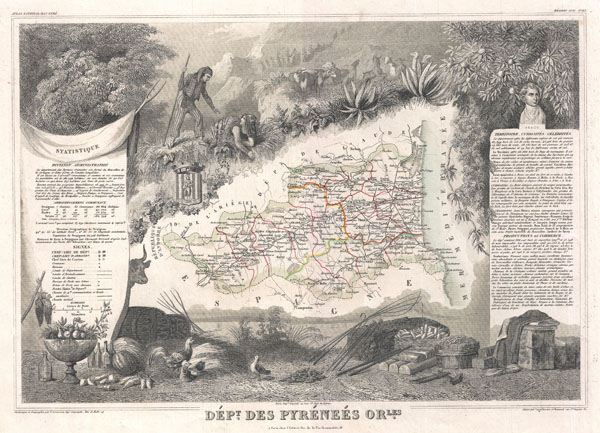
Dept. des Pyrenees Orientales.
sold
- Digital Map Information
- Suitable for large format printing
- File Size: 9.14 MB
- File Type: ZIP / TIFF
- ICC color profile embedded
- Delivered instantly via download link
This is a fascinating 1852 map of the French department of Pyrenees Orientales, France. This area is well-known wine producing region. A wide variety of wines come out of this region, including the ... (more details)
Map of France's Jurancon Wine Region.

Dept. des Basses Pyrenees.
sold
- Digital Map Information
- Suitable for large format printing
- File Size: 9.15 MB
- File Type: ZIP / TIFF
- ICC color profile embedded
- Delivered instantly via download link
This is a fascinating 1852 map of the French department of Basses Pyrenees, France. This department includes the Jurancon wine region, famous for its production dry wines and sweet white wines. The ... (more details)
Map of France's Maroilles cheese region.

Dept. du pas de Calais.
sold
- Digital Map Information
- Suitable for large format printing
- File Size: 4.26 MB
- File Type: ZIP / TIFF
- ICC color profile embedded
- Delivered instantly via download link
This is a fascinating 1852 map of the French department of Calais, France. This area is known for producing Maroilles, a soft cheese made from cow's milk and with a washed rind. The map proper is ... (more details)