
Raynal, Guillaume Thomas
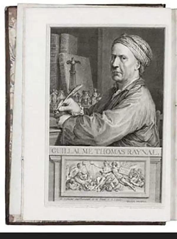
Guillaume Thomas Raynal (April 12, 1711 - March 6, 1796) was a French writer, philosopher, and historian active during the Enlightenment. Raynal was educated as a Jesuit, but left the order for unknown reasons, and moved to Paris where he dedicated himself to the production of a number of minor but popular historical works. Raynal's histories opened doors to elite social and artistic circles where he met and befriended various members of the Philosophe Coteries. Raynal's most important work is generally considered to be a 1770 collaboration with Diderot and others entitled, L'Histoire philosophique et politique des établissements et du commerce des Européens dans les deux Indes. Some of the philosophical ideas developed in the book drew negative attention from the authorities who banned the book and posted a notice for the arrest of its authors. Raynal fled to Berlin and later to St. Petersburg, where he lived for a number of years before returning to France in 1787. Though not a cartographer Raynal's name is often attached to several Atlases by Rigobert Bonne, from whom he composed the text.
Bonne's beautiful representation of the Arabian Peninsula and environs.
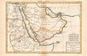
Carte de l'Arabie.
$175.00
Acquire
- Digital Map Information
- Suitable for large format printing
- DPI: 600
- File Size: 15.33 MB
- File Type: ZIP / TIFF
- ICC color profile embedded
- Delivered instantly via download link
This is Rigobert Bonne and Guillaume Raynal's 1780 map of the Arabia and Abyssinia (Ethiopia). It covers from the Nile Delta south as far as the Horn of Africa and west to Persia, fully or partly inclusive of the modern-day countries of Ethiopia, Egypt, Sudan, Eritrea, Djibouti, Somalia, Saudi Arabia, Yemen, Oman, Kuwait, and the United Arab Emirates. (more details)
Bonne's drawing of the Guinea coast, epicenter of the Transatlantic Slave Trade.
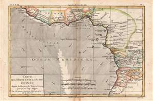
Carte de la Haute et de la Basse Guinee.
$150.00
Acquire
- Digital Map Information
- Suitable for large format printing
- DPI: 600
- File Size: 21.6 MB
- File Type: ZIP / TIFF
- ICC color profile embedded
- Delivered instantly via download link
This is Rigobert Bonne and Guillame Raynal's 1780 map of West Africa, corresponding to modern-day Sierra Leone, Liberia, Ivory Coast, Ghana, Nigeria, Cameroon, Gabon, the Republic of the Congo, the Democratic Republic of the Congo, Togo, Benin, Angola, and Equatorial Guinea. (more details)
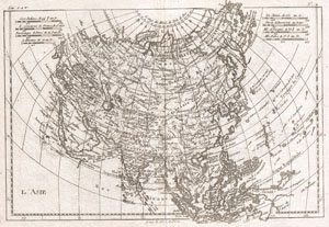
L'Asie.
$175.00
Acquire
- Digital Map Information
- Suitable for large format printing
- DPI: 300
- File Size: 4.56 MB
- File Type: ZIP / TIFF
- ICC color profile embedded
- Delivered instantly via download link
A fine example of Rigobert Bonne and Guillaume Raynal's 1780 map of Asia. Offers considerable detail considering the size, showing the tradewinds in the Pacific and Indian Oceans as well as numerous Silk Route cities in Central Asia. Highly detailed, showing ... (more details)
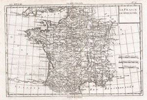
La France Par Generalites.
$150.00
Acquire
- Digital Map Information
- Suitable for large format printing
- DPI: 300
- File Size: 4.24 MB
- File Type: ZIP / TIFF
- ICC color profile embedded
- Delivered instantly via download link
A fine example of Rigobert Bonne and Guilleme Raynal's 1780 map of France. Highly detailed, showing towns, rivers, some topographical features, political boundaries and important roadways. Drawn by R. Bonne for G. Raynal's Atlas de Toutes les Parties ... (more details)
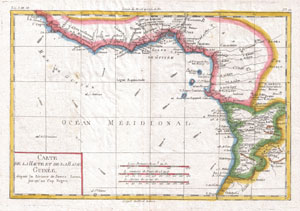
Carte De La Haute Et De La Basse Guinee
$200.00
Acquire
- Digital Map Information
- Suitable for large format printing
- DPI: 300
- File Size: 4.06 MB
- File Type: ZIP / TIFF
- ICC color profile embedded
- Delivered instantly via download link
A fine example of Rigobert Bonne and G. Raynal's 1780 map of Africa's Guinea coast. Map corresponds to modern day Liberia, Ivory Coast, Ghana, Nigeria, Cameroon, Gabon, Congo, and Equatorial Guinea. Features towns, rivers, some topographical features, ... (more details)
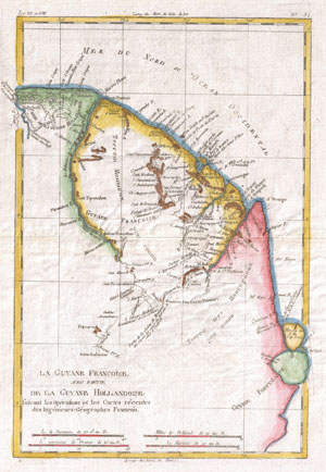
La Guyane Francoise Avec Partie De La Guyane Hollandoise
$150.00
Acquire
- Digital Map Information
- Suitable for large format printing
- DPI: 300
- File Size: 3.94 MB
- File Type: ZIP / TIFF
- ICC color profile embedded
- Delivered instantly via download link
A fine example of Rigobert Bonne and Guilleme Raynal's 1780 map of northeastern South America, depicting Guyana (Guyane). Covers parts of British Guyana, Dutch Surinam in the north, French Guyana (Guyane), modern day Mayapa, a Brazilian state, and Cap ... (more details)
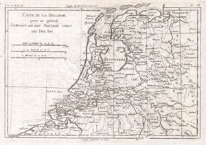
Carte de la Hollande, Prise en General Contenant les Sept Provinces Unies des Pays Bas.
$150.00
Acquire
- Digital Map Information
- Suitable for large format printing
- DPI: 300
- File Size: 4.36 MB
- File Type: ZIP / TIFF
- ICC color profile embedded
- Delivered instantly via download link
A fine example of Rigobert Bonne and Guilleme Raynal's 1780 map of Holland and Belgium. Shows towns, rivers, some topographical features, political boundaries and important roadways. Certain offshore shoals are also noted. Drawn by R. Bonne for G. ... (more details)
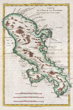
Carte de L'Isle de la Martinique Colonie Francoise dans les Illes Antilles.
$175.00
Acquire
- Digital Map Information
- Suitable for large format printing
- DPI: 300
- File Size: 4.36 MB
- File Type: ZIP / TIFF
- ICC color profile embedded
- Delivered instantly via download link
A fine example of Rigobert Bonne and Guilleme Raynal's 1780 map of the Island of Martinique. Highly detailed, showing towns, rivers, some topographical features, political boundaries and important ports. Mountains shown in profile. Drawn by R. ... (more details)
Shows Lake Parima on whose mythical shores legend situated the golden city of El Dorado.
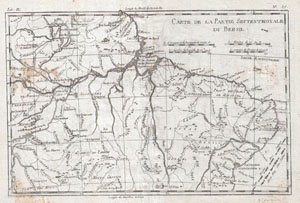
Carte De La Partie Septentrionale Du Bresil
$125.00
Acquire
- Digital Map Information
- Suitable for large format printing
- DPI: 300
- File Size: 4.38 MB
- File Type: ZIP / TIFF
- ICC color profile embedded
- Delivered instantly via download link
A fine example of Rigobert Bonne and Guilleme Raynal's 1780 map of Northern Brazil. This detailed map features the northern portion of Brazil from Bahia to Guyana. This also includes a portion of the Amazon River and its adjancet rainforest, ... (more details)
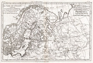
Le Nord de L'Europe, Contenant Le Danemark, La Norwege; La Suede et La Laponie avec la Majeure Partie de al Russie Europeenne.
$150.00
Acquire
- Digital Map Information
- Suitable for large format printing
- DPI: 300
- File Size: 4.1 MB
- File Type: ZIP / TIFF
- ICC color profile embedded
- Delivered instantly via download link
A fine example of Rigobert Bonne and Guillaume Raynal's 1780 map of Northern Europe and European Russia. Covers the modern day countries of Norway, Sweden, Finland, Denmark, and Finland as well as parts of Russia (including Moscow), Poland, ... (more details)
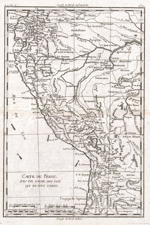
Carte Du Perou, Avec Une Partie Des Pays Qui En Sont A L'Est.
$150.00
Acquire
- Digital Map Information
- Suitable for large format printing
- DPI: 300
- File Size: 3.92 MB
- File Type: ZIP / TIFF
- ICC color profile embedded
- Delivered instantly via download link
A fine example of Rigobert Bonne and Guillaume Raynal's 1780 map of Peru. Covers from the Pacific well into the Amazon and as far south as the Aconcagua Desert. Shows Tradewinds in the pacific and shows mountains in profile. A number of ... (more details)
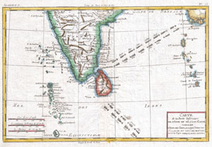
Carte De La Partie Inferieure De L'Inde En De Ca Du Gange
$175.00
Acquire
- Digital Map Information
- Suitable for large format printing
- DPI: 300
- File Size: 3.63 MB
- File Type: ZIP / TIFF
- ICC color profile embedded
- Delivered instantly via download link
A fine example of Rigobert Bonne and G. Raynal's 1780 map of Southern India. Includes the island of Sri Lanka as well as the Maldives and Andaman and Nicobar Island chains. Arrows in the Indian ocean show the direction of the trade ... (more details)
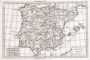
Les Royaumes d'Espagne et de Portugal.
$150.00
Acquire
- Digital Map Information
- Suitable for large format printing
- DPI: 300
- File Size: 4.34 MB
- File Type: ZIP / TIFF
- ICC color profile embedded
- Delivered instantly via download link
A fine example of Rigobert Bonne and Guilleme Raynal's 1780 map of Spain and Portugal. Includes the islands of Ibiza, Minorque, and Majorque. Shows towns, rivers, some topographical features, political boundaries and important ... (more details)