
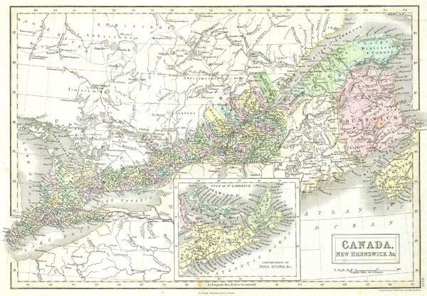
Canada, New Brunswick & C.
sold
- Digital Map Information
- Suitable for large format printing
- Full resolution TIFF file
- ICC color profile embedded
- Delivered instantly via download link
This is a fascinating 1851 hand colored map of Eastern Canada covers Ontario, New Brunswick, Quebec, and Nova Scotia. Inset includes Cape Breton Island and Prince Edward ... (more details)

Map of Ontario in Counties
sold
- Digital Map Information
- Suitable for large format printing
- File Size: 3.28 MB
- File Type: ZIP / TIFF
- ICC color profile embedded
- Delivered instantly via download link
This hand colored map is a lithographic engraving, dating to 1874 by the legendary American Mapmaker S.A. Mitchell, the younger. It represents the Canadian province of ... (more details)

Dept. De Saone et Loire.
sold
- Digital Map Information
- Suitable for large format printing
- Full resolution TIFF file
- ICC color profile embedded
- Delivered instantly via download link
This is a fascinating 1847 map of the French department of Saone et Loire is at the heart of the legendary Beaujolais wine producing region. The whole is surrounded by ... (more details)

Polen, Galizien, Ungarn, Kroatien u. Siebenburgen, Moldau and Walachey.
sold
- Digital Map Information
- Suitable for large format printing
- File Size: 3.26 MB
- File Type: ZIP / TIFF
- ICC color profile embedded
- Delivered instantly via download link
This fascinating 1862 map by Justus Perthes and Stieler depicts Poland, Hungary and Croatia. Unlike other cartographic publishers of the period, the Justus Perthes ... (more details)

Europaisches Russland.
sold
- Digital Map Information
- Suitable for large format printing
- File Size: 4.5 MB
- File Type: ZIP / TIFF
- ICC color profile embedded
- Delivered instantly via download link
This fascinating 1862 map by Justus Perthes and Stieler depicts the European part of Russia. In a cartographic flourish unique to Perthes, the bottom of the map ... (more details)

Die Europaeische Turkei, Griechenland und die Ionischen Inseln.
sold
- Digital Map Information
- Suitable for large format printing
- File Size: 3.98 MB
- File Type: ZIP / TIFF
- ICC color profile embedded
- Delivered instantly via download link
This fascinating 1862 map by Justus Perthes and Stieler depicts Greece, the Balkans, parts of Turkey, and the islands of the Adriatic as far south as Crete or ... (more details)
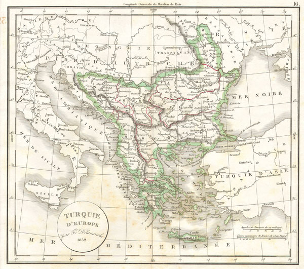
Turquie d'Europe
sold
- Digital Map Information
- Suitable for large format printing
- Full resolution TIFF file
- ICC color profile embedded
- Delivered instantly via download link
This hand colored map is a copper plate engraving, dating to 1832 by the well known French mapmaker Delamarche. It is a representation of Greece and the ... (more details)

Italien order die Apenninische Halbinsel.
sold
- Digital Map Information
- Suitable for large format printing
- File Size: 1.92 MB
- File Type: ZIP / TIFF
- ICC color profile embedded
- Delivered instantly via download link
This fascinating 1862 map by Justus Perthes and Stieler depicts Italy. In cartographic flourish unique to Perthes, land profiles decorate either side o ... (more details)

Sud-ostliches Deutschland.
sold
- Digital Map Information
- Suitable for large format printing
- File Size: 4.43 MB
- File Type: ZIP / TIFF
- ICC color profile embedded
- Delivered instantly via download link
This fascinating 1862 map by Justus Perthes and Stieler depicts Switzerland. In a cartographic flourish unique to Perthes, a elevation profile chart ... (more details)

Sud-ostliches Deutschland.
sold
- Digital Map Information
- Suitable for large format printing
- File Size: 3.87 MB
- File Type: ZIP / TIFF
- ICC color profile embedded
- Delivered instantly via download link
This fascinating 1862 map by Justus Perthes and Stieler depicts Bohemia (modern day Czech Republic) and Austria. Unlike other cartographic ... (more details)

Nordostliches Deutschland.
sold
- Digital Map Information
- Suitable for large format printing
- File Size: 3.24 MB
- File Type: ZIP / TIFF
- ICC color profile embedded
- Delivered instantly via download link
This fascinating 1862 map by Justus Perthes and Stieler depicts Prussia and the states of northeastern Germany. Unlike other cartographic ... (more details)

Nordwestliches Deutschland, Niederlande und Belgien.
sold
- Digital Map Information
- Suitable for large format printing
- File Size: 3.09 MB
- File Type: ZIP / TIFF
- ICC color profile embedded
- Delivered instantly via download link
This fascinating 1862 map by Justus Perthes and Stieler depicts Holland (the Netherlands) and Belgium as well as parts of western ... (more details)

Uebersicht der Staaten des Deutschen Bundes.
sold
- Digital Map Information
- Suitable for large format printing
- File Size: 1.99 MB
- File Type: ZIP / TIFF
- ICC color profile embedded
- Delivered instantly via download link
This fascinating 1862 map by Justus Perthes and Stieler depicts the north central part of Germany including Hannover, Holstein, ... (more details)

Gebirgs Karte von Deutschland.
sold
- Digital Map Information
- Suitable for large format printing
- File Size: 2.43 MB
- File Type: ZIP / TIFF
- ICC color profile embedded
- Delivered instantly via download link
This fascinating 1862 map by Justus Perthes and Stieler depicts the physical geography of central Europe (or as it is called ... (more details)
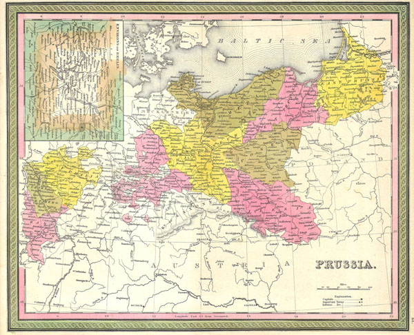
Prussia.
sold
- Digital Map Information
- Suitable for large format printing
- Full resolution TIFF file
- ICC color profile embedded
- Delivered instantly via download link
This hand colored map is a copper plate engraving, dating to 1850 by the legendary American mapmaker S.A. Mitchell, the ... (more details)

Delamarche's Map of Germany in Roman Times.
sold
- Digital Map Information
- Suitable for large format printing
- Full resolution TIFF file
- ICC color profile embedded
- Delivered instantly via download link
This hand colored map is a copper plate engraving, dating to 1832 by the well known French mapmaker Delamarche. It is ... (more details)

Delamarche's Map of Spain and Portugal under the Roman Empire.
sold
- Digital Map Information
- Suitable for large format printing
- Full resolution TIFF file
- ICC color profile embedded
- Delivered instantly via download link
This hand colored map is a copper plate engraving, dating to 1832 by the well known French mapmaker Delamarche. It is ... (more details)
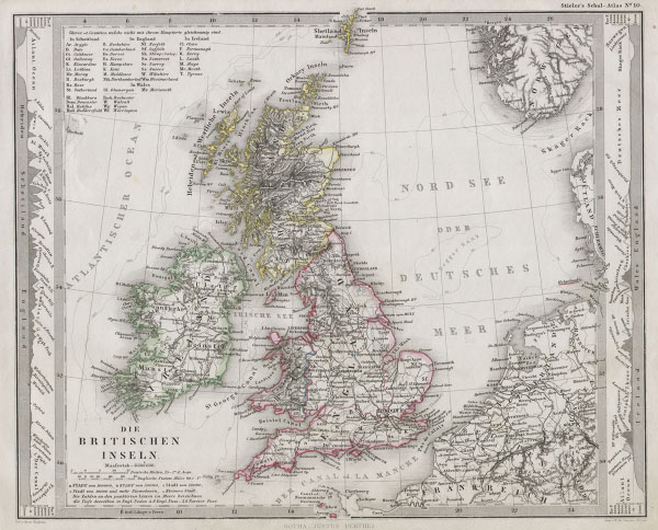
Die Britischen Inseln.
sold
- Digital Map Information
- Suitable for large format printing
- File Size: 1.88 MB
- File Type: ZIP / TIFF
- ICC color profile embedded
- Delivered instantly via download link
This fascinating 1862 map by Justus Perthes and Stieler depicts the British Isles including England, Scotland and ... (more details)

Politische Ubersicht von Europa.
sold
- Digital Map Information
- Suitable for large format printing
- File Size: 2.1 MB
- File Type: ZIP / TIFF
- ICC color profile embedded
- Delivered instantly via download link
This fascinating 1862 map by Justus Perthes and Stieler continent of Europe. Unlike other cartographic ... (more details)
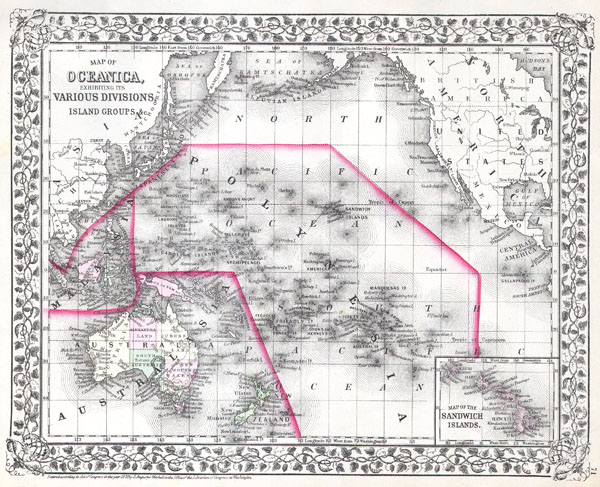
Map of Oceanica, Exhibiting its Various Divisions, Island Groups &c.
sold
- Digital Map Information
- Suitable for large format printing
- File Size: 3.71 MB
- File Type: ZIP / TIFF
- ICC color profile embedded
- Delivered instantly via download link
A beautiful example of the American map publisher Samuel Augustus Mitchell Jr.'s 1872 map of the ... (more details)