

Johnson's Hindostan or British India.
sold
- Digital Map Information
- Suitable for large format printing
- File Size: 4.16 MB
- File Type: ZIP / TIFF
- ICC color profile embedded
- Delivered instantly via download link
A very nice example of A. J. Johnson and Ross C. Browning's 1861 map of India and Southeast Asia. Covers from the Mouths of the Indus River eastward to include all of India, Burma, Siam (Thailand), Laos, Cambodia, Malaysia (Malacca). Singapore, and Vietnam ... (more details)

Johnson's Turkey in Asia Persia Arabia & C.
sold
- Digital Map Information
- Suitable for large format printing
- File Size: 8.59 MB
- File Type: ZIP / TIFF
- ICC color profile embedded
- Delivered instantly via download link
A very nice example of A. J. Johnson and Ross Browning's 1861 map of Arabia, Persia and Turkey in Asia. Covers from the Mediterranean and egypt eastwards as far as the Mouths of the Indus River, as well as southward as far as the Horn of Africa and ... (more details)

Johnson's Palestine.
sold
- Digital Map Information
- Suitable for large format printing
- File Size: 8.21 MB
- File Type: ZIP / TIFF
- ICC color profile embedded
- Delivered instantly via download link
A beautiful example of A. J. Johnson's 1862 map of Palestine / Israel / Holy Land. Details the region from Beirut south to Busaireh and Kadesh Barnea. extends eastward as far as Mount Alsadamus in modern day Syria. Offers both contemporary and ... (more details)
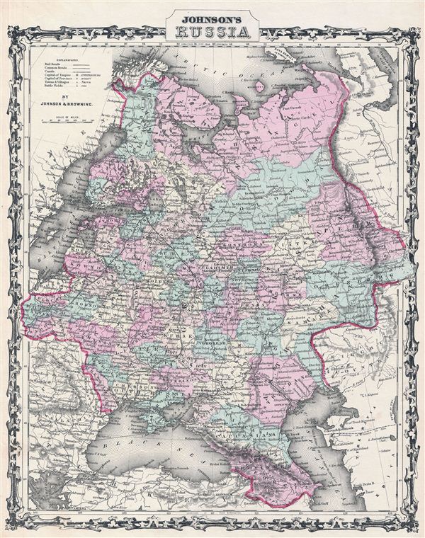
Johnson's Russia.
sold
- Digital Map Information
- Suitable for large format printing
- File Size: 10.28 MB
- File Type: ZIP / TIFF
- ICC color profile embedded
- Delivered instantly via download link
A beautiful example of A. J. Johnson and R. Browning's 1861 map of Russia. Depicts the european portions of Russia from the Arctic Sea south to the Black Sea and Caspian Sea. extends west as far as Warsaw and east as far as Orenburg and Perm. ... (more details)

Johnson's Europe.
sold
- Digital Map Information
- Suitable for large format printing
- File Size: 18.09 MB
- File Type: ZIP / TIFF
- ICC color profile embedded
- Delivered instantly via download link
A very beautiful example of Johnson's 1862 map of europe. This map details all of europe as well as adjacent parts of Asia and Africa. Highly detailed with countless place names. Also shows the starting points and european routes of ... (more details)

Johnson's South America.
sold
- Digital Map Information
- Suitable for large format printing
- File Size: 16.41 MB
- File Type: ZIP / TIFF
- ICC color profile embedded
- Delivered instantly via download link
This is a magnificent 1861 hand colored map of South America. Shows the region in incredible detail with notations of geographical features, political features, and other information such as telegraph cables, roads, and nautical facts. ... (more details)

Johnson's North and South Carolina.
sold
- Digital Map Information
- Suitable for large format printing
- File Size: 19.76 MB
- File Type: ZIP / TIFF
- ICC color profile embedded
- Delivered instantly via download link
A beautiful example of A. J. Johnson's 1861 map of North Carolina and South Carolina. Offers a fascinating snapshot of these Confederate states shortly following the outbreak of the American Civil War. Map shows both states in full ... (more details)
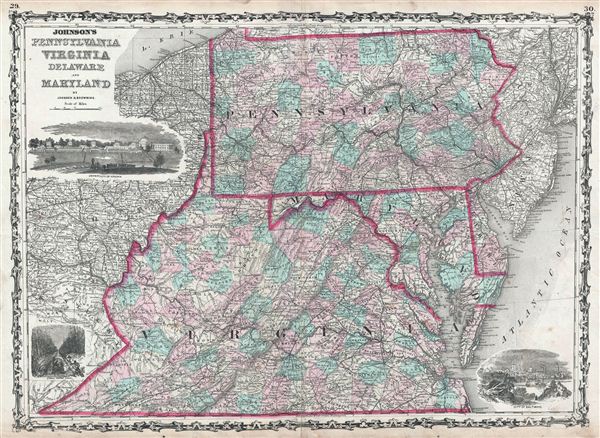
Johnson's Pennsylvania Virginia Delaware and Maryland.
sold
- Digital Map Information
- Suitable for large format printing
- File Size: 19.91 MB
- File Type: ZIP / TIFF
- ICC color profile embedded
- Delivered instantly via download link
A beautiful example of A. J. Johnson's 1861 map of Virginia, Maryland, Delaware and Pennsylvania. Offers a fascinating snapshot of these north-south borderlands shortly following the outbreak of the American Civil War. Map shows ... (more details)
Lovely depiction of New Jersey by Johnson and Browning.

Johnson's New Jersey.
sold
- Digital Map Information
- Suitable for large format printing
- File Size: 9.76 MB
- File Type: ZIP / TIFF
- ICC color profile embedded
- Delivered instantly via download link
A beautiful example of A. J. Johnson's 1861 map of New Jersey. Covers the entire state along with portions of adjacent Delaware, Pennsylvania, and New York. Offers color-coding according to county and notations for railways, ... (more details)
Johnson's rarest and most decorative map of New England.

Johnson's Pennsylvania Virginia Delaware and Maryland.
sold
- Digital Map Information
- Suitable for large format printing
- File Size: 19.11 MB
- File Type: ZIP / TIFF
- ICC color profile embedded
- Delivered instantly via download link
One of A. J. Johnson's rarest and most visually appealing maps, this is his 1861 Map of New england. The map covers the New england region from Long Island to Main and from the Hudson Valley to the Atlantic seaboard, with ... (more details)

Johnson's Lower Canada and New Brunswick. Johnson's Upper Canada.
sold
- Digital Map Information
- Suitable for large format printing
- File Size: 18.09 MB
- File Type: ZIP / TIFF
- ICC color profile embedded
- Delivered instantly via download link
This is A. J. Johnson and R. Browning's 1861 map of Upper Canada (Ontario) and Lower Canada (Quebec). Divided into two maps. The upper map consists of the provinces of Quebec and New Brunswick. Features an inset map of ... (more details)
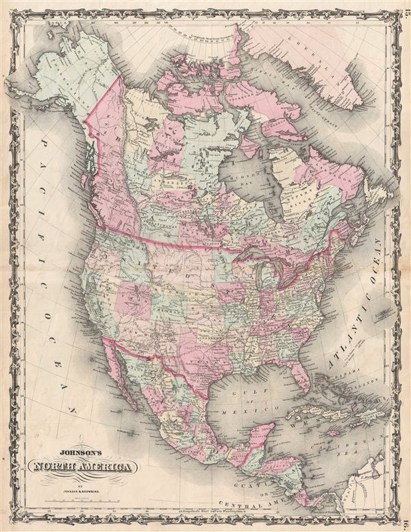
Johnson's North America.
sold
- Digital Map Information
- Suitable for large format printing
- File Size: 16.54 MB
- File Type: ZIP / TIFF
- ICC color profile embedded
- Delivered instantly via download link
A beautiful example of A. J. Johnson's 1861 map of North America. Offers a fascinating snapshot of North America, particularly the United States, Canada and Mexico, just after the outbreak of the American Civil War. ... (more details)

Johnson's Michigan and Wisconsin.
sold
- Digital Map Information
- Suitable for large format printing
- File Size: 19.59 MB
- File Type: ZIP / TIFF
- ICC color profile embedded
- Delivered instantly via download link
A beautiful example of A. J. Johnson's 1861 map of Michigan and Wisconsin. This rare map offers a fascinating snapshot of these two states shortly following the outbreak of the American Civil War. Map shows both ... (more details)

Johnson's Georgia and Alabama.
sold
- Digital Map Information
- Suitable for large format printing
- File Size: 19.33 MB
- File Type: ZIP / TIFF
- ICC color profile embedded
- Delivered instantly via download link
A beautiful example of A. J. Johnson's 1861 map of Georgia and Alabama. Offers a fascinating snapshot of these southern states shortly following the outbreak of the American Civil War. Map shows both states in full ... (more details)

Johnson's Delaware and Maryland.
sold
- Digital Map Information
- Suitable for large format printing
- File Size: 3.81 MB
- File Type: ZIP / TIFF
- ICC color profile embedded
- Delivered instantly via download link
A fine map of Maryland and Delaware dating to 1861 by A. J. Johnson. This is the most decorative example of Johnson's Maryland - Delaware series. Along the top of the map, in what would be Pennsylvania there are ... (more details)

Johnson's New York.
sold
- Digital Map Information
- Suitable for large format printing
- File Size: 20.19 MB
- File Type: ZIP / TIFF
- ICC color profile embedded
- Delivered instantly via download link
This is Johnson and Ward's 1862 map of New York State. This rare map offers a fascinating snapshot of New York shortly following the outbreak of the American Civil War. Map New York in full with bold and ... (more details)

Johnson's Central America.
sold
- Digital Map Information
- Suitable for large format printing
- File Size: 9.37 MB
- File Type: ZIP / TIFF
- ICC color profile embedded
- Delivered instantly via download link
This is A. J. Johnson and R. Browning's 1861 map of Central America. Covers Central America from the Isthmus of Tehuantepec, Mexico to the Bay of Panama. Shows the countries of Guatemala, Honduras, el ... (more details)

Johnson's Washington and Oregon.
sold
- Digital Map Information
- Suitable for large format printing
- File Size: 9.09 MB
- File Type: ZIP / TIFF
- ICC color profile embedded
- Delivered instantly via download link
A beautiful example of A. J. Johnson's 1861 map of Washington and Oregon. This rare map offers a fascinating snapshot of this region shortly following the outbreak of the American Civil War. Shows ... (more details)
An early pre-Colorado mapping of this region.

Johnson's Nebraska, Dakota, Colorado, Kansas.
sold
- Digital Map Information
- Suitable for large format printing
- File Size: 7.64 MB
- File Type: ZIP / TIFF
- ICC color profile embedded
- Delivered instantly via download link
From the 1861 Johnson and Browning edition of the Johnson's Atlas , this is one of the rarest and most desirable states of the Johnson's Dakota, Nebraska and Kansas map. In this example Nebraska is ... (more details)

Johnson's Missouri and Kansas.
sold
- Digital Map Information
- Suitable for large format printing
- File Size: 17.4 MB
- File Type: ZIP / TIFF
- ICC color profile embedded
- Delivered instantly via download link
A beautiful example of A. J. Johnson's 1861 map of Missouri and Kansas. One of Johnson's more decorative maps, this rare map offers a fascinating snapshot of these hotly contested states shortly ... (more details)