
Issed by the Japanese at the opening of the First Sino-Japanese War.
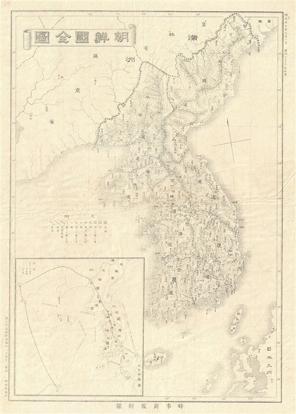
Korea.
sold
- Digital Map Information
- Suitable for large format printing
- Full resolution TIFF file
- ICC color profile embedded
- Delivered instantly via download link
This is an unusual and scarce example of the 1894 or Meiji 27 Japanese map of Korea or Corea. This map of Korea, made in the first year of Emperor Taisho's reign, covers all of Peninsular Korea, inclusive of the Tsushima, Iki and Jeju Islands. An Inset map is ... (more details)

Firehole Geyser Basin. Geology Sheet XXII.
sold
- Digital Map Information
- Suitable for large format printing
- File Size: 21.78 MB
- File Type: ZIP / TIFF
- ICC color profile embedded
- Delivered instantly via download link
A fine example of Arnold Hague's 1904 geological survey map of the spectacular Firehole Geyser Basin in Yellowstone National Park, Wyoming. Focusing on the Firehole River, the map covers from Goose Lake, the Gooslings and Feather Lake northward, along the ... (more details)

Crandall Sheet. Geology Sheet XIV.
sold
- Digital Map Information
- Suitable for large format printing
- File Size: 16.74 MB
- File Type: ZIP / TIFF
- ICC color profile embedded
- Delivered instantly via download link
A fine example of Arnold Hague's 1904 geological survey map of the spectacular Crandall Region in the Yellowstone National Park, Wyoming. Centered on Crandall Creek, the map covers the Absaroka Range from the Crow Peak to Kersey Lake in Montana. The map ... (more details)

Lake Sheet. Geology Sheet XIII.
sold
- Digital Map Information
- Suitable for large format printing
- File Size: 15.07 MB
- File Type: ZIP / TIFF
- ICC color profile embedded
- Delivered instantly via download link
A fine example of Arnold Hague's 1904 geological survey map of the spectacular Yellowstone Lake Region of the Yellowstone National Park, Wyoming. The map covers from the Absaroka Range to the Big Game Ridge and from the lower half of the Yellowstone Lake ... (more details)
Features the Grand Canyon of Yellowstone.

Canyon Sheet. Geology Sheet XII.
sold
- Digital Map Information
- Suitable for large format printing
- File Size: 17.77 MB
- File Type: ZIP / TIFF
- ICC color profile embedded
- Delivered instantly via download link
A fine example of Arnold Hague's 1904 geological survey map of the spectacular Grand Canyon of the Yellowstone National Park, Wyoming. The map covers the entire Canyon Region and the Absaroka Range from the Yellowstone Lake northward, along the ... (more details)

Ishawooa Sheet. Topography Sheet IX.
sold
- Digital Map Information
- Suitable for large format printing
- File Size: 13.68 MB
- File Type: ZIP / TIFF
- ICC color profile embedded
- Delivered instantly via download link
A fine example of Arnold Hague's 1904 topographical survey map of the spectacular Ishawooa Region in the Yellowstone National Park, Wyoming. Centered on Ishawooa Cone, the map covers the Absaroka Range from the Thorofare Plateau and Ash ... (more details)
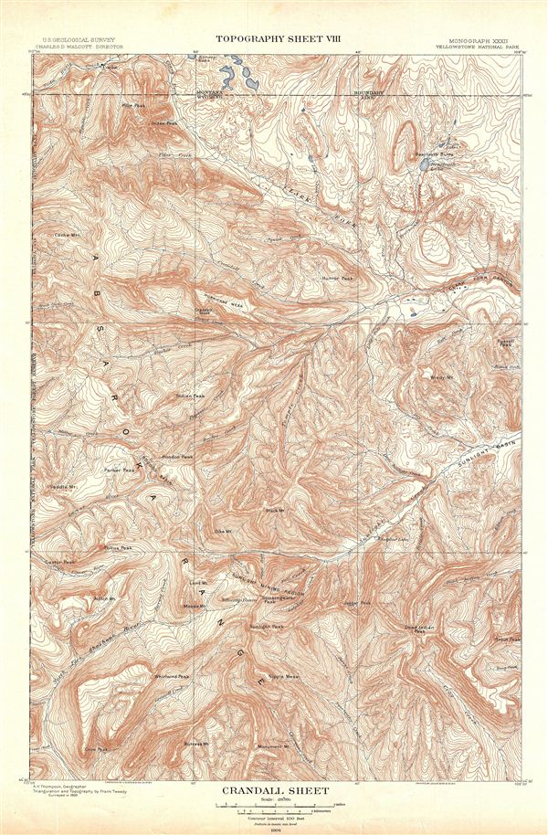
Crandall Sheet. Topography Sheet VIII.
sold
- Digital Map Information
- Suitable for large format printing
- File Size: 13.96 MB
- File Type: ZIP / TIFF
- ICC color profile embedded
- Delivered instantly via download link
A fine example of Arnold Hague's 1904 topographical survey map of the spectacular Crandall Region in the Yellowstone National Park, Wyoming. Centered on Crandall Creek, the map covers the Absaroka Range from the Crow Peak to Kersey Lake ... (more details)

Lake Sheet. Topography Sheet VII.
sold
- Digital Map Information
- Suitable for large format printing
- File Size: 10.91 MB
- File Type: ZIP / TIFF
- ICC color profile embedded
- Delivered instantly via download link
A fine example of Arnold Hague's 1904 topographical survey map of the spectacular Yellowstone Lake Region of the Yellowstone National Park, Wyoming. The map covers from the Absaroka Range to the Big Game Ridge and from the lower half of ... (more details)
Features the Grand Canyon of Yellowstone.

Canyon Sheet. Topography Sheet VI.
sold
- Digital Map Information
- Suitable for large format printing
- File Size: 11.9 MB
- File Type: ZIP / TIFF
- ICC color profile embedded
- Delivered instantly via download link
A fine example of Arnold Hague's 1904 topographical survey map of the spectacular Grand Canyon of the Yellowstone National Park, Wyoming. The map covers the entire Canyon Region and the Absaroka Range from the Yellowstone Lake ... (more details)
Possibly the only surviving example of this remarkable 19th century Manhattan Birds-Eye View.
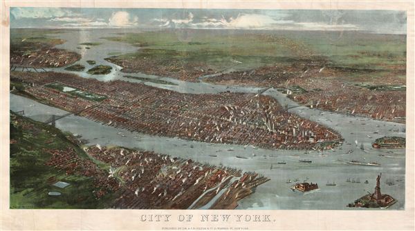
City of New York.
sold
- Digital Map Information
- Suitable for large format printing
- File Size: 4.87 MB
- File Type: ZIP / TIFF
- ICC color profile embedded
- Delivered instantly via download link
A rare possibly unique find, this is G. W. and C. B. Colton's magnificent 1897 panoramic birds-eye view of New York City. Presented in chromolithograph color this map reveals Manhattan, Brooklyn, and Queens as seen from high ... (more details)

The Shores of Yellowstone Lake. Geology Sheet XXVII.
sold
- Digital Map Information
- Suitable for large format printing
- File Size: 12.78 MB
- File Type: ZIP / TIFF
- ICC color profile embedded
- Delivered instantly via download link
A fine example of Arnold Hague's 1904 geological survey map of the spectacular shores of the Yellowstone Lake in Yellowstone National Park, Wyoming. Centered on the Yellowstone Lake, the largest mountain lake in the United ... (more details)
The highest concentration of Geysers in the world!

Shoshone Geyser Basin. Geology Sheet XXVI.
sold
- Digital Map Information
- Suitable for large format printing
- File Size: 11.23 MB
- File Type: ZIP / TIFF
- ICC color profile embedded
- Delivered instantly via download link
A fine example of Arnold Hague's 1904 geological survey map of the spectacular Shoshone Geyser Basin in Yellowstone National Park, Wyoming. Centered on the Shoshone Creek, the map covers the basin from the Shoshone River ... (more details)
Details the area aroun the Prismatic Spring!

Excelsior Geyser Basin. Geology Sheet XXIII.
sold
- Digital Map Information
- Suitable for large format printing
- File Size: 11.26 MB
- File Type: ZIP / TIFF
- ICC color profile embedded
- Delivered instantly via download link
A fine example of Arnold Hague's 1904 geological survey map of the spectacular excelsior Geyser Basin in Yellowstone National Park, Wyoming. Focusing on the excelsior Geyser, the map covers the Midway Geyser Basin from ... (more details)

Mammoth Hot Springs and Vicinity. Geology Sheet XIX.
sold
- Digital Map Information
- Suitable for large format printing
- File Size: 16.44 MB
- File Type: ZIP / TIFF
- ICC color profile embedded
- Delivered instantly via download link
A fine example of Arnold Hague's 1904 geological survey map of the spectacular Mammoth Springs in Yellowstone National Park, Wyoming. The map covers the Mammoth Hot Spring Terraces from Terrace Mountain to Mount ... (more details)

Mammoth Hot Springs and Vicinity. Topography Sheet XVIII.
sold
- Digital Map Information
- Suitable for large format printing
- File Size: 11.86 MB
- File Type: ZIP / TIFF
- ICC color profile embedded
- Delivered instantly via download link
A fine example of Arnold Hague's 1904 topographical survey map of the spectacular Mammoth Springs in Yellowstone National Park, Wyoming. The map covers the Mammoth Hot Spring Terraces from Terrace Mountain to ... (more details)

Shoshone Sheet. Geology Sheet XI.
sold
- Digital Map Information
- Suitable for large format printing
- File Size: 22.36 MB
- File Type: ZIP / TIFF
- ICC color profile embedded
- Delivered instantly via download link
A fine example of Arnold Hague's 1904 geological survey map of the spectacular Shoshone Region in Yellowstone National Park, Wyoming. Centered on Pitchstone Plateau, the map covers from Snake River ... (more details)
Includes the spectacular Mammoth Hot Spring!

Gallatin Sheet. Geology Sheet X.
sold
- Digital Map Information
- Suitable for large format printing
- File Size: 22.26 MB
- File Type: ZIP / TIFF
- ICC color profile embedded
- Delivered instantly via download link
A fine example of Arnold Hague's 1904 geological survey map of the spectacular Gallatin Region in Yellowstone National Park, Wyoming. Centered on the Gallatin Range, the map covers from the Lower ... (more details)
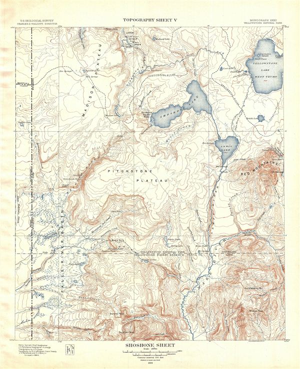
Shoshone Sheet. Topography Sheet V.
sold
- Digital Map Information
- Suitable for large format printing
- File Size: 10.55 MB
- File Type: ZIP / TIFF
- ICC color profile embedded
- Delivered instantly via download link
A fine example of Arnold Hague's 1904 topographical survey map of the spectacular Shoshone Region in Yellowstone National Park, Wyoming. Centered on Pitchstone Plateau, the map covers from Snake ... (more details)
Includes the spectacular Mammoth Hot Spring!
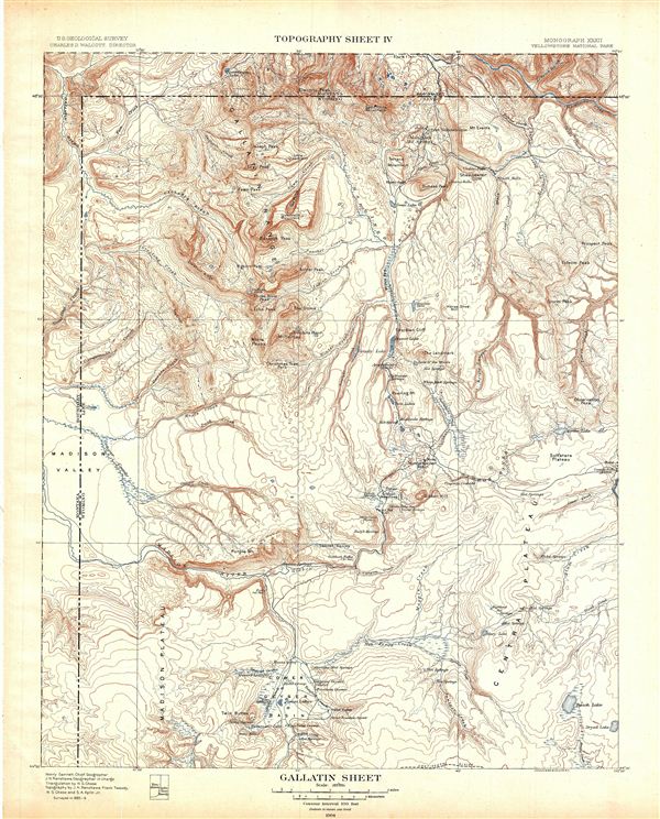
Gallatin Sheet. Topography Sheet IV.
sold
- Digital Map Information
- Suitable for large format printing
- File Size: 12.75 MB
- File Type: ZIP / TIFF
- ICC color profile embedded
- Delivered instantly via download link
A fine example of Arnold Hague's 1904 topographical survey map of the spectacular Gallatin Region in Yellowstone National Park, Wyoming. Centered on the Gallatin Range, the map covers from the ... (more details)
Includes Old Faithful!

Central Posrtion of Upper Geyser Basin. Topography Sheet XXV.
sold
- Digital Map Information
- Suitable for large format printing
- File Size: 16.76 MB
- File Type: ZIP / TIFF
- ICC color profile embedded
- Delivered instantly via download link
A fine example of Arnold Hague's 1904 topographical survey map of the spectacular Upper Geyser Basin in Yellowstone National Park, Wyoming. Focusing on the Firehole River, the map covers from ... (more details)