
Survey of Egypt (c. 1898 - 1952)

Survey of Egypt (c. 1898 - present; مصلحة المساحة المصرية) was the official surveying body of the Egyptian government from the turn of the 20th century until the founding of the Republic of Egypt. As Egypt was a British Protectorate for most of this period, the survey closely resembled government survey operations in other British colonies and protectorates. However, unlike many other surveys, the Survey of Egypt did not continue under its colonial name in the postcolonial period. Instead, in the independence era, the former Survey became known as the Egyptian General Survey Authority (الهيئة المصرية العامة للمساحة), from 1971 has been affiliated with the Ministry of Irrigation (وزارة الري).
AKA: c. 1898 - 1952
Constructing Modern Cairo.
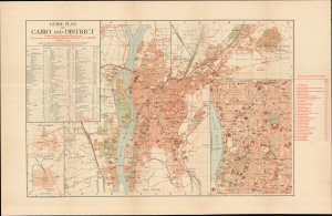
Guide Plan of Cairo and District Prepared by the Survey of Egypt for the Xth. Congress of the International Society of Surgery.
$450.00
Acquire
- Digital Map Information
- Suitable for large format printing
- File Size: 880.72 MB
- File Type: ZIP / TIFF
- ICC color profile embedded
- Delivered instantly via download link
A scarce 1935 Survey of Egypt city map of Cairo under the British Protectorate, here produced for an international conference of surgeons. It displays the city undergoing a tremendous revitalization when new infrastructure, planned communities, and public institutions remade the cityscape. (more details)
Bride of the Red Sea.
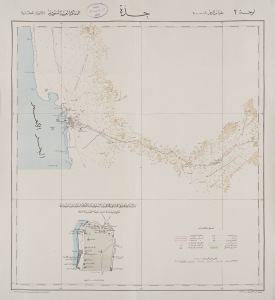
جدّة المملكة العربية السعودية (الأقطار الحجازية) / [Jeddah The Kingdom of Saudi Arabia (Hijaz Region)].
$3,000.00
Acquire
- Digital Map Information
- Suitable for large format printing
- File Size: 64.01 MB
- File Type: ZIP / TIFF
- ICC color profile embedded
- Delivered instantly via download link
This is a scarce 1945 Arabic-language Survey of Egypt map of Jeddah (Jiddah), Saudi Arabia, the great transit point for Hajj pilgrims. It depicts the city at a time when it, like several other key Saudi cities, was being reshaped through profits from the Kingdom's abundant oil reserves. (more details)
Formation of the Arab League.
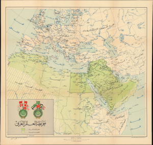
خَرِيطَة العَالَم العَرَبِيّ / [Map of the Arab World].
$800.00
Acquire
- Digital Map Information
- Suitable for large format printing
- Full resolution TIFF file
- ICC color profile embedded
- Delivered instantly via download link
This is a 1945 Arabic-language persuasive map of the Arab World published by the Survey of Egypt. It was created to celebrate the formation of the League of Arab States (Arab League) on March 22, 1945. A key event in the history of Pan-Arabism, the Arab League was closely connected to worsening violence in Palestine. Though historically significant as a forum for representatives from all Arab countries, the organization has struggled to unify Arab States over the decades amid mistrust, ideological differences, and narrow national interests. (more details)
Modernizing Madinah
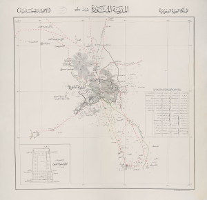
المدينة المنورة، مقياس / [al-Madinah al-Munawwarah].
$4,000.00
Acquire
- Digital Map Information
- Suitable for large format printing
- File Size: 62.26 MB
- File Type: ZIP / TIFF
- ICC color profile embedded
- Delivered instantly via download link
This is a scarce 1946 Survey of Egypt map of the Islamic holy city of Medina (or Madinah), in the Hejaz, Saudi Arabia. The map illustrates the Saudi drive to modernize the infrastructure and access of Islam's second-holiest city. (more details)
Grandiose Scheme to tame the Nile.
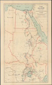
...خَرِيطَة حَوْضِ النِّيل / [Map of the Nile Basin…]. / مصلحة المساحة ١٩٤٩ (٣٤٢ / ٤٩) ١٩٤٩ (٤٦٠ / ٤٩) / [Survey Department 1949 (342/49) 1949 (460/49)].
$950.00
Acquire
- Digital Map Information
- Suitable for large format printing
- Full resolution TIFF file
- ICC color profile embedded
- Delivered instantly via download link
This 1949 Survey of Egypt hydrological map presents an ambitious vision for harnessing the Nile: Century Storage, as it was known, proposed a coordinated network of reservoirs designed to capture floodwaters in wet years and release them during drought. The grandiose scheme, proposed by British hydrologist Harold Edwin Hurst, promised to transform the Nile's unpredictable flow into a dependable water supply. Decolonization, competing national interests, and Cold War rivalries prevented its full realization, but portions were implemented, and others laid the groundwork for projects that continue to reshape the Nile Basin. (more details)
Saudi Drive for Self-Sufficiency in Agriculture.
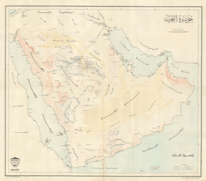
This is a scarce, large-format 1972 Arabic-language map of the Arabian Peninsula produced by the Egyptian General Survey Authority for the recently established King Abdul Aziz Research Center. (more details)