This copy is copyright protected.
Copyright © 2024 Geographicus Rare Antique Maps
1574 Ruscelli Map of Brazil
Brazil-ruscelli-1561-2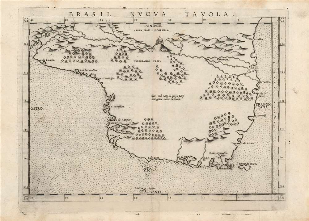
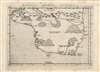

Girolamo Ruscelli (1500 - 1566) was an Italian polymath, humanist, editor, and cartographer active in Venice during the early 16th century. Born in Viterbo, Ruscelli lived in Aquileia, Padua, Rome and Naples before relocating to Venice, where he spent much of his life. Cartographically, Ruscelli is best known for his important revision of Ptolemy's Geographia, which was published posthumously in 1574. Ruscelli, basing his work on Gastaldi's 1548 expansion of Ptolemy, added some 37 new "Ptolemaic" maps to his Italian translation of the Geographia. Ruscelli is also listed as the editor to such important works as Boccaccio's Decameron, Petrarch's verse, Ariosto's Orlando Furioso, and various other works. In addition to his well-known cartographic work many scholars associate Ruscelli with Alexius Pedemontanus, author of the popular De' Secreti del R. D. Alessio Piemontese. This well-known work, or "Book of Secrets" was a compilation of scientific and quasi-scientific medical recipes, household advice, and technical commentary on a range of topics that included metallurgy, alchemy, dyeing, perfume making. Ruscelli, as Alexius, founded a "Academy of Secrets," a group of noblemen and humanists dedicated to unearthing "forbidden" scientific knowledge. This was the first known experimental scientific society and was later imitated by a number of other groups throughout Europe, including the Accademia dei Secreti of Naples. More by this mapmaker...
Giocomo Gastaldi (c. 1500 - October, 1566) was an Italian astronomer, cartographer, and engineer active in the second half of the 16th century. Gastaldi (sometimes referred to as Jacopo or Iacobo) began his career as an engineer, serving the Venetian Republic in that capacity until the fourth decade of the sixteenth century. During this time he traveled extensively, building a large library relating to voyages and exploration. From about 1544 he turned his attention to mapmaking, working extensively with Giovanni Battista Ramusio, Nicolo Bascarini, and Giovanbattista Pedrezano, as well ask taking private commission for, among others, Venice's Council of Ten. He is credited with the fresco maps of Asia and Africa still extent in the map room of the Doge's Palace. Gastaldi was also one of the first cartographers to embrace copper plate over woodblock engraving, marking and important development in the history of cartography. His 1548 edition of Ptolemy's Geographia was the first to be printed in a vernacular; it was the first to be printed in copperplate. As with his Swiss/German contemporary Münster, Gastaldi;'s work contained many maps depicting newly discovered regions for the first time, including the first map to focus on the East Coast of North America, and the first modern map of the Indian Peninsula. His works provided the source for the vast majority of the Venetian and Roman map publishers of the 1560s and 70s, and would continue to provide an outsize influence on the early maps of Ortelius, De Jode, and Mercator. Learn More...
Giulio Sanuto (fl. 1540 – 1580) was a Venetian engraver. He was born the illegitimate son of Cavaliere Francesco di Angelo Sanuto; With his brother, the cartographer and scientific instrument maker Livio Sanuto (1520 – 1576) he produced an array of some of the most important geographical works produced in Venice during the second half of the sixteenth century. These included a 27-inch globe and the 1588 12-sheet atlas, Geografia della Africa. Giulio's career is singluar among Venice's engraves in that it appears to have been equally based on artistic, figurative work as well as his cartographic works. Giulio is more broadly known for a small but sought-after selection of decorative engravings; no more than twelve of these can be attributed confidently to him, including the monumental Apollo and Marsyas, measuring over 1.30 meters wide. Whilst Sanuto's engravings were generally based upon the designs of other artists, his work was both ambitious and grand, and he often signed these works. Learn More...
Copyright © 2024 Geographicus Rare Antique Maps | Geographicus Rare Antique Maps
This copy is copyright protected.
Copyright © 2024 Geographicus Rare Antique Maps