
Ruscelli, Girolamo
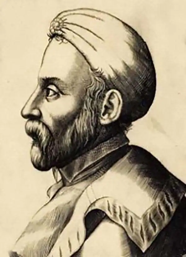
Girolamo Ruscelli (1500 - 1566) was an Italian polymath, humanist, editor, and cartographer active in Venice during the early 16th century. His work as a polygraph - a writer on many subjects, producing, editing, and copying content for the new printing industry - required erudition in a broad array of fields. Born in Viterbo, Ruscelli lived in Aquileia, Padua, Rome, and Naples before relocating to Venice, where he spent much of his life. Cartographically, Ruscelli is best known for his important revision of Ptolemy's Geographia, which he published in 1561, with further editions as late as 1599. Ruscelli's work represented a marked improvement on Gastaldi's 1548 Ptolemy, presenting both the ancient and modern maps in larger, more clearly-engraved examples. His edition also included maps not present in Gastaldi's Ptolemy, including the first double-hemisphere world map to appear in a Geography, the earliest mapping of the British Isles from an English source, and the notorious and influential Zeno map of the North Atlantic. Ruscelli is also listed as the editor of such important works as Boccaccio's Decameron, Petrarch's verse, Ariosto's Orlando Furioso, and various other works. In addition to his well-known cartographic work, many scholars associate Ruscelli with Alexius Pedemontanus, author of the popular De' Secreti del R. D. Alessio Piemontese. This well-known work, or "Book of Secrets," was a compilation of scientific and quasi-scientific medical recipes, household advice, and technical commentary on a range of topics that included metallurgy, alchemy, dyeing, and perfume making. Ruscelli, as Alexius, founded an "Academy of Secrets," a group of noblemen and humanists dedicated to unearthing "forbidden" scientific knowledge. This was the first known experimental scientific society and was later imitated by a number of other groups throughout Europe, including the Accademia dei Secreti of Naples.
Earliest acquirable state of the Zeno map.
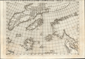
Septentrionalium Partium Nova Tabula.
$1,400.00
Acquire
- Digital Map Information
- Suitable for large format printing
- Full resolution TIFF file
- ICC color profile embedded
- Delivered instantly via download link
This is the most important map of Girolamo Ruscelli's 1561 - 1564 edition Ptolemy: the earliest acquirable iteration of Nicoló Zeno's 1558 Carta Da Navegar De Nicolo et Antonio Zeni Furono In Tramontana Lano MCCCLXXX, revealing the alleged 14th-century voyages of Zeno's ancestors, Nicoló and Antonio. Zeno's fraud, likely intended to enhance his political power in Venice and later embraced to co-opt the 1492 Columbia discovery of America, was responsible for the initial appearance and subsequent tenacity of the apocryphal islands Frisland, Icaria, Drogeo, and the coastline of Estotiland, which was taken by some of Europe's finest geographers to be the coast of Labrador. (more details)
One of the Earliest Modern Maps of the Holy Land and Cyprus.
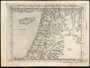
Soria et Terra Santa Nuova Tavola.
$650.00
Acquire
- Digital Map Information
- Suitable for large format printing
- Full resolution TIFF file
- ICC color profile embedded
- Delivered instantly via download link
This is a handsome example of Girolamo Ruscelli's 1561 / 1574 map of the Holy Land and Cyprus. It is an enlarged, more finely-engraved iteration of Giocomo Gastaldi's 1548 Soria e Terra Sancta nova tabula. While Tibbetts avers that the Ruscelli contains fewer place names than its Gastaldi source, he is incorrect: Ruscelli's map preserves all the data of the Gastaldi, but between the increased size of the plate and the clear, legible, and well-spaced engraving of the newer map, its data is presented without the crowding evident on the 1548 map. The skill evident in this work can be credited to the engraver Giulio Sanuto, one of the few Venetian engravers whose career was not isolated either to map engraving or to figurative artistic works, but consisted of both over a career of more than forty years. (more details)
One of the earliest Acquirable Post-Magellan Maps of Southeast Asia.
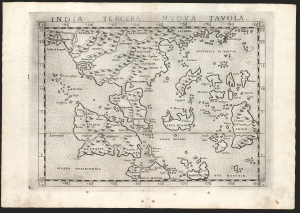
India Tercera Nuova Tavola.
$450.00
Acquire
- Digital Map Information
- Suitable for large format printing
- Full resolution TIFF file
- ICC color profile embedded
- Delivered instantly via download link
This is Girolamo Ruscelli's 1561 / 1574 map of the East Indies and Southeast Asia, considered to be among the earliest maps of Southeast Asia. Although based on Giacomo Gastaldi's 1548 map of the same title, it is roughly twice the size and better engraved. (more details)
One of the Earliest Double-Hemisphere World Maps, Updated.
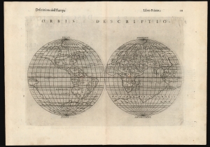
Orbis Descriptio.
$1,400.00
Acquire
- Digital Map Information
- Suitable for large format printing
- Full resolution TIFF file
- ICC color profile embedded
- Delivered instantly via download link
This is a 1598 second-state issue of Girolamo Ruscelli's 1561 map of the world. In its first 1561 state, this is the earliest acquirable double-hemisphere world map, but even this later issue remains one of the earliest acquirable maps to use this format. (more details)
One of the Earliest Modern Maps of Egypt.
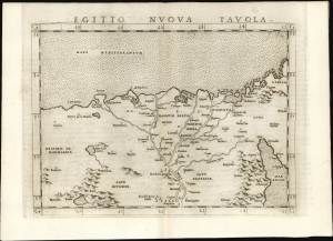
Egitto Nuova Tavola.
$325.00
Acquire
- Digital Map Information
- Suitable for large format printing
- Full resolution TIFF file
- ICC color profile embedded
- Delivered instantly via download link
This is Girolamo Ruscelli's 1561 map of Egypt. It is the second modern map of the Lower Nile, predated only by the 1548 Gastaldi map, upon which it is based. It is among the earliest acquirable maps to show the Nile Delta with contemporaneous information; it is also one of the first printed maps to depict the Egyptian Pyramids. (more details)
One of the Earliest Modern Maps of Italy.
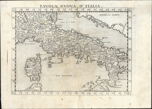
Tavola Nuova d' Italia.
$500.00
Acquire
- Digital Map Information
- Suitable for large format printing
- Full resolution TIFF file
- ICC color profile embedded
- Delivered instantly via download link
An influential 1561 map of Italy by Girolamo Ruscelli, based upon Giacomo Gastaldi's groundbreaking cartography and representing one of the defining maps of Renaissance Italy. Engraved by Giulio Sanuto for Ruscelli's edition of Ptolemy, the map greatly enlarged and refined Gastaldi's seminal 1548 map. From the Alps and Venice to Sicily, it presents Italy with a wealth of cities, mountains, rivers, and coastal detail, enlivened by a dramatically erupting Mount Etna and a miniature view of Venice. Gastaldi's geography, disseminated through Ruscelli's widely read atlas, remained the dominant cartographic representation of Italy until Giovanni Antonio Magini's 1608 map. (more details)
Among the Earliest Acquirable Contemporary Maps of Russia.
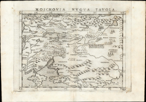
Moschovia Nuova Tavola.
$750.00
Acquire
- Digital Map Information
- Suitable for large format printing
- Full resolution TIFF file
- ICC color profile embedded
- Delivered instantly via download link
This is the 1561 first Ruscelli edition of Giacomo Gastaldi's map of Muscovy, one of the earliest acquirable modern maps of Russia. It is among the earliest obtainable maps to include Paolo Giovio's geography from the Muscovite Embassy. (more details)
Among the Earliest Acquirable Contemporary Maps of the Baltic Coast.
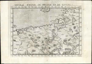
Tavola nuova di Prussia et di Livonia.
$650.00
Acquire
- Digital Map Information
- Suitable for large format printing
- Full resolution TIFF file
- ICC color profile embedded
- Delivered instantly via download link
This is the 1561 first Ruscelli edition of Giacomo Gastaldi's map of the Baltic Coast of Prussia and Livonia, now the coastline of Poland, Lithuania, Latvia, and Estonia. It is among the earliest detailed maps of this part of the world based on contemporary geographical knowledge, particularly with respect to the Gulf of Riga. (more details)
One of the Earliest Maps of Scandinavia, Greenland and Ultima Thule.
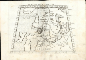
Schonlandia Nuova.
$1,000.00
Acquire
- Digital Map Information
- Suitable for large format printing
- Full resolution TIFF file
- ICC color profile embedded
- Delivered instantly via download link
This is a handsome example of Girolamo Ruscelli's 1561 map of Scandinavia, after Gastaldi. It is among the earliest generally acquirable modern maps of the northern parts of the world, capturing a period when geographers were struggling to integrate new geographical information with heretofore authoritative classical knowledge. Ruscelli's map is an expanded, more clearly-engraved and legible iteration of Gastaldi's 1548 Schonlandia Nova. (more details)
Roman-Era Egypt, as drafted by a Native Son.
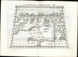
Tabula Africae III.
$600.00
Acquire
- Digital Map Information
- Suitable for large format printing
- Full resolution TIFF file
- ICC color profile embedded
- Delivered instantly via download link
This is a handsome example, in its first edition, of Girolamo Ruscelli's 1561 map of Libya and Egypt, extending to the Red Sea, based on the 2nd-century knowledge of Claudius Ptolemy. It represents the first mapping of the region based on information from someone who lived there. (more details)
First Edition of the Earliest Acquirable Englishman's Map of the British Isles.
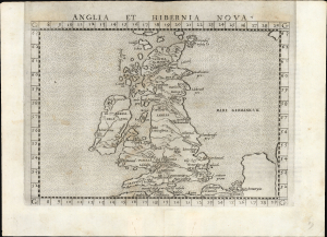
Anglia et Hibernia Nova.
$750.00
Acquire
- Digital Map Information
- Suitable for large format printing
- Full resolution TIFF file
- ICC color profile embedded
- Delivered instantly via download link
This is a handsome example of Girolamo Ruscelli's 1561 map of the British Isles. Of the maps prepared for Ruscelli's Ptolemy, it is among the most important: while most were larger, superior copies of the maps appearing in the 1548 Gastaldi Ptolemy, this map was a unique, updated work based on an English source, George Lily. (more details)
One of the First Acquirable Maps Specifically of Cuba.
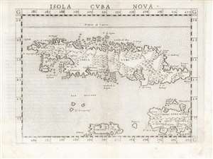
Isola Cuba Nova
$750.00
Acquire
- Digital Map Information
- Suitable for large format printing
- DPI: 600
- File Size: 12.43 MB
- File Type: ZIP / TIFF
- ICC color profile embedded
- Delivered instantly via download link
This is the first state of Girolamo Ruscelli's 1561 map of Cuba, Jamaica, the Cayman Islands, and the western part of Hispaniola. It is among the earliest detailed maps of these islands, and is the fourth printed map specifically of Cuba. (more details)
Northeastern Europe as Known to the Ancients.
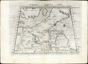
Europa Tabula VIII.
$350.00
Acquire
- Digital Map Information
- Suitable for large format printing
- Full resolution TIFF file
- ICC color profile embedded
- Delivered instantly via download link
This is the 1561 first Ruscelli edition of Ptolemy's map of the lands in Europe occupied in the 1st and 2nd centuries CE by the Sarmatians, a large Iranian confederation who, during the classical era, were pressing from the steppes north of the Black Sea into what would become Russia, Ukraine, Poland, and Hungary. (more details)
One of the First Acquirable Maps Specifically of Hispaniola.
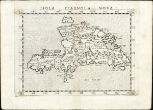
Isola Spagnola Nova.
$550.00
Acquire
- Digital Map Information
- Suitable for large format printing
- Full resolution TIFF file
- ICC color profile embedded
- Delivered instantly via download link
This is the first state of Girolamo Ruscelli's 1561 map of Hispaniola, comprising modern-day Haiti and the Dominican Republic. It is among the earliest detailed maps of the island and is the fourth printed map specifically of it. (more details)
Early Glimpses of Mexico, California and the Gulf Coast.
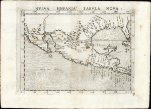
Nueva Hispania Tabula Nova.
$1,250.00
Acquire
- Digital Map Information
- Suitable for large format printing
- Full resolution TIFF file
- ICC color profile embedded
- Delivered instantly via download link
This is Girolamo Ruscelli's 1561 Nueva Hispania Tabula Nova, an early and influential map of what would become Mexico, California, Texas, and Florida. Ruscelli's work is an enlarged and improved version of the 1548 map of the same region by fellow Venetian Giacomo Gastaldi. Apart from the Gastaldi, Ruscelli's map is the earliest to focus so closely on the southern parts of what would become the United States and is one of the earliest acquirable maps to reflect Spanish exploration and colonization in the Americas. Overall, along with the map covering the East Coast north of Florida, this is among the earliest maps to focus on North America. (more details)
One of the First Acquirable Maps of the North American East Coast in its earliest issue.
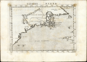
Tierra Nueva.
$2,250.00
Acquire
- Digital Map Information
- Suitable for large format printing
- Full resolution TIFF file
- ICC color profile embedded
- Delivered instantly via download link
This is the first state, first edition, of Girolamo Ruscelli's 1561 map 'Tierra Nueva', an early and influential map of what would become New England and the Canadian Maritime Provinces. It is among the earliest acquirable maps to cover the eastern coastline of North America. The map spans from upper Florida northwards past Cabo de Santa Maria to Larcadia (Kitty Hawk), Angoulesme (New York Harbor), Nova Scotia, and Labrador. The map is a further development of the 1548 Gastaldi map of the same region. While the Gastaldi was limited entirely to the coastline, Ruscelli's map attempted to show a network of rivers and is among the first regional maps to show mountains in the interior of North America. (more details)
Among the earliest detailed maps of the coast of Sub-Saharan Africa.
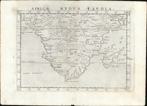
Africa Nuova Tavola.
$500.00
Acquire
- Digital Map Information
- Suitable for large format printing
- Full resolution TIFF file
- ICC color profile embedded
- Delivered instantly via download link
This is Girolamo Ruscelli's 1561 map of southern Africa, an enlarged and improved version of the 1548 map of fellow Venetian Giacomo Gastaldi. It is among the earliest detailed maps of the coast of Sub-Saharan Africa; while Münster's 1540 map presented an image of the whole continent, it lacked significant coastal detail. This map, like its Gastaldi model, is among the earliest obtainable maps to include details of both the African coastline and its river systems. (more details)
One of the Earliest Depictions of Discovery-Era India.
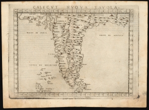
Calecut Nuova Tavola.
$400.00
Acquire
- Digital Map Information
- Suitable for large format printing
- Full resolution TIFF file
- ICC color profile embedded
- Delivered instantly via download link
This is Girolamo Ruscelli's 1561 / 1574 map of India. It is among the earliest printed, modern maps of India - most earlier maps being iterations of Claudius Ptolemy's geographical information of the 2nd century. (more details)
Venice Discovers America! Maybe not.
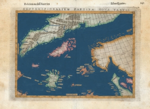
Septenirionalium Partium Nova Tabula.
$500.00
Acquire
- Digital Map Information
- Suitable for large format printing
- DPI: 600
- File Size: 9.93 MB
- File Type: ZIP / TIFF
- ICC color profile embedded
- Delivered instantly via download link
This is Girolamo Ruscelli's 1599 edition of the 1558 Carta Da Navegar De Nicolo et Antonio Zeni Furono In Tramontana Lano MCCCLXXX by Nicoló Zeno the Younger, revealing the alleged 14th-century voyages of his ancestors, Nicoló and Antonio Zeno. The fraud, seen largely as an attempt to co-opt the 1492 Columbia discovery of America, is responsible for the tenacious mapping of the apocryphal islands Frisland, Icaria, and Drogeo, and the coastline of Estotiland, which was taken to be the coast of Labrador. (more details)
First Specific Copperplate Map of Brazil.
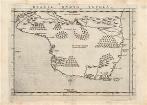
Brasil Nuova Tavola.
$650.00
Acquire
- Digital Map Information
- Suitable for large format printing
- Full resolution TIFF file
- ICC color profile embedded
- Delivered instantly via download link
This is a bold, sharp strike of Girolamo Ruscelli's 1561 map of Brazil. It is among the first detailed specific maps of any part of South America. While most of the maps in Ruscelli's edition of Ptolemy were based on those appearing in Gastaldi's 1548 Ptolemy, this map was a new composition. It is predated only by the Ramusio woodcut map of 1556, whose geography is also credited to Gastaldi, and from which much of the detail of the Ruscelli is derived. (more details)
One of the Earliest Maps of the North American East Coast.
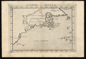
Tierra Nueva.
$1,600.00
Acquire
- Digital Map Information
- Suitable for large format printing
- Full resolution TIFF file
- ICC color profile embedded
- Delivered instantly via download link
This is Girolamo Ruscelli's 1574 map Tierra Nueva, one of the earliest maps to focus on the North American East Coast and the Canadian Maritime Provinces. (more details)
An Early Map of Western Africa.
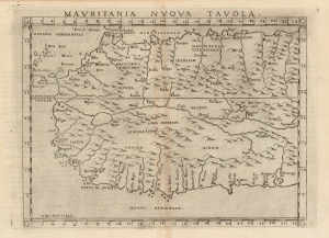
Mauritania Nuova Tavola.
$400.00
Acquire
- Digital Map Information
- Suitable for large format printing
- Full resolution TIFF file
- ICC color profile embedded
- Delivered instantly via download link
This is Girolamo Ruscelli's 1574 map of western Africa, here termed 'Mauritania' but extending south to include northwestern Africa from Gibraltar in the north to the Guinea coast in the south. The map spans from the Canary Islands in the west, eastwards to modern Tunisia and Nigeria. Ruscelli's work is an enlarged and improved version of the 1548 map of fellow Venetian Giacomo Gastaldi. (more details)
One of the First Modern Maps of Poland and Hungary.
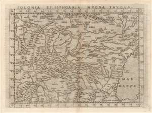
Polonia Et Hungaria Nuova Tavola.
$450.00
Acquire
- Digital Map Information
- Suitable for large format printing
- DPI: 600
- File Size: 11.36 MB
- File Type: ZIP / TIFF
- ICC color profile embedded
- Delivered instantly via download link
This is an attractive example of Girolamo Ruscelli's 1574 modern map of Poland and Hungary. An enlarged version of Giacomo Gastaldi's 1548 map representing what was the state-of-the-art of the mapping of Europe from the Danube to Lithuania, the map depicts as far east as the Black Sea (here named Mar Mazor. Gastaldi's map was a detailed copperplate improvement on Münster's 1540 woodcut map, and would not be improved upon significantly until Ortelius. (more details)
Rare, Venetian Imprint.
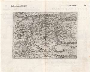
Di Hungaria et Transilvania Tavola novissima Franco for.
$600.00
Acquire
- Digital Map Information
- Suitable for large format printing
- DPI: 600
- File Size: 14.88 MB
- File Type: ZIP / TIFF
- ICC color profile embedded
- Delivered instantly via download link
This is a rare 1597 map of Hungary and Transylvania by the Venetian mapmaker Giacomo Franco. The map is credited as the work of Bernardino Valle, that draftsman's sole known work. It is derived from the cartography of János Zsámboky, probably via the intermediary of Abraham Ortelius. (more details)