1929 Poole Brothers Map of Alaska and Alaska Steamship Company Routes
AlaskaSteamship-poolebros-1929$450.00

Title
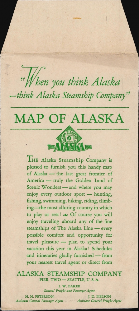
When You Think Alaska - Think Alaska Steamship Co.
1929 (dated) 21.75 x 30.75 in (55.245 x 78.105 cm) 1 : 4500000
1929 (dated) 21.75 x 30.75 in (55.245 x 78.105 cm) 1 : 4500000
Description
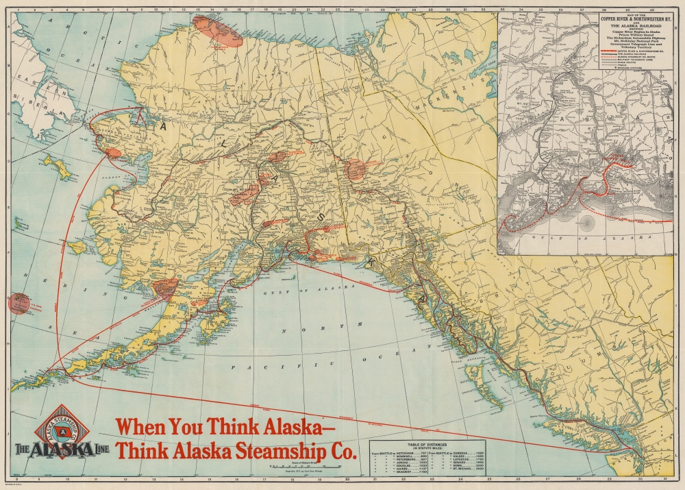
This is a 1929 Poole Brothers map of Alaska promoting the Alaska Steamship Company and their routes from the northernmost Alaska to Seattle, Washington. The map highlights American enthusiasm over the mineral wealth and natural resources of Alaska and the Yukon.
Go to Alaska and Make a Fortune
The Klondike, Fairbanks, and Nome gold placers are highlighted, as well as the Nenana, Matanuska, and Bering River coal fields. Other highlighted resources include the Point Barrow Oil Field, along with a handful of other oil fields, and the Kennecott copper mines. Mt. McKinley National Park and the U.S. Seal Preserve around the Pribilof Islands are identified using the same symbol, allowing for no distinction in importance between preservation of natural landscapes and the exploitation of natural resources.How to Get There
The two major routes of the Alaska Steamship Company are illustrated in red, the Inside Route (which ventured up the Pacific coast to Skagway, Valdez, and Seward) and the Nome and St. Michael route. The Copper River and Northwestern Railroad and the Alaska Railroad are depicted both on the central map and via an inset. The inset map details the route of the Copper River and Northwestern from Seward to Fairbanks and the Alaska from Cordova to Kennecott. The inset map also notes the military telegraph lines, stage routes, and wireless stations. A table of distances from Seattle to thirteen locations in Alaska is included along the bottom border.Publication History and Census
This map was created and published by the Poole Brothers Company of Chicago to promote the Alaska Steamship Company. The first edition was published in 1917, with the present edition being dated December 2, 1929.Cartographer
Poole Brothers (1878 - 1968) were a Chicago based firm active in the late 19th and early 20th century with an initial focus on promotional railroad maps. Poole Brothers was founded by George Amos Poole (March 20, 1843 – September 7, 1918). In 1868, Poole, along with his uncle William H. Rand (1828 - 1915) and Andrew McNally (1836 - 1904), purchased the Chicago Tribune's job printing plant and formed the firm Rand McNally. In 1878, he left Rand McNally to form, with his brother William H. Poole, Poole Brothers, a direct competitor to Rand McNally for the lucrative railroad business. Like many of its competitors, Poole Brothers maintained an office on Chicago's Printer's Row (downtown Loop district). Their earliest known work is an 1880 map of Yellowstone National Park. In 1887, Poole Brothers, Andrew McNally, and several others formed the United Typothetae of America, a master printers association. In 1848, they were cited, along with Rand McNally and George Cram, by the Federal Trade Commission for price fixing. Their earliest known work is an 1880 map of Yellowstone National Park. Afterward they went on to produce a vast range of maps and other print products including tickets, cards, coupons, and restaurant menus. In time Poole Brothers merged with Newman-Randolph, which was then acquired by the American Can Company in the early 1960s. The American Can Company liquidated its printing concerns later in the same decade. More by this mapmaker...
Condition
Very good. Light wear along original fold lines.
References
OCLC 21111531.