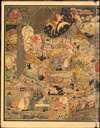
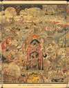
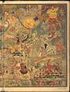
Digital Image: 1923 Luxor Price Panoramic View Map of Mother Goose Land
AllMotherGoosePanorama-luxorprice-1923_d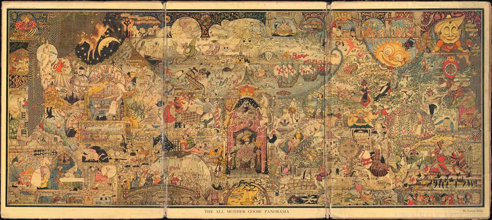

Title
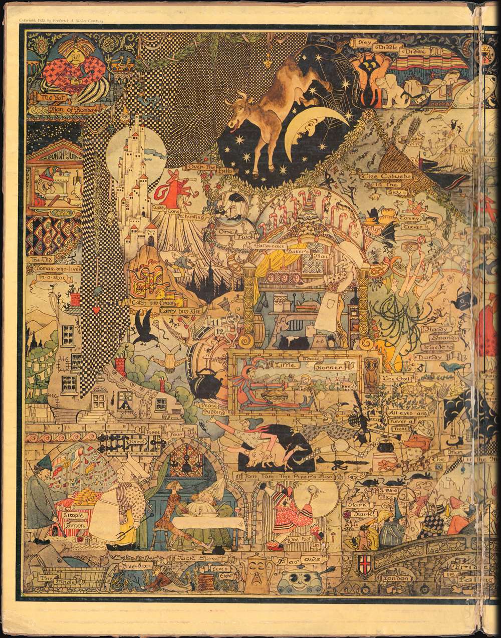
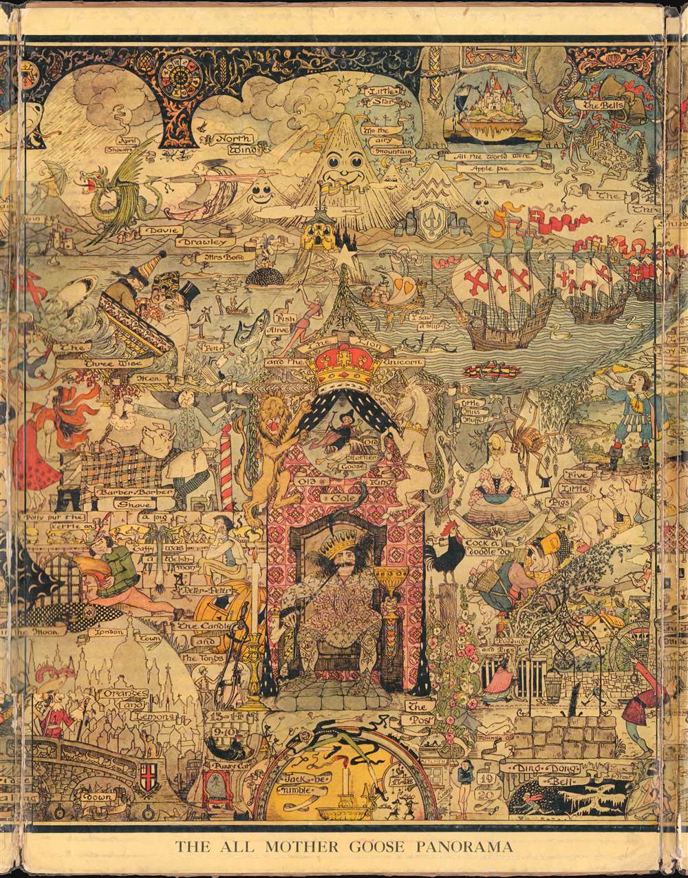
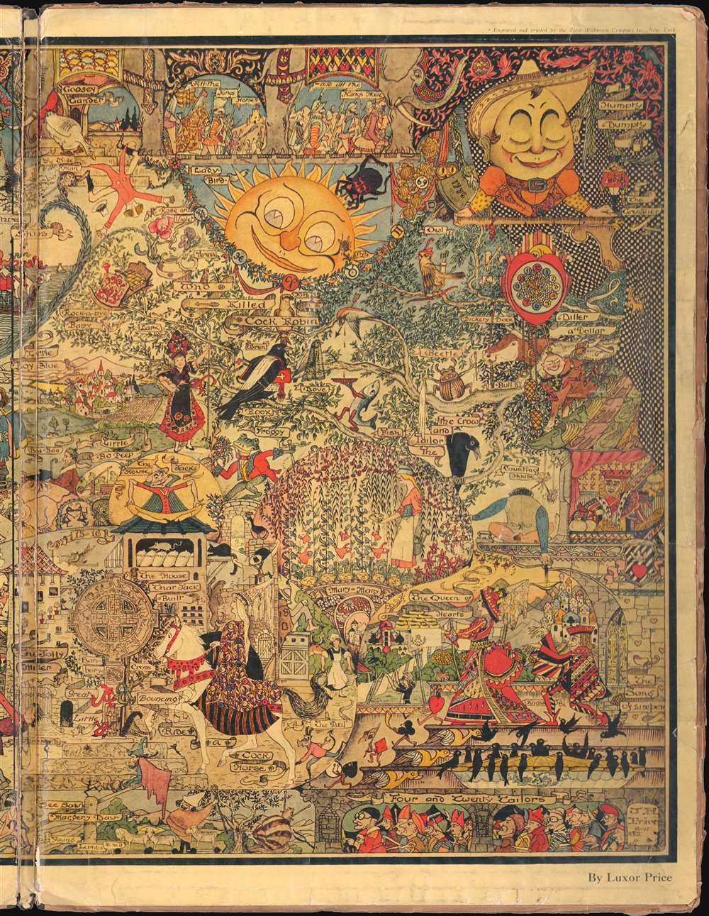
All Mother Goose Panorama.
1923 (dated) 20.5 x 45.75 in (52.07 x 116.205 cm)
1923 (dated) 20.5 x 45.75 in (52.07 x 116.205 cm)
Description
FOR THE ORIGINAL ANTIQUE MAP, WITH HISTORICAL ANALYSIS, CLICK HERE.
Digital Map Information
Geographicus maintains an archive of high-resolution rare map scans. We scan our maps at 300 DPI or higher, with newer images being 600 DPI, (either TIFF or JPEG, depending on when the scan was done) which is most cases in suitable for enlargement and printing.
Delivery
Once you purchase our digital scan service, you will receive a download link via email - usually within seconds. Digital orders are delivered as ZIP files, an industry standard file compression protocol that any computer should be able to unpack. Some of our files are very large, and can take some time to download. Most files are saved into your computer's 'Downloads' folder. All delivery is electronic. No physical product is shipped.
Credit and Scope of Use
You can use your digial image any way you want! Our digital images are unrestricted by copyright and can be used, modified, and published freely. The textual description that accompanies the original antique map is not included in the sale of digital images and remains protected by copyright. That said, we put significant care and effort into scanning and editing these maps, and we’d appreciate a credit when possible. Should you wish to credit us, please use the following credit line:
Courtesy of Geographicus Rare Antique Maps (https://www.geographicus.com).
How Large Can I Print?
In general, at 300 DPI, you should at least be able to double the size of the actual image, more so with our 600 DPI images. So, if the original was 10 x 12 inches, you can print at 20 x 24 inches, without quality loss. If your display requirements can accommodate some loss in image quality, you can make it even larger. That being said, no quality of scan will allow you to blow up at 10 x 12 inch map to wall size without significant quality loss. For more information, it is best consult a printer or reprographics specialist.
Refunds
If the high resolution image you ordered is unavailable, we will fully refund your purchase. Otherwise, digital images scans are a service, not a tangible product, and cannot be returned or refunded once the download link is used.
Cartographer
John Penry Hyde 'Luxor' Price (June 15, 1874 - February 23, 1950), publishing under the pseudonym Luxor Price, was an American illustrator and children's book author active in the early 20th century. Price was born in Cardiff, Wales of the lesser gentry (his father was an architect) and educated at Christ’s College, Brecon. He emigrated to the United States in 1893. After traveling throughout the country, he settled in Clinton Corners, New York, with his wife Gladys C. Powell Price, also from Cardiff. From about 1899 Price worked as a personal secretary to James Gregory McLoughlin (180 - 1918), a railroad official, but also heir to the McLoughlin Brothers publishing empire - noted for their work with children's books. It is not clear how Price came to be associated with McLoughlin, but they may have been connected through family friend. Price was a self-trained artist. His first printed work began appearing in magazines in the 1920s. It was around this time that he issued the 'All Mother Goose Panorama', a piece that earned him the attention of children's book publishers and authors. Price issued various fantasy maps, many inspired by European serio-comic maps, through Arden Galleries, and others. He also illustrated The Magic Map for Mary Graham Bonner. He also issued his own work, including a popular book called The Quoks starting 'funny little people' that he invented for his son, Peter. Price did not issue any further children's works after 1933. He died in upstate New York in 1950. More by this mapmaker...