Digital Image: 1805 Harris Map of the Allegheny, Monongahela, and Yohiogany Rivers
AlleghanyMonongahela-harris-1805_d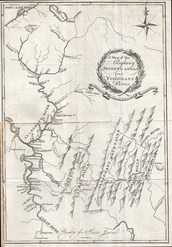

Title
A Map of the Alleghany Monongahela and Yohiogany Rivers.
1805 (undated) 13 x 9 in (33.02 x 22.86 cm) 1 : 1031000
1805 (undated) 13 x 9 in (33.02 x 22.86 cm) 1 : 1031000
Description
FOR THE ORIGINAL ANTIQUE MAP, WITH HISTORICAL ANALYSIS, CLICK HERE.
Digital Map Information
Geographicus maintains an archive of high-resolution rare map scans. We scan our maps at 300 DPI or higher, with newer images being 600 DPI, (either TIFF or JPEG, depending on when the scan was done) which is most cases in suitable for enlargement and printing.
Delivery
Once you purchase our digital scan service, you will receive a download link via email - usually within seconds. Digital orders are delivered as ZIP files, an industry standard file compression protocol that any computer should be able to unpack. Some of our files are very large, and can take some time to download. Most files are saved into your computer's 'Downloads' folder. All delivery is electronic. No physical product is shipped.
Credit and Scope of Use
You can use your digial image any way you want! Our digital images are unrestricted by copyright and can be used, modified, and published freely. The textual description that accompanies the original antique map is not included in the sale of digital images and remains protected by copyright. That said, we put significant care and effort into scanning and editing these maps, and we’d appreciate a credit when possible. Should you wish to credit us, please use the following credit line:
Courtesy of Geographicus Rare Antique Maps (https://www.geographicus.com).
How Large Can I Print?
In general, at 300 DPI, you should at least be able to double the size of the actual image, more so with our 600 DPI images. So, if the original was 10 x 12 inches, you can print at 20 x 24 inches, without quality loss. If your display requirements can accommodate some loss in image quality, you can make it even larger. That being said, no quality of scan will allow you to blow up at 10 x 12 inch map to wall size without significant quality loss. For more information, it is best consult a printer or reprographics specialist.
Refunds
If the high resolution image you ordered is unavailable, we will fully refund your purchase. Otherwise, digital images scans are a service, not a tangible product, and cannot be returned or refunded once the download link is used.
Cartographer
Thaddeus Mason Harris (July 7, 1768 - April 3, 1842) was a Harvard librarian, Unitarian minister and author. He was born in Charlestown, Massachusetts. After his father’s death while fighting on the colonial side in the American Revolutionary War, Harris was sent to live on a farm in Sterling, Massachusetts. Harris studied at Harvard University and graduated in 1787. Following his graduation, Harris spent a year as a school teacher in Worcester, Massachusetts, after which he was offered an appointment as secretary to George Washington. Unfortunately he contracted small-pox, and his lengthly recovery prevented him from taking the post. In 1791, Harris became the librarian at Harvard and was appointed as the minister of the First Unitarian Church on Meeting House Hill in Dorchester, Massachusetts, in 1793. In 1806, he was elected as a Fellow of the American Academy of Arts and Sciences and was also a founding member of the American Antiquarian Society in 1812. He served as corresponding secretary for the Antiquarian Society from 1812-1831, and as secretary of foreign correspondence from 1831-1832. More by this mapmaker...
Source
Harris, T.M., The Journal of a Tour into the Territory Northwest of the Alleghany Mountains; Made in the Spring of the Year 1803. With a Geographical and Historical Account of the State of Ohio., (Boston: Manning and Loring) 1805.
The Journal of a Tour into the Territory Northwest of the Alleghany Mountains; Made in the Spring of the Year 1803. With a Geographical and Historical Account of the State of Ohio. by Thaddeus Mason Harris, published in 1805, presents a history of Harris’s journey to Marietta, Ohio. The first section of the book consists of Harris’s journal, which is divided into two sections: the trip to Marietta, and the return trip to Boston. The second section, entitled, ‘Geographical and Historical Account of the State of Ohio’, was compiled by Harris. It includes a discussion of the state’s boundaries, its climate, minerals, rivers, fish, counties and towns, exports, antiquities, ‘curiosities’, government and history. In the chapter discussing Ohio’s history, a lengthy discussion of the Ohio Company is included. The final section is an appendix, which includes information about navigating the Ohio River and reprinted versions of a number of documents concerning the early history of Ohio, including the 1785 Land Ordinance, the contract between the Ohio Company and the U.S. Government for the sale of millions of acres of land (1787), the Northwest Ordinance (1787), the Congressional act enabling the establishment of Ohio (1802) and the Ohio Constitution (1802).