Digital Image: 1876 Seelstrang / Tourmente Communications and Transportation Map of Argentina
Argentina-seelstrang-1876_d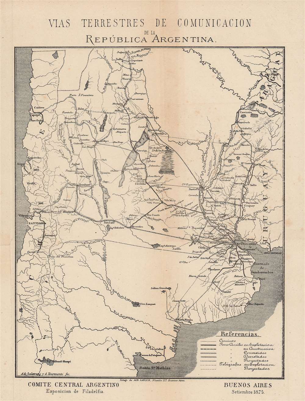

Title
Vias terrestres de Comunicacion de la República Argentina.
1876 (undated) 9.75 x 8 in (24.765 x 20.32 cm) 1 : 8000000
1876 (undated) 9.75 x 8 in (24.765 x 20.32 cm) 1 : 8000000
Description
FOR THE ORIGINAL ANTIQUE MAP, WITH HISTORICAL ANALYSIS, CLICK HERE.
Digital Map Information
Geographicus maintains an archive of high-resolution rare map scans. We scan our maps at 300 DPI or higher, with newer images being 600 DPI, (either TIFF or JPEG, depending on when the scan was done) which is most cases in suitable for enlargement and printing.
Delivery
Once you purchase our digital scan service, you will receive a download link via email - usually within seconds. Digital orders are delivered as ZIP files, an industry standard file compression protocol that any computer should be able to unpack. Some of our files are very large, and can take some time to download. Most files are saved into your computer's 'Downloads' folder. All delivery is electronic. No physical product is shipped.
Credit and Scope of Use
You can use your digial image any way you want! Our digital images are unrestricted by copyright and can be used, modified, and published freely. The textual description that accompanies the original antique map is not included in the sale of digital images and remains protected by copyright. That said, we put significant care and effort into scanning and editing these maps, and we’d appreciate a credit when possible. Should you wish to credit us, please use the following credit line:
Courtesy of Geographicus Rare Antique Maps (https://www.geographicus.com).
How Large Can I Print?
In general, at 300 DPI, you should at least be able to double the size of the actual image, more so with our 600 DPI images. So, if the original was 10 x 12 inches, you can print at 20 x 24 inches, without quality loss. If your display requirements can accommodate some loss in image quality, you can make it even larger. That being said, no quality of scan will allow you to blow up at 10 x 12 inch map to wall size without significant quality loss. For more information, it is best consult a printer or reprographics specialist.
Refunds
If the high resolution image you ordered is unavailable, we will fully refund your purchase. Otherwise, digital images scans are a service, not a tangible product, and cannot be returned or refunded once the download link is used.
Cartographer S
Arturo Seelstrang (May 1838 – November 30, 1896), sometimes as 'de Seelstrang' or 'von Seelstrang,' was a Prussian-born Argentinian mathematician, cartographer, and geographer. He arrived in Argentina in 1863 and spent the first part of his career conducting topographical surveys for different railway companies. Due to his accomplishments in exploring and surveying, he was invited to serve as a Professor of Topography and later a Dean of the Faculty of Physical-Mathematical Sciences of the National University of Córdoba. In 1880, Seelstrang was appointed a member of the National Academy of Sciences (Academia Nacional de Ciencias) and two years later he joined as a member of the Board of Directors. He was also a member of the Argentine Geographical Institute (Instituto Geográfico Argentino). Among his most important contributions were the Atlas of the Argentine Republic (Atlas de la República Argentina) and the 'Hypsometric map of the Argentine Republic' ('Mapa hipsométrico de la República Argentina'). More by this mapmaker...
Alberto Larsch (fl. c. 1875 – 1895) was a map printer active in Buenos Aires in the late 19th century who often lithographed maps by the prominent topographer and geographer Arturo Seelstrang. Learn More...
Source
Napp, R., Die Argentinische Republik, im Auftrag des Argentin-Central Comité's für die Philadelphia-Ausstellung, (Buenos Aires: Sociedad anonima) 1876.
References
OCLC 556399022.