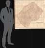
1911 British War Office Map of Lesotho as British Basutoland
Basutoland-waroffice-1911$1,500.00

Title
Basutoland.
1911 (dated) 42 x 42 in (106.68 x 106.68 cm) 1 : 250000
1911 (dated) 42 x 42 in (106.68 x 106.68 cm) 1 : 250000
Description
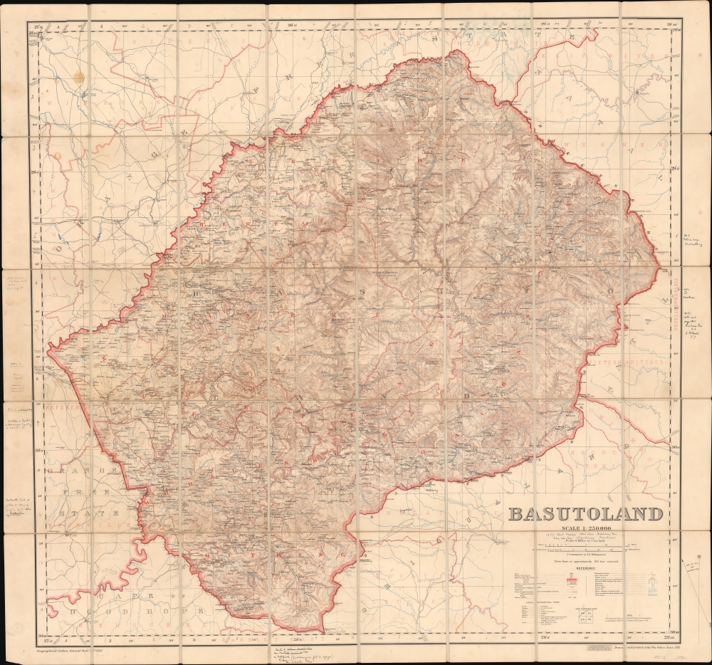
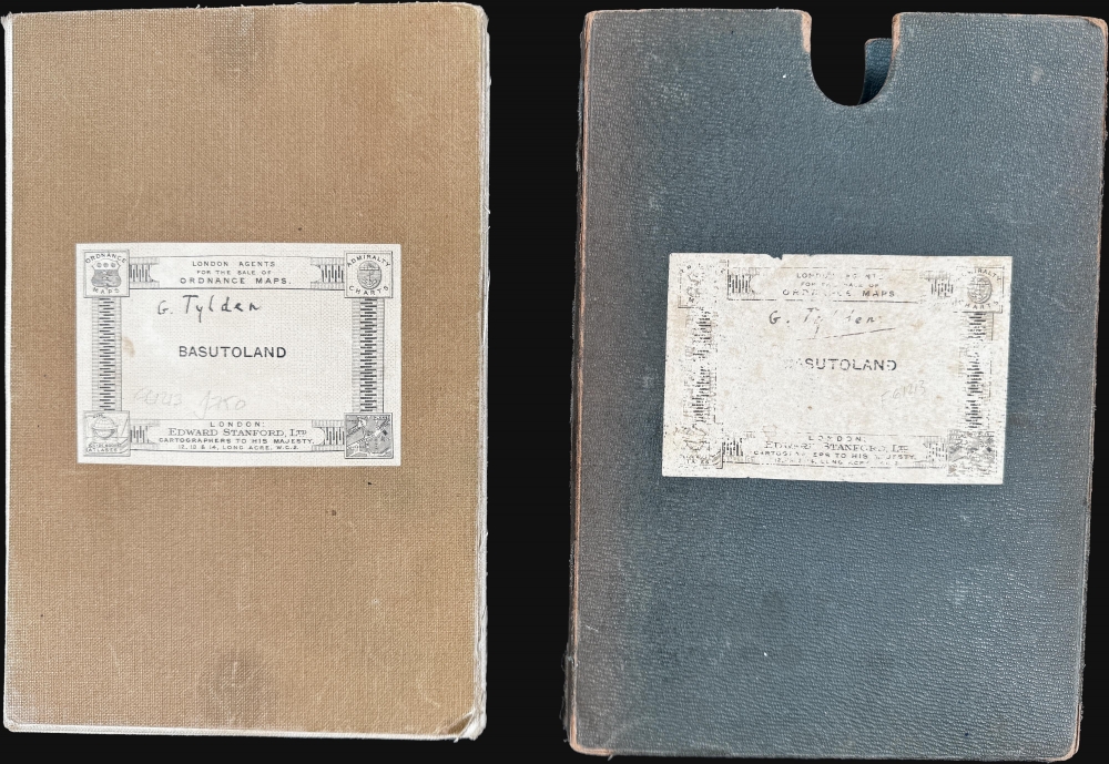
Considered the first trigonometric survey of Lesotho, this 1911 map was published by the British War Office after the work of Captain M.C. Dobson. The map is the product of a singular effort carried out single-handedly by Dobston between 1904 and 1909. It features extensive manuscript additions and annotations by the important British military historian Geoffrey Tylden, who owned the map and likely used it in his research. The fact that Tylden was using this map nearly 50 years after its production underscores both its accuracy and longevity.
There are copious manuscript annotations date to about 1951-56. The annotations focus on several treks through the region and include updates associated with isolated mountain peaks and passes, often with elevations. Some of the updates are significant, reflecting unique cartographic updates that likely appear on no contemporaneous printed map. These updates are almost certainly the work of the British historian Geoffrey Tylden who has signed both the map and the slipcase.
Geoffrey Tylden (1883 - 1970) was a British-born military historian known for his extensive work on South African military history. Born into a distinguished military family in England, he later settled in South Africa, where he became a leading authority on the region's military affairs. Tylden was specifically interested in the roles of indigenous African forces within colonial military structures. His research provided valuable insights into the complexities of South African military engagements and the diverse groups involved.
A Closer Look
This large-format map covers all of what is today Lesotho, offering mind-boggling granular detail throughout. Lesotho's complex mountain topography is meticulously rendered, including all river and stream courses. Dotted lines note footpaths through the mountains. Ruins, stores, schools, temples, villages, grazing grounds, telegraphs, and more are included.There are copious manuscript annotations date to about 1951-56. The annotations focus on several treks through the region and include updates associated with isolated mountain peaks and passes, often with elevations. Some of the updates are significant, reflecting unique cartographic updates that likely appear on no contemporaneous printed map. These updates are almost certainly the work of the British historian Geoffrey Tylden who has signed both the map and the slipcase.
Geoffrey Tylden (1883 - 1970) was a British-born military historian known for his extensive work on South African military history. Born into a distinguished military family in England, he later settled in South Africa, where he became a leading authority on the region's military affairs. Tylden was specifically interested in the roles of indigenous African forces within colonial military structures. His research provided valuable insights into the complexities of South African military engagements and the diverse groups involved.
Basutoland to Lesotho
Basutoland was a British protectorate in southern Africa from 1868 to 1966, contiguous with present-day Lesotho. Initially inhabited by the Basotho people, the territory was unified under King Moshoeshoe I (1786 - 1870) in the early 19th century as a defensive response to regional conflicts, including the Zulu expansion and Boer encroachment. After a series of territorial losses to the Boers and fearing further annexation, Moshoeshoe appealed to Queen Victoria for protection. The British declared Basutoland a protectorate in 1868 and placed it under Cape Colony administration, though mismanagement and local resistance led to direct rule from London in 1884. Despite being surrounded by South Africa, Basutoland maintained a distinct political identity and was not incorporated into the Union of South Africa in 1910. It gained independence peacefully in 1966, becoming the Kingdom of Lesotho, a constitutional monarchy with enduring ties to its founding leadership and traditional governance structures.Publication History and Census
This map is based on a reconnaissance survey completed by M. C. Dobson between 1904 - 09. OCLC notes examples in 11 institutional collections.CartographerS
Thomas Dobson (1751 - 1823) was an American publisher active in Philadelphia during the late 18th and early 19th centuries. Dobson was born in Edinburgh, Scotland in 1751 and emigrated to Philadelphia c. 1780. In Philadelphia, he established a successful printing business by republishing edited and updated versions of important British reference materials in matching quality but at a much lower price point. He is best known for publishing the first American edition of the Encyclopedia Britannica. He also published America's first Hebrew Bible. Cartographically Dobson's most notable work is 1818 republication of Pinkerton's fantastic Modern Atlas. More by this mapmaker...
The British War Office (1857 - 1964) was a department of the British Government responsible for the administration of the Royal Army until 1964, when its functions were transferred to the Ministry of Defense. The War Office was to the Royal Army what the Admiralty was to the Royal Navy, and later, the Air Ministry. Within the War Office, the General Staff Topographical Section was responsible for thousands of maps issued for British intelligence and military use. The Topographical Section was renamed Geographical Section in April 1907. Many, once their military use passed, were offered through licensed agents to the general public. The sole London agent for War Office material was Edward Stanford. Learn More...
Condition
Very good. Slight edge wear. Folds into original case.
References
OCLC 5060619.