
Dobson, Thomas

Thomas Dobson (1751 - 1823) was an American publisher active in Philadelphia during the late 18th and early 19th centuries. Dobson was born in Edinburgh, Scotland in 1751 and emigrated to Philadelphia c. 1780. In Philadelphia, he established a successful printing business by republishing edited and updated versions of important British reference materials in matching quality but at a much lower price point. He is best known for publishing the first American edition of the Encyclopedia Britannica. He also published America's first Hebrew Bible. Cartographically Dobson's most notable work is 1818 republication of Pinkerton's fantastic Modern Atlas.
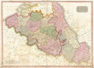
The Netherlands and the Countries to the Left Bank of the Rhine.
$250.00
Acquire
- Digital Map Information
- Suitable for large format printing
- Full resolution TIFF file
- ICC color profile embedded
- Delivered instantly via download link
Pinkerton's extraordinary 1818 map of Belgium. Covers what is essentially today's Belgium between the Dutch Brabant and France. When this map was drawn this area was united with what is today Holland under Napoleon and the French Empire. Later the southern parts ... (more details)
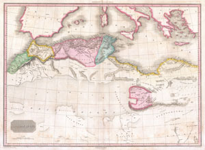
Northern Africa.
$300.00
Acquire
- Digital Map Information
- Suitable for large format printing
- DPI: 300
- File Size: 18.59 MB
- File Type: ZIP / TIFF
- ICC color profile embedded
- Delivered instantly via download link
This fascinating hand colored 1818 map by Edinburgh cartographer John Pinkerton depicts northern Africa. Covers from Morocco to Siwa (Siwah) Oasis in the Libyan Desert. Focuses Morocco and the Mediterranean regions of Fez, Algeria, Tunisia and Tripoli. Also ... (more details)
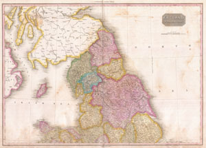
England Northern Part.
$300.00
Acquire
- Digital Map Information
- Suitable for large format printing
- DPI: 300
- File Size: 19.23 MB
- File Type: ZIP / TIFF
- ICC color profile embedded
- Delivered instantly via download link
Pinkerton's extraordinary 1818 map of the northern part of England. Covers from Cheshire and Lincoln in the south to Scotland in the north. Includes part adjacent Scotland and Ireland. Covers the entire region in considerable detail with political divisions ... (more details)
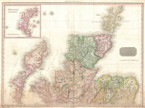
Scotland Northern Part.
$300.00
Acquire
- Digital Map Information
- Suitable for large format printing
- DPI: 300
- File Size: 20.34 MB
- File Type: ZIP / TIFF
- ICC color profile embedded
- Delivered instantly via download link
Pinkerton's extraordinary 1818 map of the northern part of Scotland. Covers from the Isle of Skye (Skey) to the Orkney Islands. Covers the entire region in considerable detail with political divisions and color coding at the regional level. Identifies ... (more details)
A significant advance in the mapping of South America.
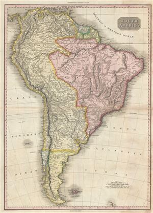
South America.
$300.00
Acquire
- Digital Map Information
- Suitable for large format printing
- DPI: 300
- File Size: 20.03 MB
- File Type: ZIP / TIFF
- ICC color profile embedded
- Delivered instantly via download link
Pinkerton's extraordinary 1818 map of South America. Covers the entire continent from Panama to Tierra del Fuego. Includes the Falklands and South Gerogia Island. Pinkerton offers impressive detail throughout noting indigenous groups, missions, towns and ... (more details)
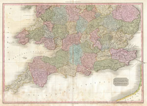
England Southern Part.
$350.00
Acquire
- Digital Map Information
- Suitable for large format printing
- Full resolution TIFF file
- ICC color profile embedded
- Delivered instantly via download link
Pinkerton's extraordinary 1818 map of the southern part of England. Covers the southern half of England from Norfolk and Staffordshire in the north to Cornwall in the south. Includes part of France across the English Channel. Covers the entire region ... (more details)
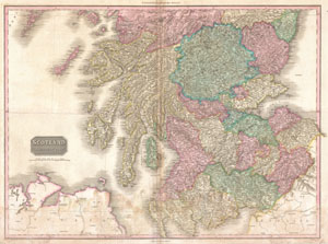
Scotland Southern Part.
$300.00
Acquire
- Digital Map Information
- Suitable for large format printing
- DPI: 300
- File Size: 26.64 MB
- File Type: ZIP / TIFF
- ICC color profile embedded
- Delivered instantly via download link
Pinkerton's extraordinary 1818 map of the southern part of Scotland. Covers from England in the south to Angus Shire in the north. Includes parts of Adjacent England and Ireland. Covers the entire region in considerable detail with political ... (more details)
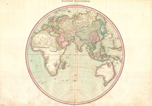
Eastern Hemisphere.
$500.00
Acquire
- Digital Map Information
- Suitable for large format printing
- DPI: 300
- File Size: 19.46 MB
- File Type: ZIP / TIFF
- ICC color profile embedded
- Delivered instantly via download link
A rare and important 1818 map of the Eastern Hemisphere by John Pinkerton. Depicts Asia, Europe, Africa and Australia. This map offers fairly accurate shorelines throughout. In Africa, the interior remains unexplored except for the Congo, the ... (more details)
First scientific survey of Lesotho.
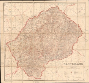
Basutoland.
$1,500.00
Acquire
- Digital Map Information
- Suitable for large format printing
- File Size: 107.15 MB
- File Type: ZIP / TIFF
- ICC color profile embedded
- Delivered instantly via download link
Considered the first trigonometric survey of Lesotho, this 1911 map was published by the British War Office after the work of Captain M.C. Dobson. The map is the product of a singular effort carried out single-handedly by Dobston between 1904 and 1909. It features extensive manuscript additions and annotations by the important British military historian Geoffrey Tylden, who owned the map and likely used it in his research. The fact that Tylden was using this map nearly 50 years after its production underscores both its accuracy and longevity. (more details)