Digital Image: 1639 Van Lochom Map of the British Isles - rare!
BritishIsles-vanlochom-1639_d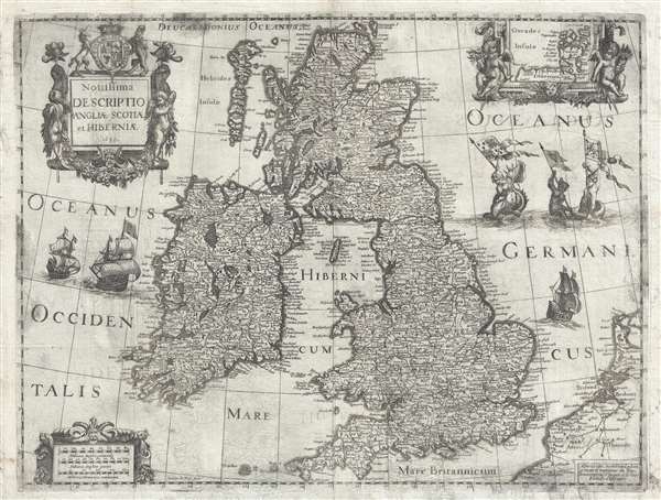

Title
Novissima descriptio Angliae Scotiae et Hiberniae.
1636 (dated) 16 x 20 in (40.64 x 50.8 cm) 1 : 2344320
1636 (dated) 16 x 20 in (40.64 x 50.8 cm) 1 : 2344320
Description
FOR THE ORIGINAL ANTIQUE MAP, WITH HISTORICAL ANALYSIS, CLICK HERE.
Digital Map Information
Geographicus maintains an archive of high-resolution rare map scans. We scan our maps at 300 DPI or higher, with newer images being 600 DPI, (either TIFF or JPEG, depending on when the scan was done) which is most cases in suitable for enlargement and printing.
Delivery
Once you purchase our digital scan service, you will receive a download link via email - usually within seconds. Digital orders are delivered as ZIP files, an industry standard file compression protocol that any computer should be able to unpack. Some of our files are very large, and can take some time to download. Most files are saved into your computer's 'Downloads' folder. All delivery is electronic. No physical product is shipped.
Credit and Scope of Use
You can use your digial image any way you want! Our digital images are unrestricted by copyright and can be used, modified, and published freely. The textual description that accompanies the original antique map is not included in the sale of digital images and remains protected by copyright. That said, we put significant care and effort into scanning and editing these maps, and we’d appreciate a credit when possible. Should you wish to credit us, please use the following credit line:
Courtesy of Geographicus Rare Antique Maps (https://www.geographicus.com).
How Large Can I Print?
In general, at 300 DPI, you should at least be able to double the size of the actual image, more so with our 600 DPI images. So, if the original was 10 x 12 inches, you can print at 20 x 24 inches, without quality loss. If your display requirements can accommodate some loss in image quality, you can make it even larger. That being said, no quality of scan will allow you to blow up at 10 x 12 inch map to wall size without significant quality loss. For more information, it is best consult a printer or reprographics specialist.
Refunds
If the high resolution image you ordered is unavailable, we will fully refund your purchase. Otherwise, digital images scans are a service, not a tangible product, and cannot be returned or refunded once the download link is used.
Cartographer S
Michel van Lochom (April 28, 1601 - January 23, 1647) was a Calvinist Flemish engraver active in Antwerp and Paris during the first half of the 17th century. Van Lochom was born in Antwerp, the son of Hans van Lochom, also an engraver, and Clara Janssens. He mastered engraving under the tutelage of his father and in 1613 joined the Antwerp branch of the Guild of St. Luke (a artist and printers guild). As part of the guild he trained under Abraham van Merlen (1579-1660), a Flemish painter and engraver. Van Lochom became a master in the guild in 1621. Four years later, in 1625 he relocated to Paris where is established himself as a painter and engraver. He may have relocated to Paris in order to marry Marguerite Lenoir, the daughter of the prominent Paris bookseller Guillaume Lenoir, and sister-in-law to Pierre Mariette via her sister Geneviève Lenoir. Attaining some prominence engraving religious portraits, Van Lochom was awarded the title of Graveur et Imprimeur du Roy. His address, in 1836, was St Jacques à la Rose Blanche Couronnée, Paris. He remained in Paris until his death in 1647. After his death, his widow sold some 3000 pounds of printing plates to Balthasar Moncornet. His remaining stock went to Pierre Mariette who may have owned part of Lochom's business. Lochom is alternatively known as Lochum or Lochem. More by this mapmaker...
Henry Le Roy (1579 - November 20, 1651) was a Dutch goldsmith, engraver, and printer active in Paris during the first half of the 17th century. Le Roy was born in Rotterdam and moved to Paris in around the turn of the century. He is best known for his avian and botanical imagery, which is reminiscent of Hollar, but did engrave a few maps with Michel van Lochom, and others. He is interred at the Protestant cemetery of the Faubourg Saint-Marcel, Paris. Learn More...
References
Bibliothèque Nationale de France, GED-4438. OCLC 316392937, 751468274. Shirley, R.W. Early Printed Maps of the British Isles, 1477-1650, 493.