
This item below is out of stock, but another example (left) is available. To view the available item, click "Details."
Details
1639 Van Lochom Map of the British Isles - rare!
1639 (dated) $3,500.00
1639 Van Lochom Map of the British Isles - rare!
BritishIsles-vanlochom-1639$1,250.00

Title
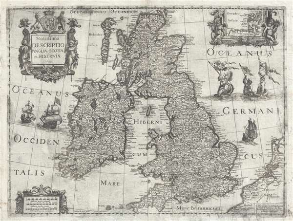
Novissima descriptio Angliae Scotiae et Hiberniae.
1636 (dated) 16 x 20 in (40.64 x 50.8 cm) 1 : 2344320
1636 (dated) 16 x 20 in (40.64 x 50.8 cm) 1 : 2344320
Description
This is an extremely rare and unusual 1639 map of the British Isles by Michel van Lochom. Centered on the Irish Sea, the map extends to cover all of the British Isles, including England, Scotland, Wales, and Ireland. There is an inset map of the Orkney Islands in the upper right. The Wall of Hadrian, fortifications built by the Roman Empire to defend against the unruly tribes of the north, separates England and Scotland.
When Van Lochom died in 1647, part of his stock was sold to Balthasar Moncornet, the remainder was acquired by his brother-in-law, Pierre Mariette (1603 - 1657). The copper printing plate for this map must have been part of the stock inherited by Mariette who, working with Sanson, published a c, 1650 version of the is map without the decorative imagery.
This map appears to be a separate issue, occasionally appearing on composite atlases, but without regularity or consistency. It is extremely rare, with the OCLC only positively identifying only two extant institutional collection examples, at the British Library and the Bibliothèque Nationale.
CartographerS
Michel van Lochom (April 28, 1601 - January 23, 1647) was a Calvinist Flemish engraver active in Antwerp and Paris during the first half of the 17th century. Van Lochom was born in Antwerp, the son of Hans van Lochom, also an engraver, and Clara Janssens. He mastered engraving under the tutelage of his father and in 1613 joined the Antwerp branch of the Guild of St. Luke (a artist and printers guild). As part of the guild he trained under Abraham van Merlen (1579-1660), a Flemish painter and engraver. Van Lochom became a master in the guild in 1621. Four years later, in 1625 he relocated to Paris where is established himself as a painter and engraver. He may have relocated to Paris in order to marry Marguerite Lenoir, the daughter of the prominent Paris bookseller Guillaume Lenoir, and sister-in-law to Pierre Mariette via her sister Geneviève Lenoir. Attaining some prominence engraving religious portraits, Van Lochom was awarded the title of Graveur et Imprimeur du Roy. His address, in 1836, was St Jacques à la Rose Blanche Couronnée, Paris. He remained in Paris until his death in 1647. After his death, his widow sold some 3000 pounds of printing plates to Balthasar Moncornet. His remaining stock went to Pierre Mariette who may have owned part of Lochom's business. Lochom is alternatively known as Lochum or Lochem. More by this mapmaker...
Henry Le Roy (1579 - November 20, 1651) was a Dutch goldsmith, engraver, and printer active in Paris during the first half of the 17th century. Le Roy was born in Rotterdam and moved to Paris in around the turn of the century. He is best known for his avian and botanical imagery, which is reminiscent of Hollar, but did engrave a few maps with Michel van Lochom, and others. He is interred at the Protestant cemetery of the Faubourg Saint-Marcel, Paris. Learn More...
Condition
Very good. Some transference. Strong impression. Platemark. Blank on verso.
References
Bibliothèque Nationale de France, GED-4438. OCLC 316392937, 751468274. Shirley, R.W. Early Printed Maps of the British Isles, 1477-1650, 493.